
-
0:54

Fairly nice morning
-
2:47

6th Annual Juneteenth Celebration held today in Niles
-
3:07

Thousands of people across the country pour into Chicago for...
-
2:28

Local street art murals promote water quality awareness
-
2:51

59th annual Leeper Park Art Fair returns
-
1:39

South Bend Chapter of Indiana Black Expo hosts 27th annual Juneteenth...
-
1:51

Try to beat the rain on Father’s Day
-
0:28

Mother killed after being struck by vehicle Thursday night identified,...
-
1:00

A pleasant day for Juneteenth
-
3:42

Family of 24-year-old Timothy Johnson killed in Cass County hold...
-
2:24

Sun shines on Elkhart Jazz Fest
-
2:33

Juneteenth celebration kicks off Elkhart Jazz Fest

A frigid start to Thursday, temperatures near zero, this is the calm before our next snow storm. The next round of snow will be the biggest this week and has the potential to be one of the biggest single day events of the season. Friday, a nearly all-day snow is expected with accumulation of more than six inches likely. The pattern stays snowy this weekend but looks to break next week.
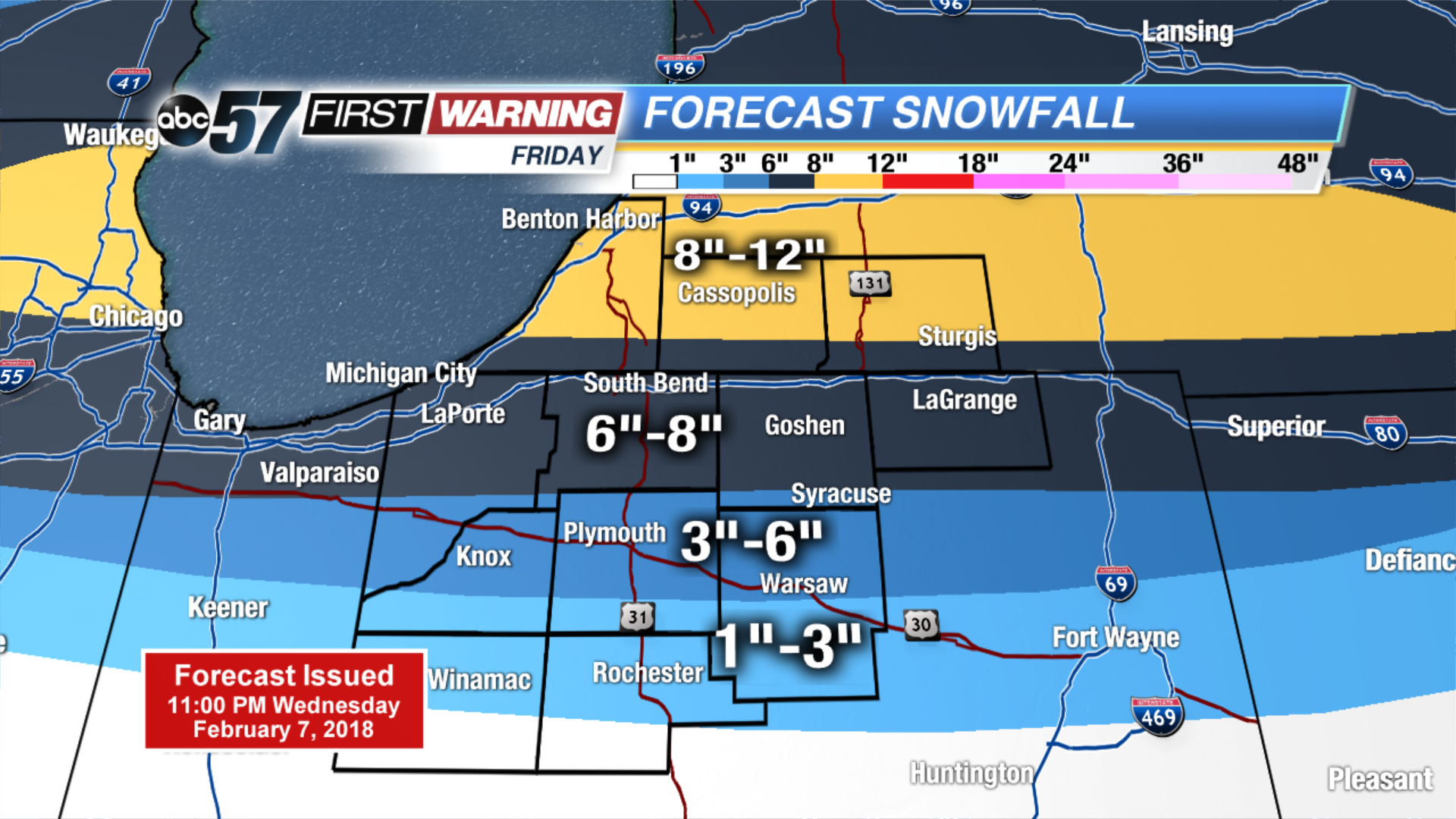
Tonight: Flurries ending, partly cloudy, low of 2.
Thursday: Mostly cloudy, chance of snow, high of 18.
Friday: Heavy snow, high of 28.
Saturday: PM Snow showers, highs in the mid-20s.
Sign up for the ABC 57 Newsletter