


Sunday, December 29th, 2019
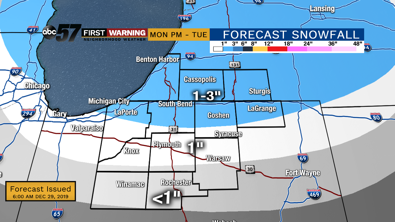
Scattered rain showers last on and off today and will be heavy at times. Even with the rain, daytime highs manage to reach near 60 degrees! The cold front moves through overnight into Monday morning, dropping our temperatures into the 30s by Monday evening. It will start off as rain in the morning with a couple of isolated snow showers in the evening. The chance of snow continues overnight into Tuesday morning. 1-3" of snow is possible north of US-30 by Tuesday evening. So some could be ringing in the new year with a fresh coating of snow on the ground. As we step into 2020, temperatures again rise above normal but chances of rain end the week.
Today: Scattered rain showers. High of 60.
Tonight: Scattered rain showers. Low of 46.
Monday: AM rain showers; PM chance of snow. Temps falling from an early high of 46.
New Year's Eve: Light snow possible until midday; breezy. High of 31.