
-
3:37

South Bend Cubs explain weekend washout
-
4:02

Early voting is underway as Indiana prepare for its May 5 primary...
-
3:27

Tax-related scams to watch out for
-
0:09

Crews repair weekend washout under Coloma train track
-
0:58

Chilly and sunny Tuesday ahead
-
0:41

Elkhart police investigating Monday night shooting
-
3:47

Elkhart Police Department accepting applications to Citizens...
-
0:52

A slight warm-up but chilly weather still dominates
-
1:09

Bitterly cold out the door
-
3:03

Looking to younger generations to keep Dyngus Day thriving
-
3:06

Even as rivers recede, Marshall County still dealing with flooding
-
3:29

Michigan fans gather in Indianapolis ahead of National Championship...

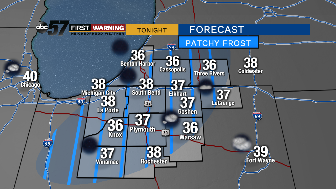
Clear skies overnight will allow temperatures to dip into the 30s. Patch frost is possible but a damaging freeze is unlikely. Only the most sensitive of plants should be covered.
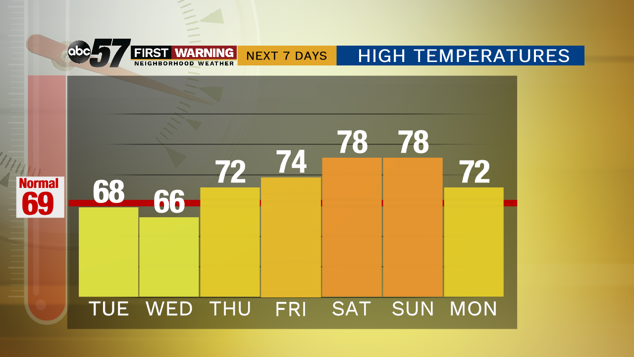
The forecast this week is finally turning milder. Tuesday is sunny with highs nearing 70 and 70s stay in the forecast the rest of the week. There are a few chances of rain but overall this week is not as rainy and drier than the past two weeks. Friday right now seems to be a toss-up as to whether a warm front can move through or not. That could change the forecast from the low 70s to closer to 80. This weekend could be our first 80 degree high of 2019.
Tonight: Mostly clear, low of 38.
Tuesday: Sunny, high of 68.
Wednesday: A chance of showers early, high of 66.
Thursday: Partly cloudy, high of 72, chance of storms late.