
-
2:00

A sunny Monday ahead, rainy almost every other day this week
-
2:59

Dusty May leads Michigan back to Final Four with dominant win...
-
0:37

Vendors and cosplayers showcase art at South Bend Anime Fest
-
3:06

Palm Sunday procession in South Bend unites faiths in call to...
-
0:48

2026 Auto Show brings crowd to Century Center Sunday
-
2:34

Warm to start the week, Rainy week ahead
-
2:44

Warmer, breezier, and cloudier than yesterday
-
0:46

Crowds gather for Fins and Feathers Fest at La Porte City Fairgrounds
-
0:46

Paramount School of Excellence hosts teacher fair
-
2:30

Voting advocacy, peaceful demonstrations and donations: South...
-
2:04

Warming to start the week, Showers and storms by Tuesday
-
2:10

Cool, but calm, today

Thursday late evening to midnight may be one of the best chances to see comet NEOWISE as clouds clear.
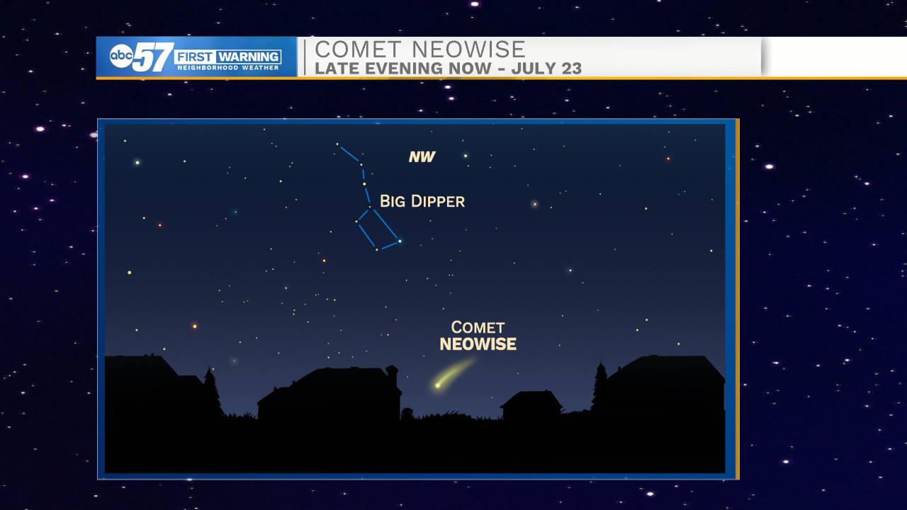
SKYWATCHERS: Comet NEOWISE gracing the night sky
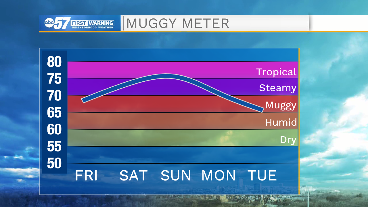
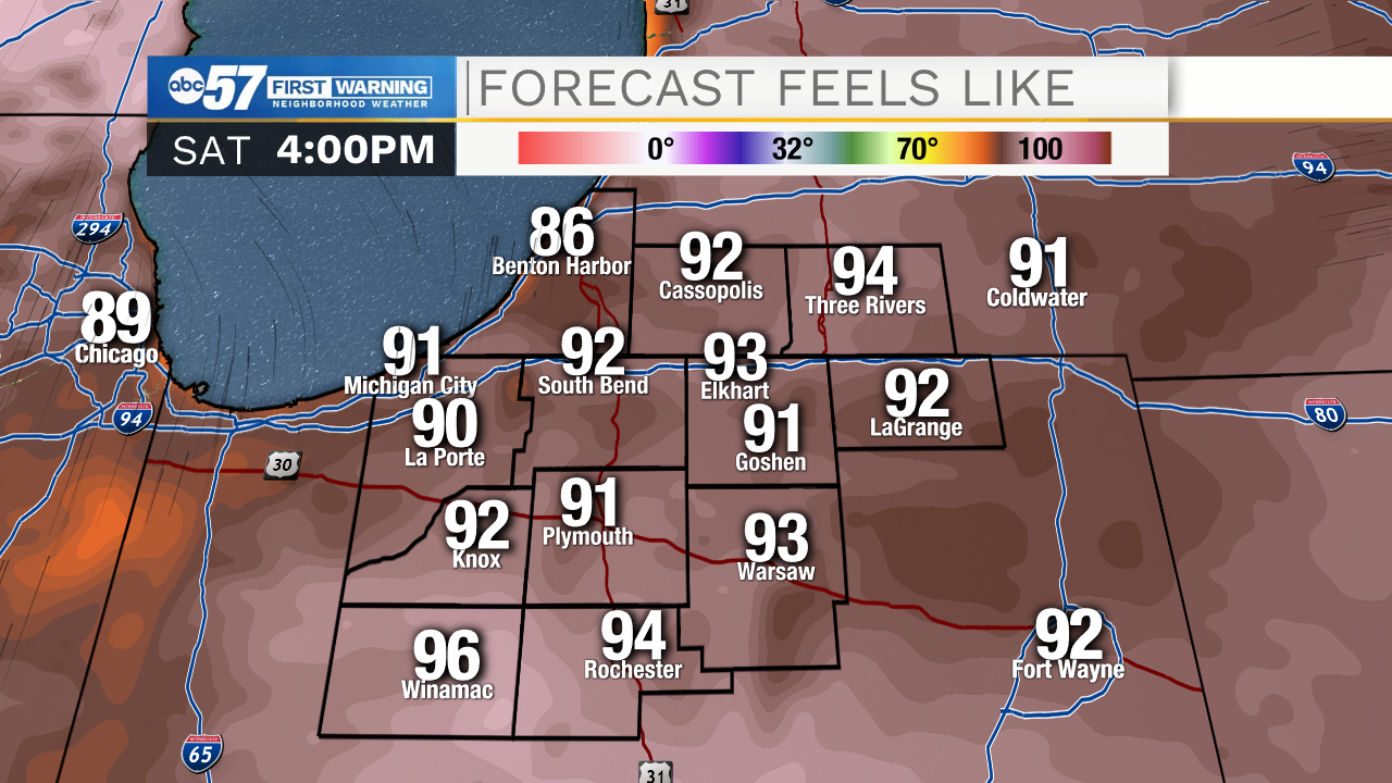
Friday, the warm-up begins and the humidity starts to surge. Highs warm into the 90s this weekend and the heat index will be 95 to 100. There's little relief at night, steamy with overnight lows above 70. Pop-up showers / storms are possible with the best chance of rain Monday. Next week's heat is less extreme.
Tonight: Mostly clear. Low 62.
Friday: Mostly sunny. High 88.
Saturday: Partly cloudy. High 93.
Sunday: Partly cloudy, isolated storms. High 92.
Sign up for the ABC 57 Newsletter