Monday, June 8th, 2020
It's another gorgeous summer day with plenty of sunshine and highs in the mid-80s. Temperatures continue to rise Tuesday, topping out near 90 with humidity making it feel sticky. All of that heat and humidity arrives ahead of Tropical Storm Cristobal.
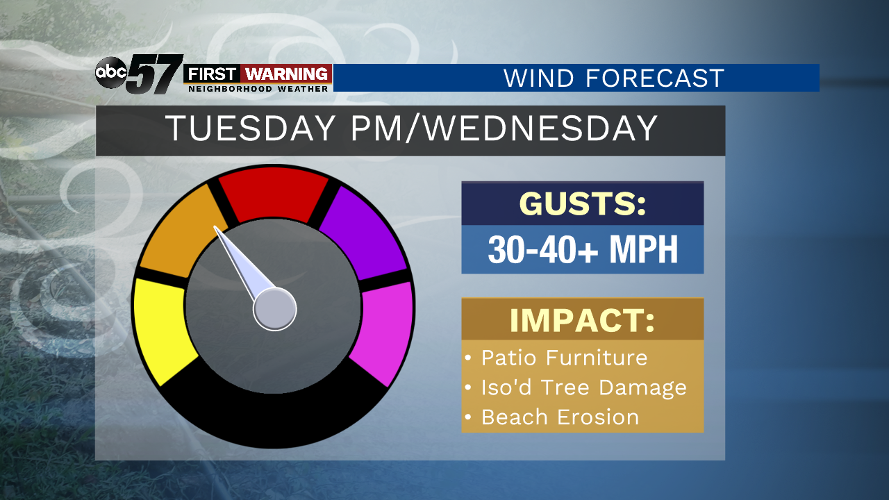
Storms from this system develop during the late afternoon to evening on Tuesday. Isolated severe storms will be possible with the threat of damaging wind and heavy rain. The rain will continue into Wednesday morning and the winds significantly pick up. Wind gusts of 40-45 mph will be possible Wednesday.
It starts to quiet down Thursday with more sunshine and comfortable temperatures. Friday is a little cooler and cloudy before we get to another beautiful weekend.
Today: Sunshine. High 86.
Tonight: Partly cloudy. Low 67.
Tuesday: Increasing clouds, PM storms. High 90.
Wednesday: AM rain, windy. High 76.