
-
0:56

Several Elkhart groups come together to teach bike safety to...
-
2:38

Make South Bend’s Rebel Art Fest kicks off summer
-
0:39

Target recalls two Up and Up brand wipes
-
2:04

At a Tribute to Veterans, a Vietnam Vet recalls challenging missions
-
2:34

Freedom Fest welcomes Indiana’s Lieutenant Governor and Attorney...
-
1:36

Southern severe storms this afternoon
-
1:53

Goshen’s First Fridays Birthday Bash celebrates, despite the...
-
0:58

Thunder out the door
-
2:00

Freedom Fest kicks off this weekend at the Kosciusko County 4-H...
-
1:22

Kosciusko’s Freedom Fest boasts the nation’s largest American...
-
1:01

Historic Union-Pacific “Big Boy“ train rolls through Argos...
-
3:07

Notre Dame’s first co-ed graduating class celebrates 50th class...

Lake effect snow will ramp-up overnight, intense snow bands, with snowfall rates of more than two inches per hour. Areas under the bands for the longest period of time could see in excess of a foot of snow through Tuesday evening.
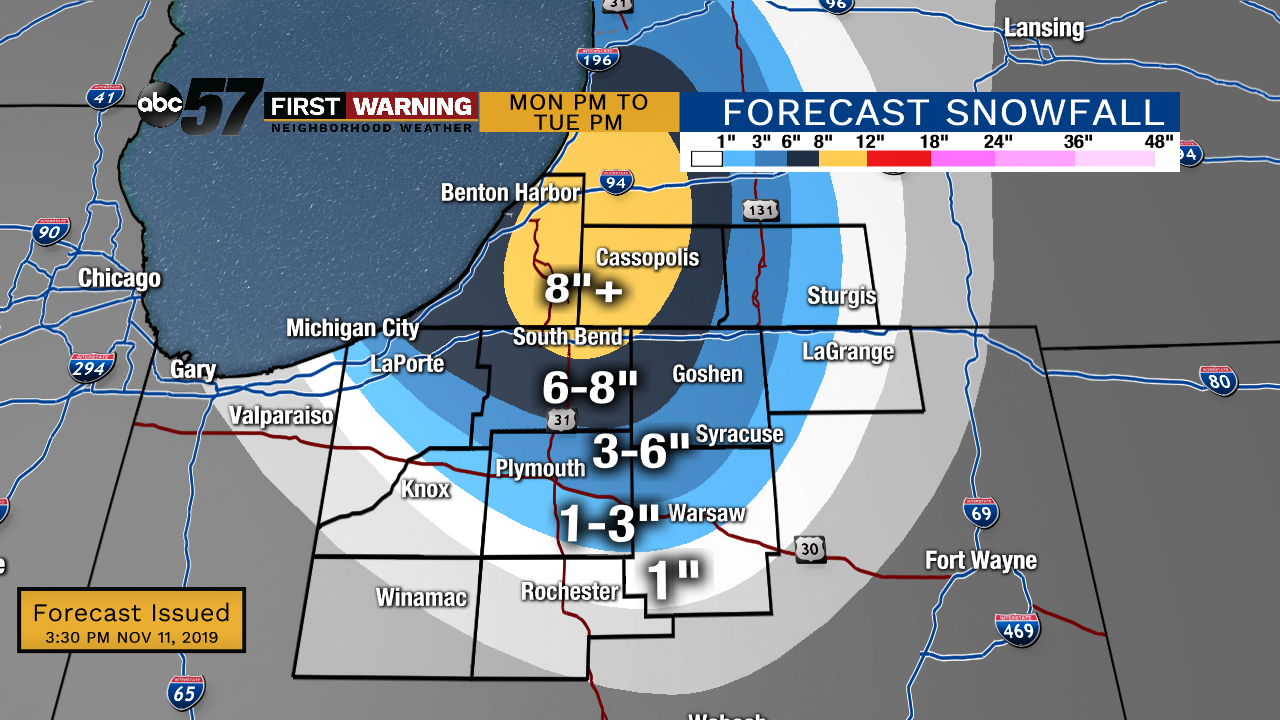
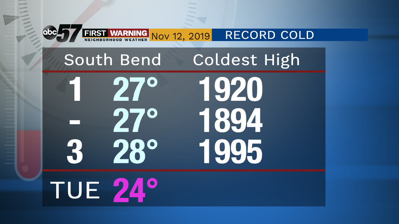
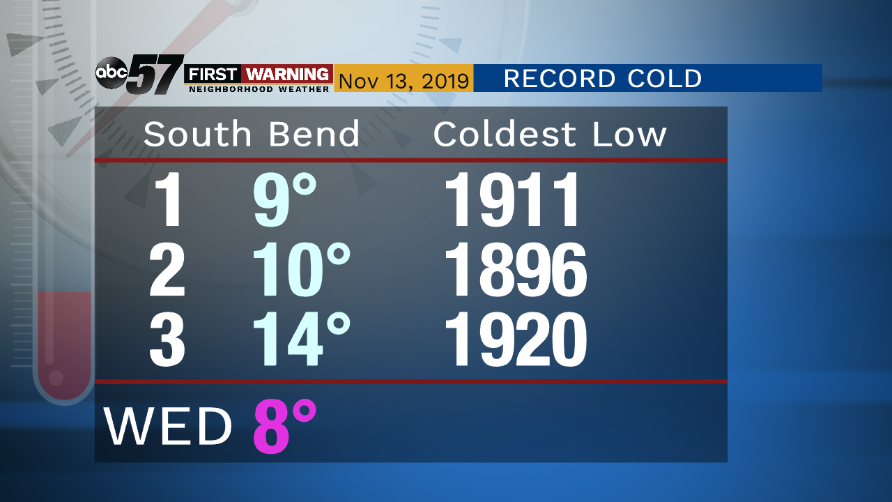
Lake effect snow and record cold in the forecast through Tuesday as high temperatures struggle to warm above 25 degrees. Snow will continue through Tuesday and gradually wind-down by early Wednesday morning. Driving in the lake effect zones will be difficult. Low temperatures fall into the single digits by early Wednesday.
Tonight: Heavy lake effect snow, breezy. Low of 18.
Tuesday: Lake effect snow showers. High of 24.
Wednesday: Mostly to partly cloudy. High of 28.
Thursday: Mostly cloudy. High of 32.
Sign up for the ABC 57 Newsletter