
-
0:32

Granger residents share input on proposed S.R. 23 roundabout
-
2:59

Seven local boards unanimously approve fire territory merger...
-
2:05

JobSpark helps inspire career exploration for middle school students
-
2:01

MPHPL launches new bookmobile to extend library access
-
2:17

Will Pauling shines, Jadarian Price shows versatility at Notre...
-
2:55

Notre Dame’s Pro Day gives 16 seniors one more shot to impress...
-
2:57

South Bend residents voice concerns over proposed pedestrian...
-
3:03

Prices at the pump continue to rise across Michiana
-
1:35

Warming up before storms arrive Thursday
-
2:06

Staying sunny until Thursday
-
0:58

Goshen City Council amends DORA rules amid community concerns
-
1:20

SB Common Council adopts Downtown 2045 Plan

Heavy rain and flood threat Wednesday night through Thursday. Slow moving heavy downpours could drop more than two inches of rain. Flooding is possible due to the already saturated ground. The heaviest rain is likely from midnight to 7:00 AM.
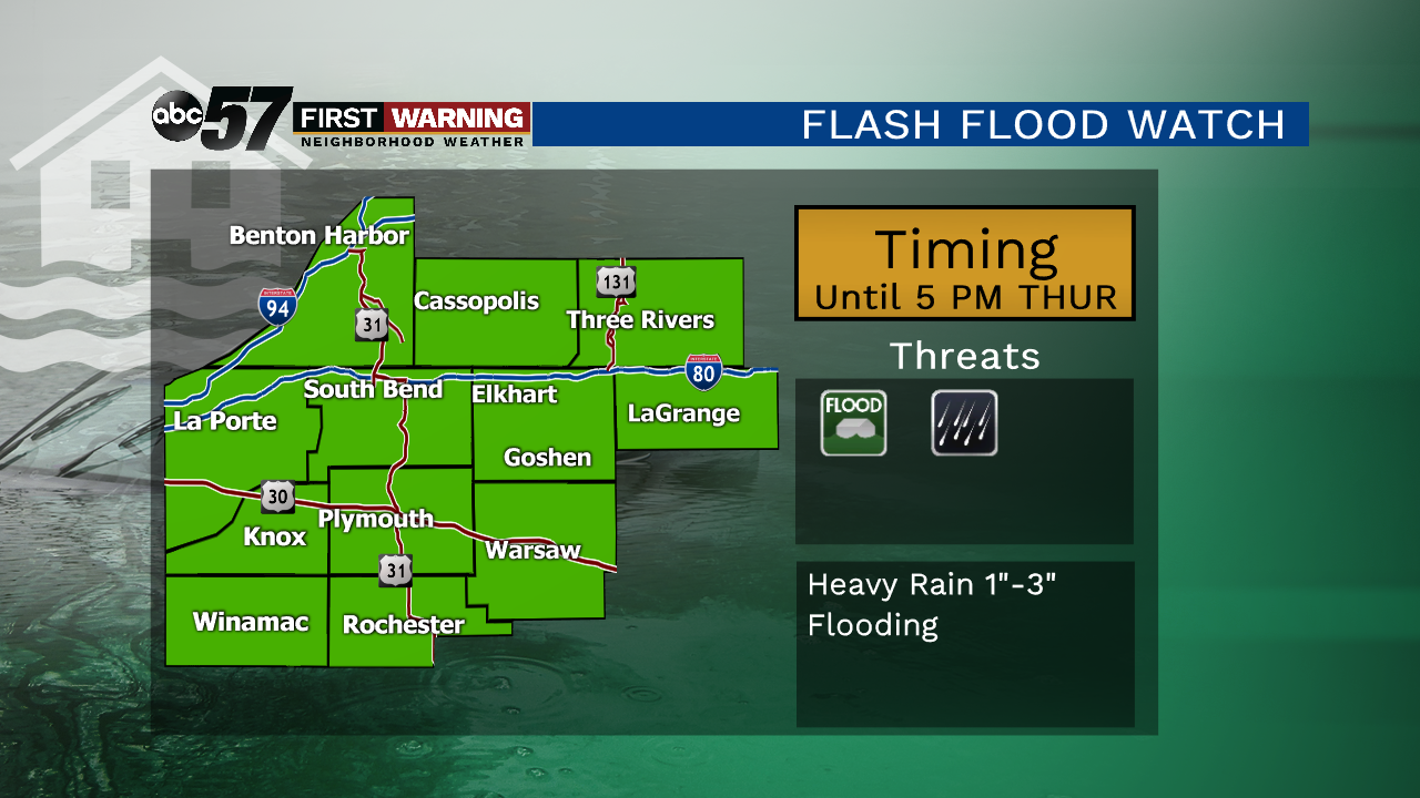
Thursday will start wet, with the possibility of standing water and flooding in the area. Rain ends Thursday afternoon but temperatures will struggle to reach 70. The beginning of summer is dry Friday but the weekend turns wet once again with showers and storms likely Saturday through Monday. Temperatures are trending warmer with highs at or above 80.
Tonight: Showers and storms, heavy rain likely, low of 62.
Thursday: AM showers, mostly cloudy, high of 68.
Friday: Mostly sunny, high of 78.
Saturday: Scattered showers and storms, high of 80.