
-
1:17

Cold and soaking rain today, another severe risk tomorrow
-
0:44

South Bend High School Music Festival highlights student talent
-
1:55

South Bend house fire possibly caused by lightning
-
2:26

Flooding remains a threat into Wednesday
-
0:40

Baxmeyer defends actions amid solar farm bond debate
-
2:11

Southwest Michigan Cares Fund reaches over $70k as families still...
-
1:35

Severe weather threat ending across Michiana
-
0:51

SJCPD responds to AG’s appeal of lawsuit dismissal
-
2:13

More strong storms likely this evening
-
2:15

The ingredients for severe weather
-
2:14

Why summer travel prices may spike due to the ongoing war in...
-
1:49

Heavy rain, high winds, and hail are main severe concerns today

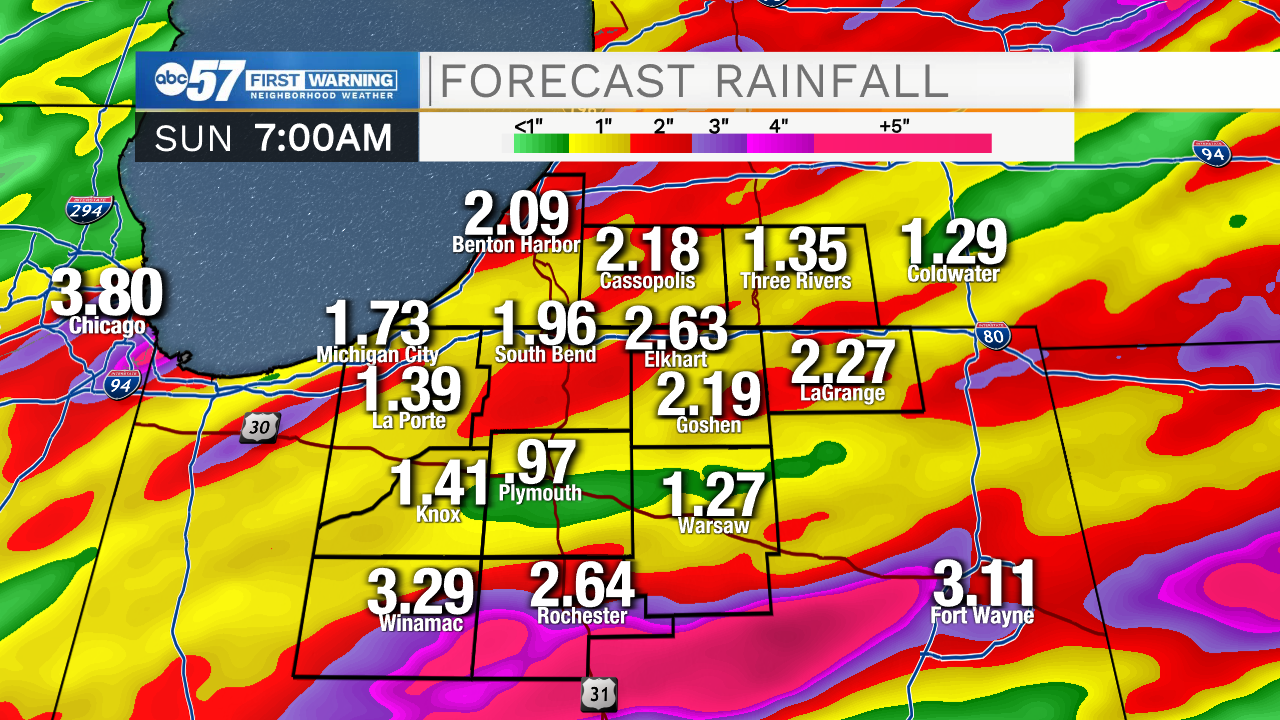
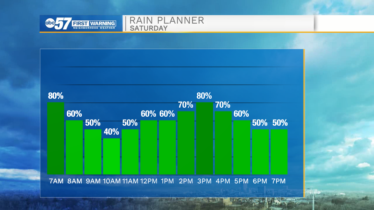
The wet weather last through the weekend. Rounds of rain, heavy at times will bring an additional one-to-two inches through Sunday morning. Thunderstorms could produce downpours of over an inch per hour. Minor flooding on roads or in basements is possible. Sunday isn't as wet, but that's only a slight improvement, with scattered storms re-firing in the afternoon. With the high humidity, storms could fire every afternoon through the middle of next week. The forecast does trend drier by the 4th of July Weekend.
Tonight: Scattered showers and storms. Low 70.
Saturday: Scattered showers and storms. High 84.
Sunday: Scattered showers and storms.. High 84
Monday: Scattered showers and storms.. High 84
Sign up for the ABC 57 Newsletter