


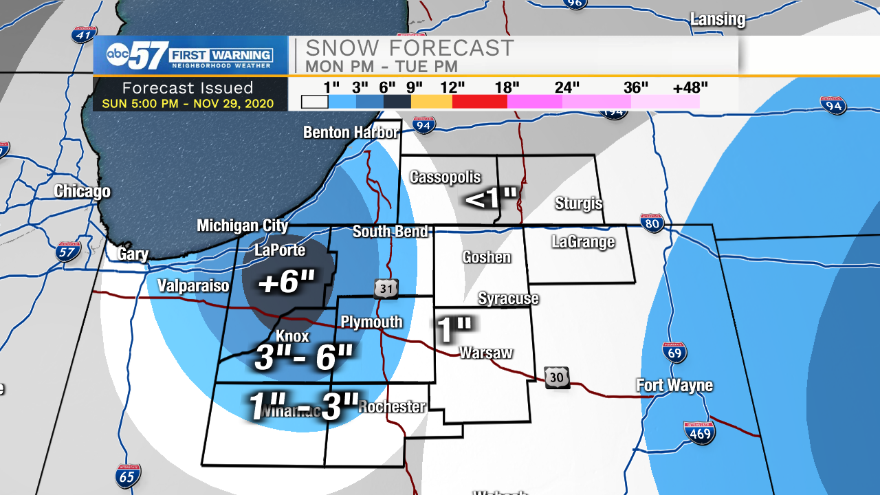
A few isolated rain showers will develop late this evening, and then turn to snow during the early morning tomorrow. Scattered snow showers will impact most of Michiana throughout Monday. A heavier band of lake effect snow will develop in our western and northwestern counties tomorrow morning leading to hazardous travel and reduced visibilities. LaPorte, Berrien, Starke, and western St. Joseph counties should expect to see the heavier accumulation and higher impacts. Snow showers will stick around into the mid to late morning hours on Tuesday. Along with the snow, strong winds are expected. Wind gusts could top out to around 40mph in these same counties.
After the snow moves out, cold air will remain in place. Low temperatures Wednesday through Friday will be in the mid 20s with highs in the lower 40s. Another round of rain/snow mix is possible Friday into Saturday.
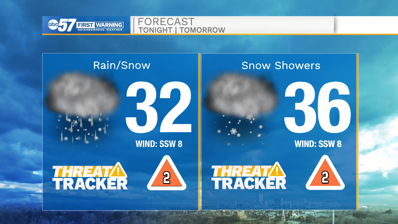
Tonight: Snow showers. Low 32.
Tomorrow: Snow showers. High 36.
Tuesday: AM snow showers. High 38.
Wednesday: Mostly sunny. High 40.