
-
2:25

Irish lacrosse head to NCAA quarterfinals with Johns Hopkins...
-
3:09

Cubs, White Sox open first Crosstown Classic series of summer...
-
3:45

South Bend Cubs dedicate plaque to Indiana born composer of ’Take...
-
1:52

Concord fourth graders launch weather balloon following months...
-
4:55

Gus Macker 3-on-3 basketball tournament returns to Benton Harbor
-
4:38

Discon at the Carousel 2026
-
2:28

Registration open for ’Gus Macker on The River’
-
3:01

Makers Collective Market features local small businesses
-
1:01

Breezy but warming up today
-
1:18

Cloudy with hit-or-miss showers early
-
2:35

A lost dog was found two years later due to the info on his ’chip’
-
2:07

Holding Michiana’s Lawmakers Accountable: Reaching out to Rep....

Now through Friday evening will be a high impact lake effect snow event. Persistent snowfall will bring at least three to six inches per day in the lake effect zones, including South Bend and Elkhart. Higher amounts of 12 to 18 inches in southwest Michigan. Whiteout conditions are possible when crossing intense squalls. Use extreme caution when traveling the next two days.
There is a break from the snow Saturday, before a system warms the area into the 30s but brings additional snowfall Sunday and Monday.
Tonight: Lake effect snow showers, low of 8. 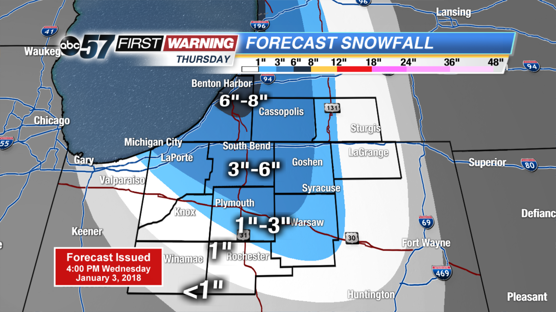 Thursday ONLY snowfall
Thursday: Lake effect snow showers, high of 12.b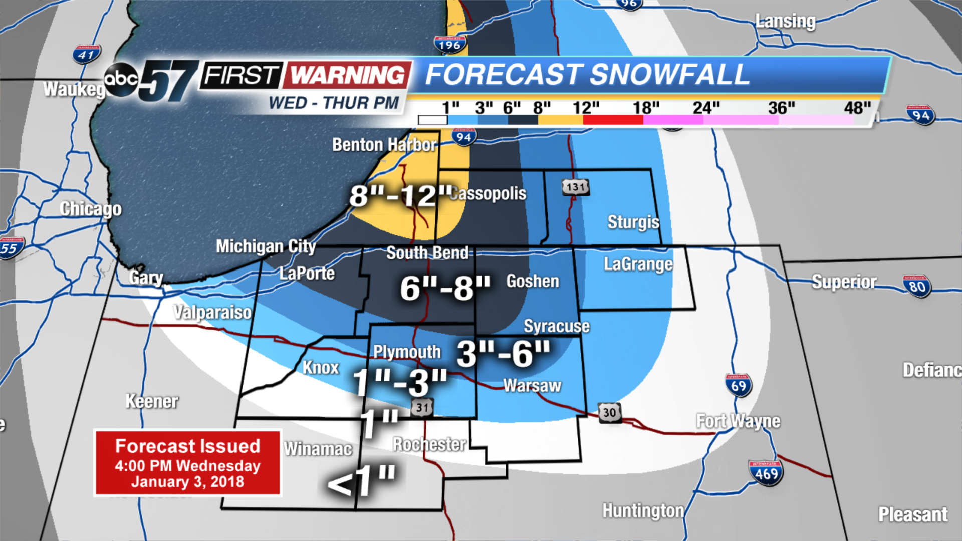 Estimated two day totals
Friday: Lake effect snow showers, high of 10.
Saturday: Partly cloudy, high of 15. ![]() High impact lake effect snow event.
High impact lake effect snow event.
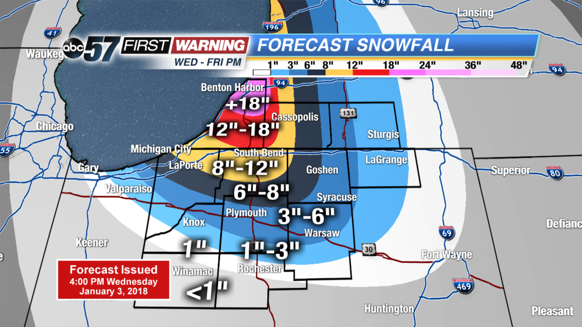 Estimated three day totals