
-
1:44

Feeling like a sauna next week
-
3:12

How to keep yourself and others protected during firework season
-
0:49

Showers creeping into Michiana
-
0:42

Judge approves $25M water lawsuit settlement
-
1:00

Scattered showers through the day
-
1:53

Hispanic Community Child Safety Meeting: A Call To Action
-
2:51

Obama Presidential Center features work of South Bend company
-
1:54

This week’s ABC57 Cub Reporter is Isaac Knefely
-
1:16

Real summer heat returns next week
-
2:28

South Bend storm drain mural project complete
-
5:17

Three local students return as national powerlifting champions
-
1:09

Rain showers to end the work week

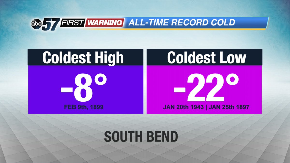
Historic cold Wednesday. Lows fall towards -20, highs may not break -10. This looks to be the coldest day ever in Michiana. The wind chill factor could be on the order of -50. Being outside for almost any period of time is hazardous and possibly life threatening. Temperatures won’t warm above zero until early Friday. Lake effect and blowing snow will continue to slow travel across southwest Michigan and near the state line.
As temperatures warm to end the week, snow is expected Friday. Highs warm above freezing this weekend, pushing 50 by Monday with rain likely. We’ll watch for possible icing impacts if ground temps stay cold.
Tonight: Extreme cold, lake effect snow. Low -20.
Wednesday: Extreme cold, lake effect snow. High of -12.
Thursday: Extreme cold, partly cloudy to mostly sunny. High of -2.