Hot and humid weekend with isolated storm chances

-
1:03

Cold showers continue this morning
-
1:07

Easter Bunny stops at Tako Loco and Tokyo for Easter fun
-
0:49

Annual Easter Egg Hunt brings families together in Elkhart
-
1:06

Marshall County Humane Society reschedules Dog Egg Hunt
-
2:01

Martin Luther King Dream Center hosts MLK March in South Bend
-
1:54

South Bend Cubs opener postponed by weather, but fans still find...
-
2:01

Sights and sounds from South Bend Cubs Opening Day
-
1:32

NIPSCO ’flatly rejected’ further negotiations, USW workers...
-
3:36

The art of groundskeeping at Four Winds Field
-
3:32

The history behind America’s only ballpark synagogue turned...
-
1:59

South Bend opens season against Quad Cities in familiar Midwest...
-
4:21

South Bend Cubs owner discusses $48M stadium expansion, changes...

ABC57 First Warning Neighborhood Weather
Friday, July 17th, 2020
Areas of patchy fog this morning, otherwise plenty of sunshine today with a high of 88F. We’ll have pretty clear skies again tonight for those hoping to catch a glimpse of Comet NEOWISE.
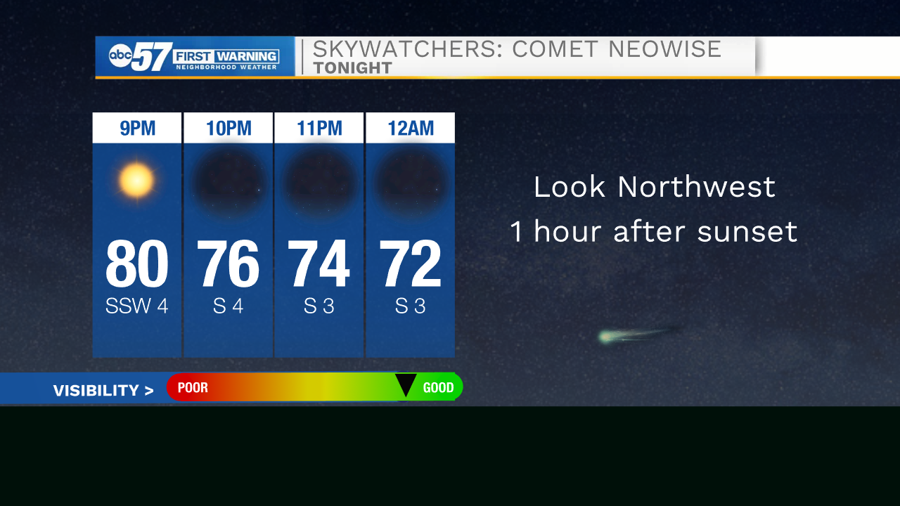
SKYWATCHERS: Comet NEOWISE gracing the night sky
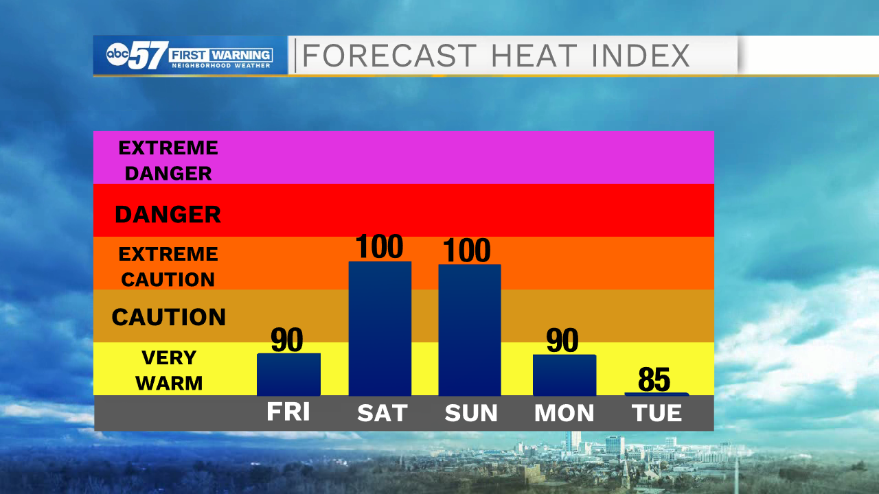
It continues to heat up with weekend with heat indices ranging from 95-100F. An isolated shower or storm is possible Saturday but a couple of showers/storms are more likely Sunday as a weak cold front passes through. More isolated shower/storm chances Monday and Tuesday. Daytime highs will be more comfortable in the mid-80s.
Today: Mostly sunny. High 88.
Tonight: Mostly clear. Low 68.
Saturday: Partly cloudy, stray shower or storm. High 93.
Sunday: Partly to mostly cloudy, isolated storms. High 92.