Hot end to holiday weekend; few afternoon storms possible


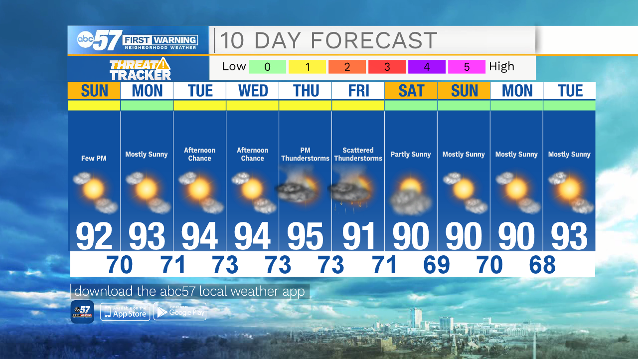
Another hot day to end the holiday weekend. Temperatures this afternoon will reach a high around 92.
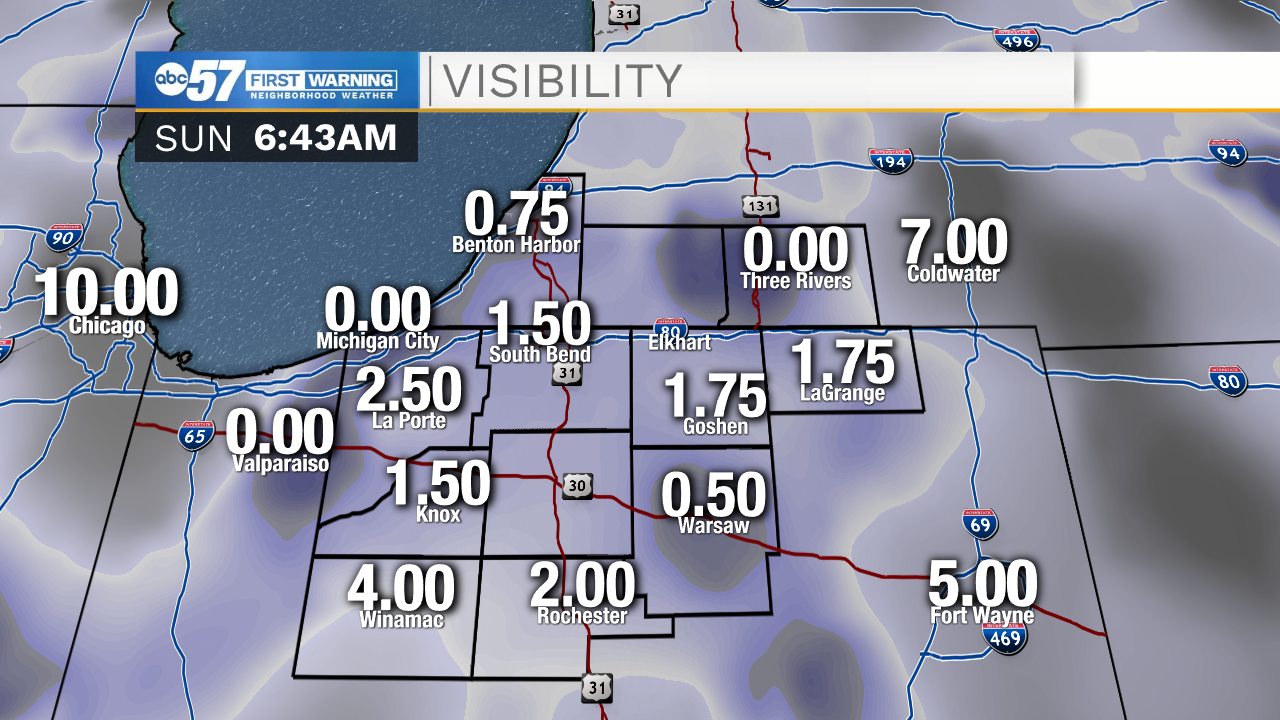
Visibility is reduced early this morning with fog across Michiana. This should clear late this morning, but use caution if you're planning to drive or boat early.
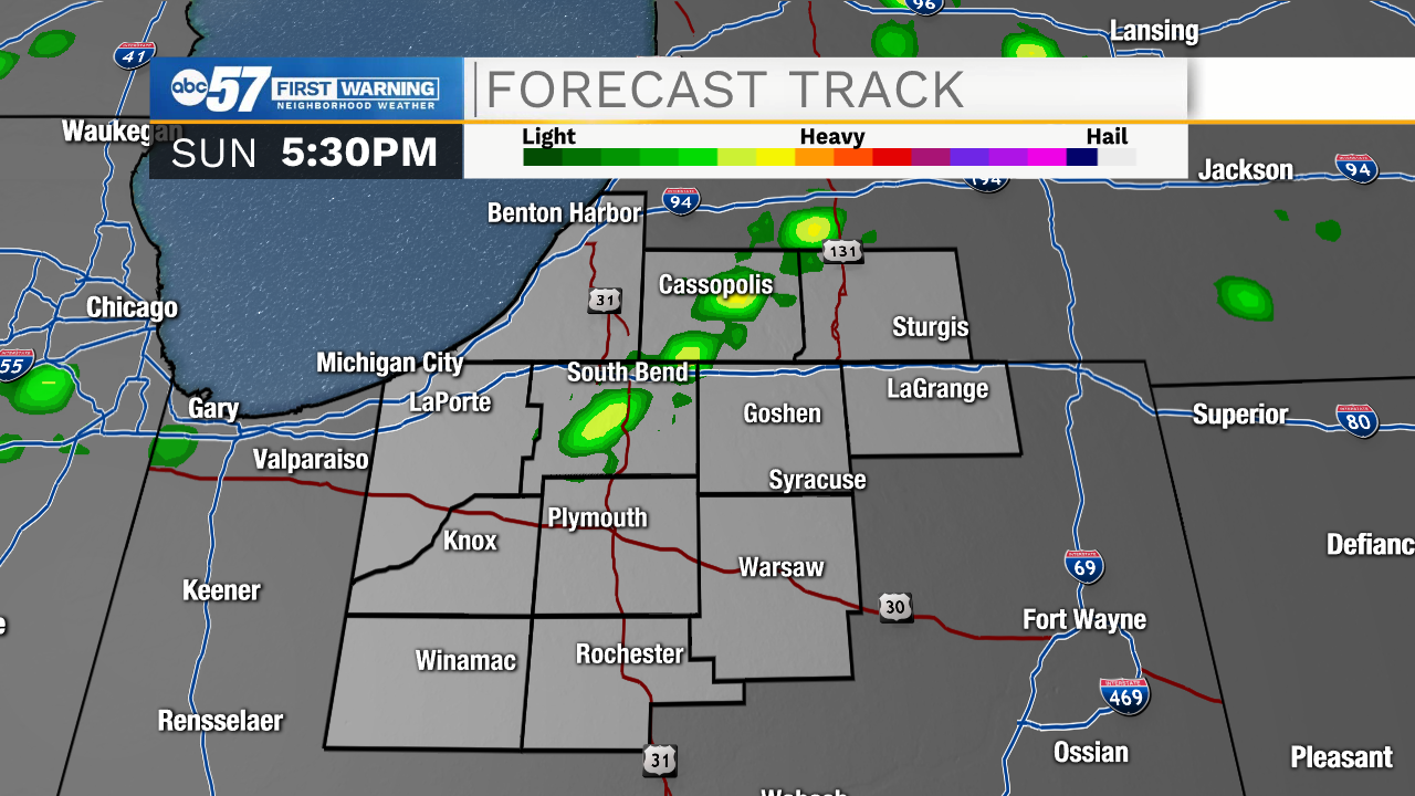
Today is mostly dry and sunny. This afternoon, there is another round of isolated showers and thunderstorms. These are not expected to be severe, but there could be locally heavy rainfall and a few fast wind gusts. Most of these will occur after 2 p.m. and before 7 p.m.
Sunday night is dry with mostly clear skies and temperatures dropping to a low around 70.
Although there are a few afternoon thunderstorms possibly popping up Tuesday and Wednesday afternoons, the week starts mostly dry. Monday will be mostly sunny with a high of 93. There is a slight warming trend in place, reaching a high of 95 by Thursday. Thunderstorms look a little more widespread starting Thursday evening. These storms will carry over into Friday, possibly a few lingering through Friday evening.
Temperatures will stay in the 90s each day in our 10-day forecast.
Today: Mostly sunny. A few isolated afternoon showers/thunderstorms. High 92.
Tonight: Mostly clear. Low 70.
Monday: Mostly sunny and hot. High 93.
Tuesday: Mostly sunny and hot. Afternoon showers/thunderstorms possible. High 94.