
-
1:05

Truly wonderful conditions
-
2:15

Fort Wayne Tin Caps put an end to the SB Cubs winning streak
-
1:21

This weekend is the annual Hall of Heroes Comic Con
-
0:46

Elkhart Police Department respond to shots fired call at the...
-
3:55

ABC57 speaks with Cass County Commissioners, Judge and Interim...
-
2:48

Common Council to consider appeal options following South Bend...
-
0:52

South Bend seniors explore local parks, event centers, and available...
-
1:51

Mentone Egg Fest celebrates 80th year
-
4:58

New reactions after Notre Dame releases findings of priest sex...
-
3:05

South Bend Police Tapes ordered to be destroyed after 14-year...
-
0:12

Road reopened after excavator fire at demolition site in Elkhart
-
3:25

Beloved board game comes to life at the Morris Performing Arts...

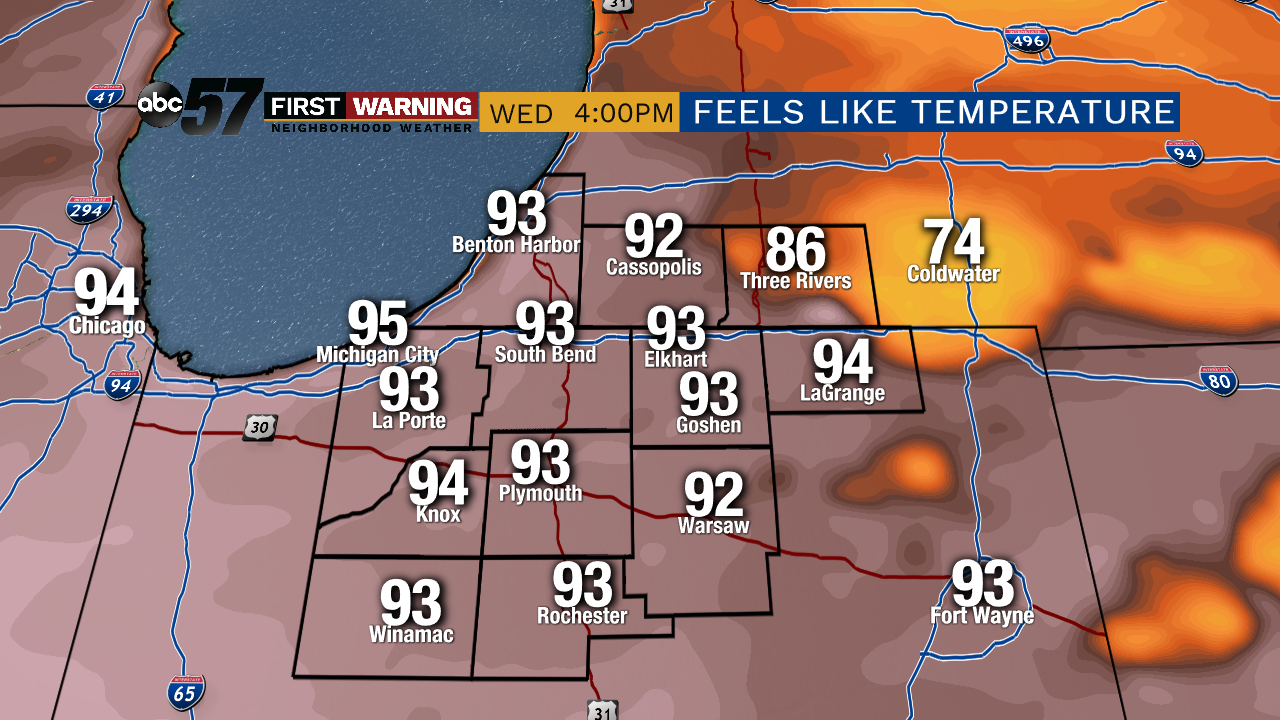
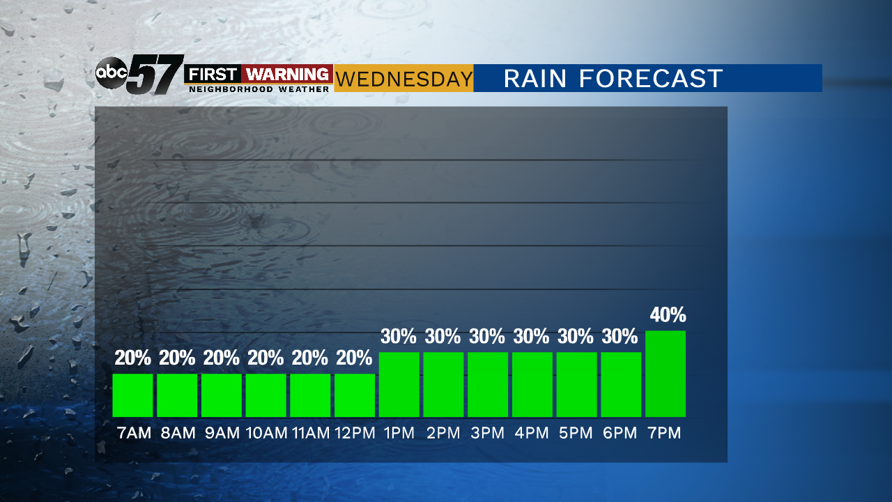
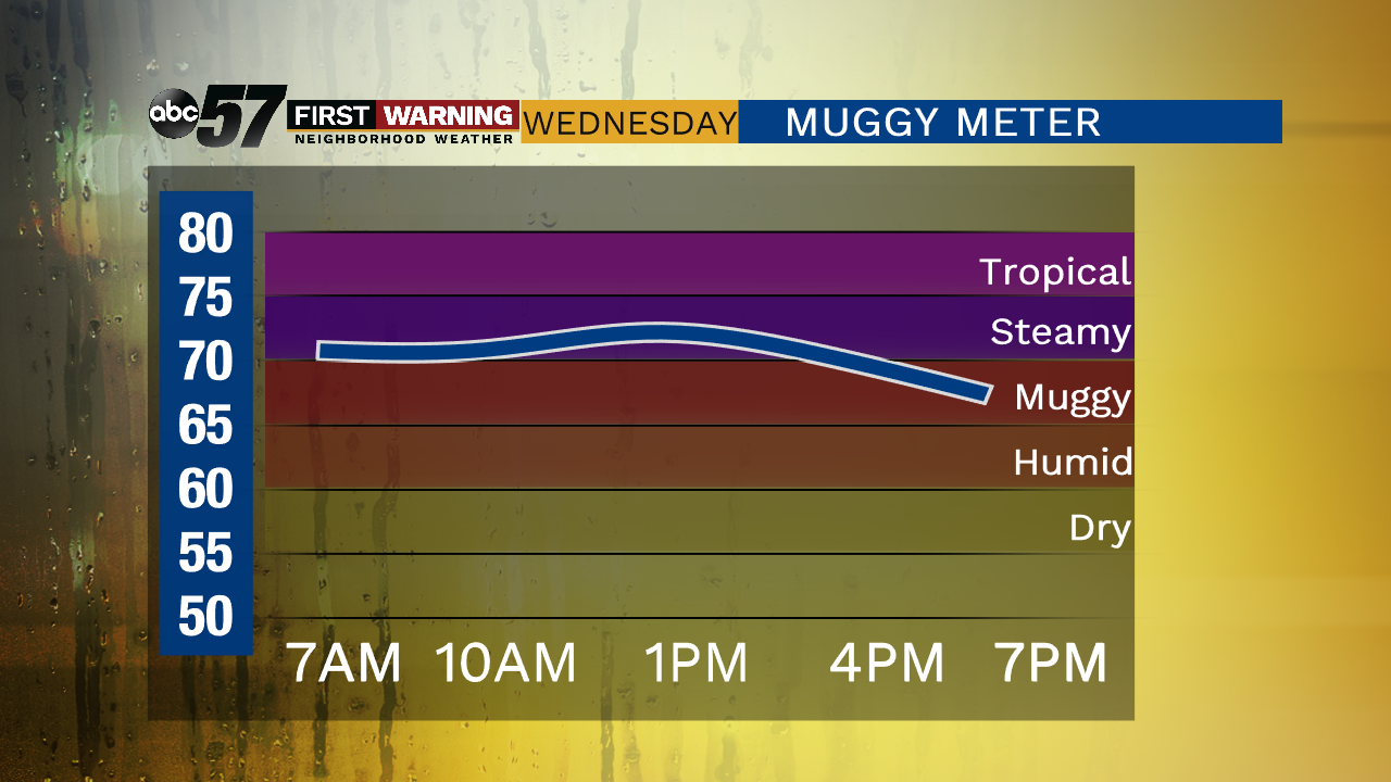
Unseasonable hot and humid weather continues through the end of the week; highs in the upper 80s, lows of 70 or above and a peak heat index in the 90s. The muggy environment will also fuel showers and storms, with the storm track just to our north will have a chance of storms each day. A cold front sweeps through Friday likely bringing widespread showers/storms and a reprieve from the heat this weekend.
Tonight: Isolated t-storms, partly cloudy. Low of 70.
Wednesday: Partly cloudy, isolated t-storms. High of 88.
Thursday: Partly cloudy, isolated t-storms. High of 88.
Friday: Scattered showers and storms. High of 80.
Sign up for the ABC 57 Newsletter