


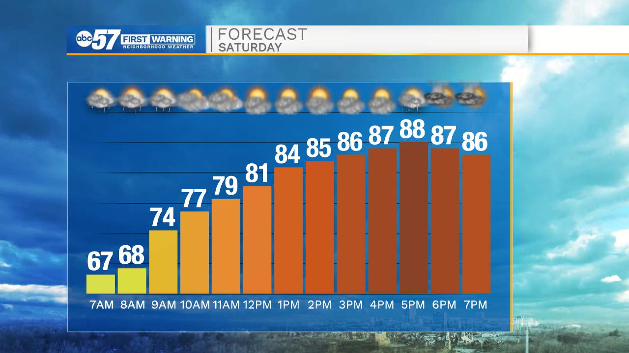
For the early birds this Saturday morning: there is a round of rain and possibly a few thunderstorms early. This round wraps up before 10 a.m., leaving a lot of the day dry. It’s going to be hot, warming into the upper 80s by afternoon.
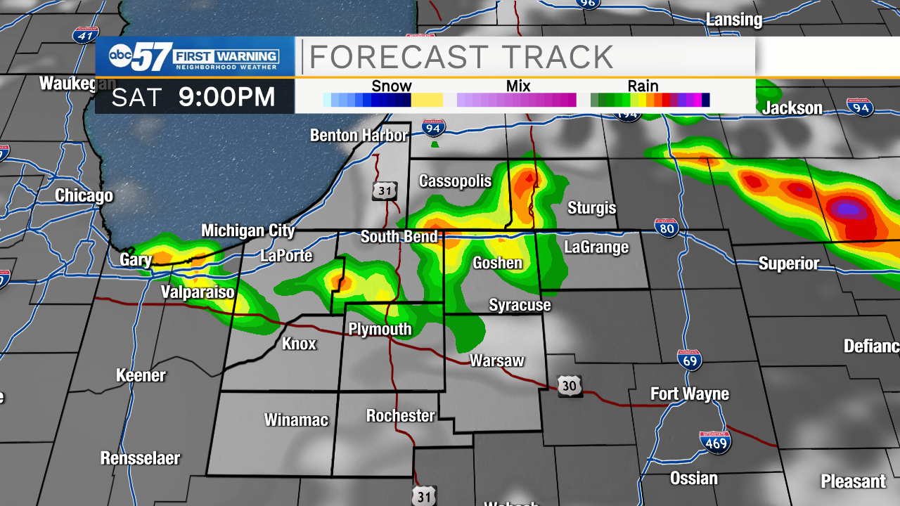
This evening, we could see another round of thunderstorms and showers start to pop again. A few thunderstorms could be on the strong side, with some gusty winds and heavy periods of rain. Many will stay dry though outside of these storms.
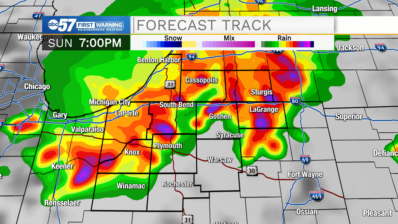
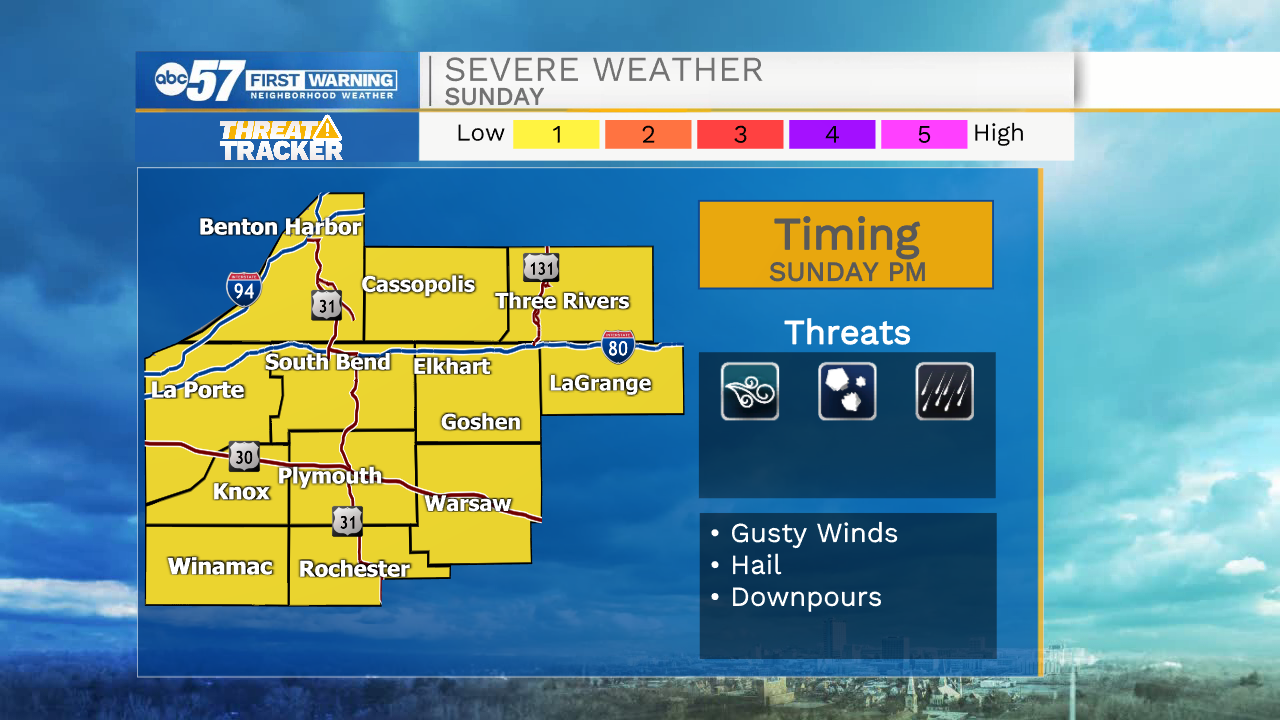
Overnight, temperatures fall into the low 60s with clearing skies. Sunday starts with a little sunshine, but by afternoon it is cloudy again with scattered thunderstorms in the second half of the day. Highs climb near 90 tomorrow. Rain and thunderstorms seems more promising on Sunday compared to Saturday.
There is a low risk for strong to severe storms Sunday evening. Primary concerns are gusty winds and hail.
There is a cool down to start the week, with high temperatures in the 70s Monday, Tuesday, and Wednesday, before warmer temperatures and a chance for showers returns Thursday.
Today: Dry day. Few evening showers/thunderstorms. High 88.
Tonight: Few showers/thunderstorms early. Some clearing late. Low 63.
Sunday: Increasing clouds. PM thunderstorms. High 90.
Monday: Morning showers. High 76.