
-
1:04

Overall pleasant for Michiana
-
1:52

South Bend Common Council issues an official apology to residents...
-
0:54

Slightly cool out the door
-
1:54

Suspect identified, charged in fatal hit-and-run of Timothy Johnson
-
0:39

Prairie Street Cemetery works to clear storm damage
-
1:36

Reaching out for support gives father a second chance in life
-
2:08

St. Joseph County police investigating Bypass incident from Saturday...
-
2:07

Color guard coach charged with Sexual Misconduct with a Minor
-
1:09

Pleasant for the rest of today
-
0:52

Still raining out the door
-
1:17

The 80s return next week
-
1:22

Rain showers for the rest of the day

The humidity continues to creep higher Wednesday and Thursday, along with it the chance of showers and thunderstorms. High in the low to mid 80s midweek, the best chance for showers and storms will be Wednesday evening and Thursday night, the latter being the most widespread and heavy. Temperatures drop to end the week with highs in the low to mid 70s going into the weekend.
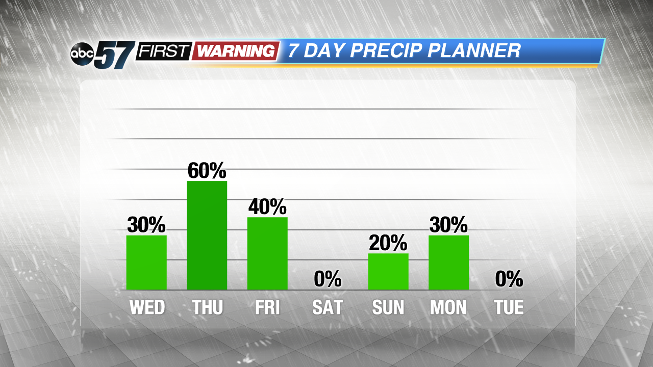 Thursday night into Friday is the most likely time for widespread storms.
Tonight: Partly cloudy, low 64.
Wednesday: Partly cloudy, a bit humid, high of 84, chance of PM storms.
Thursday: Showers and storm likely, high of 82.
Friday: Showers, highs in the low 70s.
Sign up for the ABC 57 Newsletter