


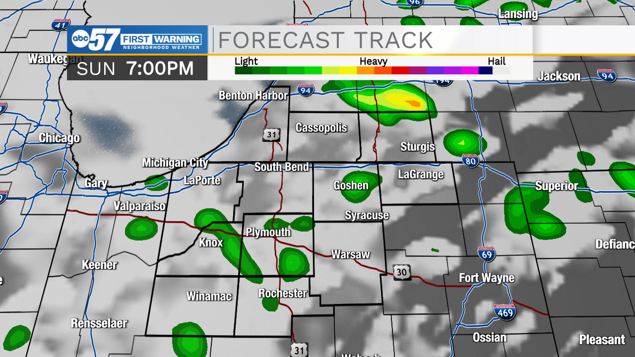
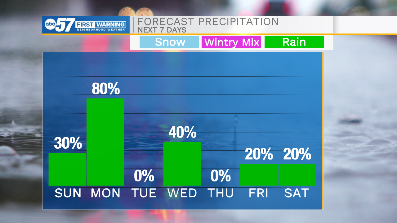
This morning a few isolated showers are impacting, primarily northern Michiana. A few off and on isolated showers will linger throughout the day. High temperatures will warm into the upper 70s to lower 80s. Tonight most of the rain will move out, then our next system arrives tomorrow afternoon. We will see scattered showers and storms move into Michiana during the late afternoon and evening. Those showers and storms will clear out during the early morning Tuesday. Tuesday afternoon partly cloudy skies are expected, so you will be able to get outside to enjoy a little sunshine. Another round of scattered showers and isolated thunderstorms will arrive Wednesday afternoon and evening. Those should clear heading into the end of the work week. Next weekend rain and storm chances should remain on the isolated side. High temperatures throughout the next several days will remain in the low to mid 70s.
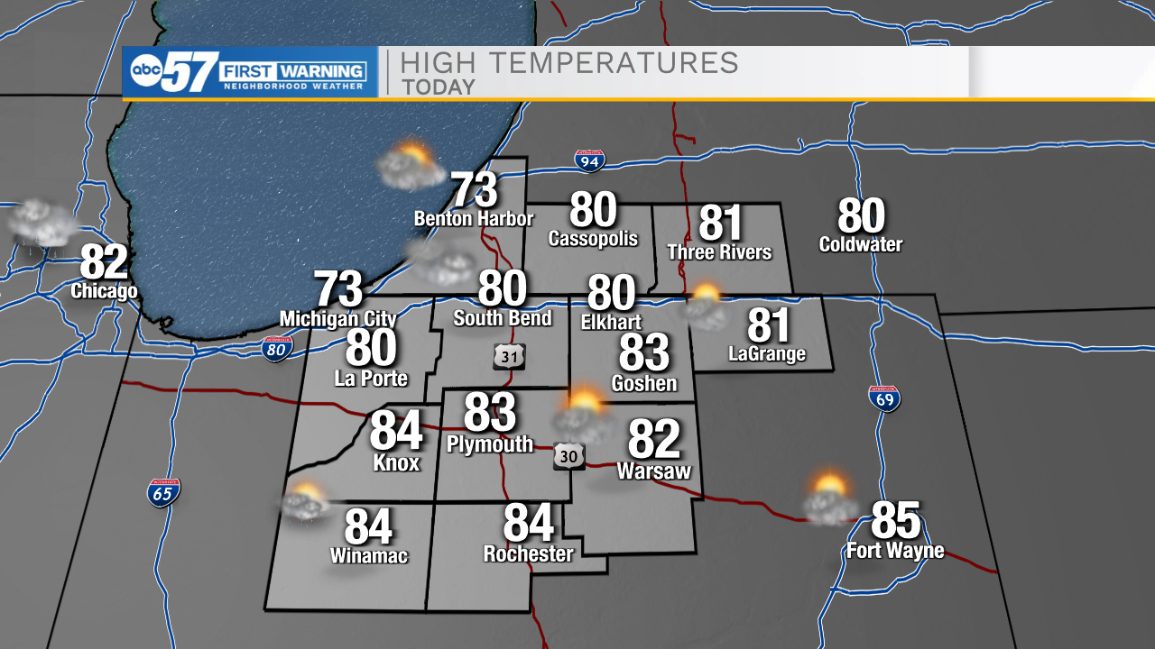
Today: Isolated light showers. High 80.
Tonight: Mostly cloudy. Low 62.
Tomorrow: Scattered showers/storms. High 78.
Tuesday: Partly cloudy. High 72.