
-
1:50

Preparations underway for South Bend’s annual St. Patrick’s...
-
0:24

CAVA set to open in Mishawaka
-
1:16

Groundbreaking project underway for housing development
-
0:52

Jefferson Boulevard renamed to kickoff St. Patrick’s Day festivities
-
0:35

Congressman Rudy Yakym on Iran conflict
-
3:22

A look at some of the big concerts coming to St. Joseph County...
-
1:50

Mild Sunday, snow Monday
-
4:37

Morris Performing Arts Center show season starts tonight
-
1:53

Thousands without power due to high wind gusts
-
2:49

High Wind Warning today
-
1:08

Elkhart residents fight unauthorized mobile home
-
2:40

Fairfield breaks ground on $7 million athletics and band facilities...

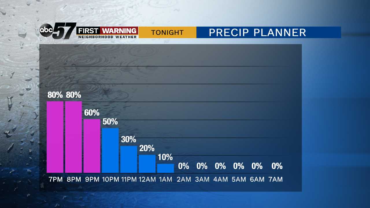
The worst weather lasts through Thursday evening; rain, snow, gusty wind and a wind chill in the 20s. Precipitation ends and the wind starts to calm after midnight.
A chilly Friday, after the first freeze of the season temperatures slowly warm into the mid-40s but there will be sunshine. A weak system could bring a few flurries early Saturday otherwise the weekend is dry. Clouds break to end the weekend and temperatures reach their warmest point on Monday with highs near 50.
Tonight: Blustery with rain and snow early. Low of 28.
Friday: Mostly sunny, breezy. High of 44.
Saturday: Early morning flurries, mostly cloudy. High of 40.
Sunday: Partly cloudy. High of 45.
Monday: Partly cloudy. High of 50.
Sign up for the ABC 57 Newsletter