
-
3:01

Southwest Michigan dispensaries welcome thousands for first 4/20...
-
3:25

Emergency funding and disaster recovery in Michigan explained...
-
1:40

American importers owed billions in refunds for tariffs
-
0:28

Mishawaka police officers rescue man from apartment fire
-
0:45

South Bend Schools fires teacher arrested for grooming and enticing...
-
1:08

Drier week expected for Michiana
-
2:33

ISP investigating death of 82-year-old inmate at Miami Correctional...
-
0:43

Freeze Warning active
-
0:42

NIA participates in road cleanup volunteer day
-
1:55

Community concert brings generations together through music at...
-
2:06

South Bend Cubs take series from Beloit despite no-hit loss in...
-
1:54

St. Joseph River rises into minor flood stage after weeks of...

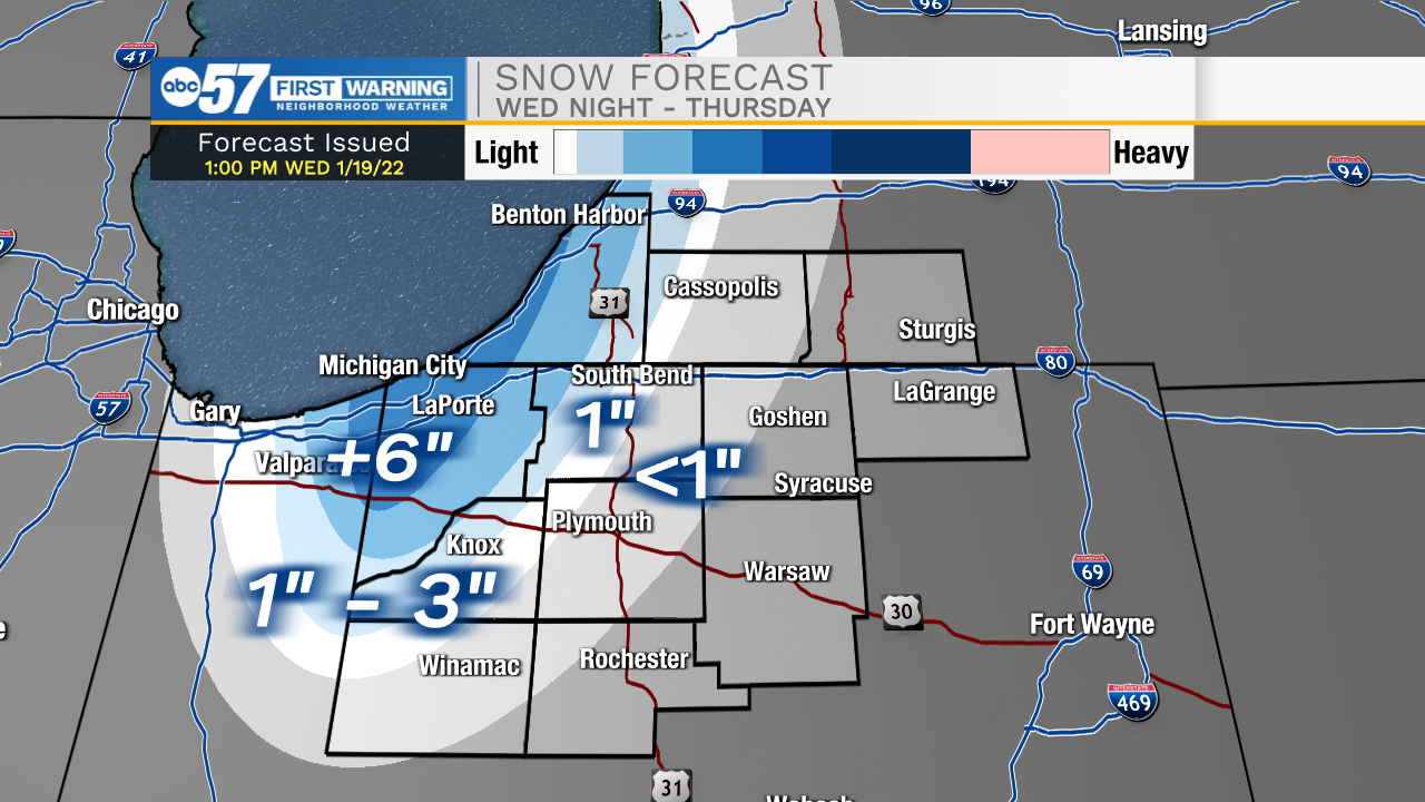
Lake effect snow showers ramp-up Thursday morning. The peak snowfall will be from 4:00 a.m. to noon, falling mostly in LaPorte and Berrien counties. The I-94 corridor will be hazardous, with whiteout conditions possible. If you can avoid travel, please do. Areas outside the main band could get lesser amounts of snowfall, but there will be a sharp cutoff. The cold takes hold over the next ten days, temperatures remain below freezing. There still is no major storm on the horizon. A clipper could bring light snow this weekend, and lake effect early next week.
Tonight: Lake effect snow. Low 14.
Thursday: Lake effect snow showers. High 22.
Friday: Mostly sunny. High 24.
Saturday: Mostly cloudy. High 28.
Sign up for the ABC 57 Newsletter