
-
0:32

Granger residents share input on proposed S.R. 23 roundabout
-
2:59

Seven local boards unanimously approve fire territory merger...
-
2:05

JobSpark helps inspire career exploration for middle school students
-
2:01

MPHPL launches new bookmobile to extend library access
-
2:17

Will Pauling shines, Jadarian Price shows versatility at Notre...
-
2:55

Notre Dame’s Pro Day gives 16 seniors one more shot to impress...
-
2:57

South Bend residents voice concerns over proposed pedestrian...
-
3:03

Prices at the pump continue to rise across Michiana
-
1:35

Warming up before storms arrive Thursday
-
2:06

Staying sunny until Thursday
-
0:58

Goshen City Council amends DORA rules amid community concerns
-
1:20

SB Common Council adopts Downtown 2045 Plan

Bitter cold, light snow showers and flurries will continue not just Tuesday but the rest of the week. Highs will struggle to break into the double digits, with overnights lows in the single digits and at times nearing zero. The bitter cold will keep roads slick, sunshine and salt have a hard time being effective with frigid temperatures. We’ll watch the weekend for another round of significant snowfall.
Tonight: Mostly cloudy with light lake effect snow, low 6.
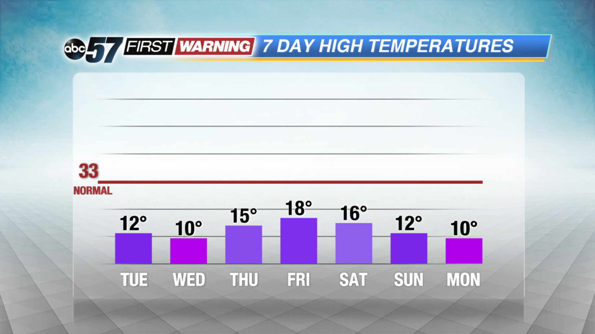
Tuesday: Mostly to partly cloudy and breezy with a chance of lake effect snow showers mainly in Michigan. High of 12.
Wednesday: Partly cloudy, slight chance of snow, high of 10.
Thursday: Partly cloudy, highs in the mid-teens.
Sign up for the ABC 57 Newsletter