Major weekend storm system to bring mild temps, strong winds, storms
Posted: Feb 19, 2019 11:49 AM EDT
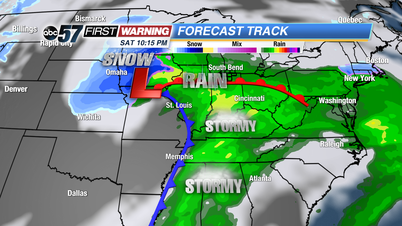
After Wednesday morning's snow and freezing rain event, all eyes will turn to the weekend as a large, potent and spring-like storm system will charge across the eastern half of the country. Yes, that does include us in Michiana. With this particular system, we're not looking at a significant wintry event. Nonetheless, we will see legitimate impacts as it pushes through the Great Lakes Saturday night and Sunday.
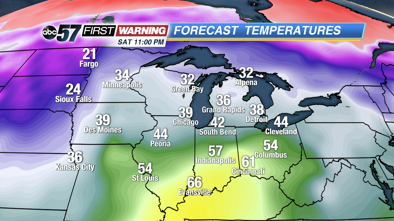
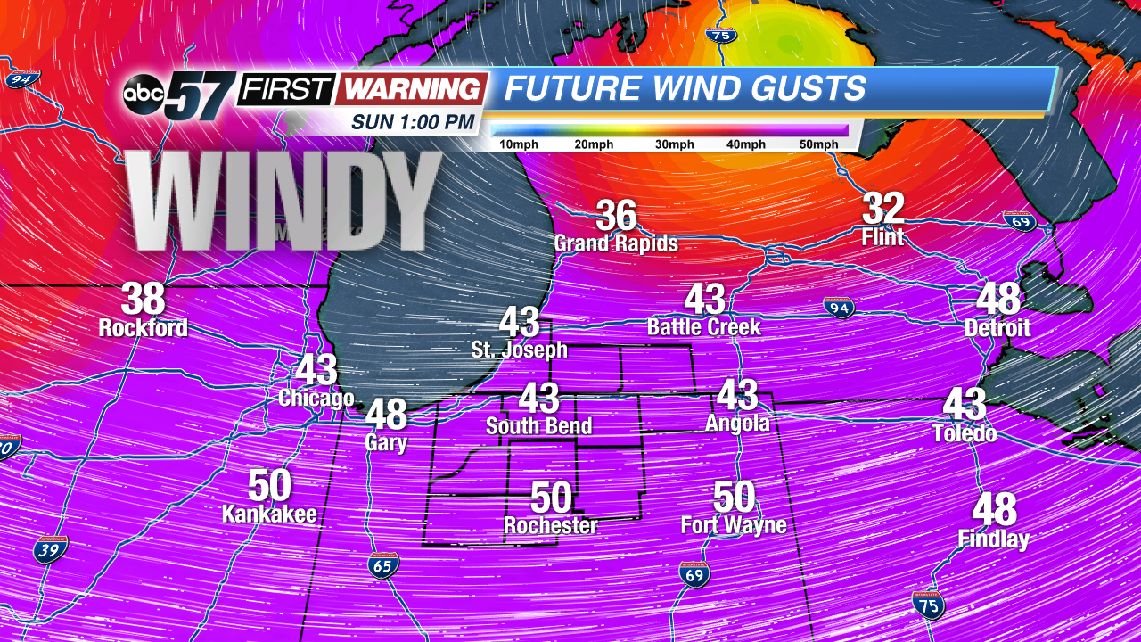
Aside from the chance of rain showers Saturday, you'll notice winds pick up and temperatures warm up. By the late afternoon and evening hours, temperatures will max out well into the 40s and 50s across the region. It will be short-lived warmth as cold air spills in for Sunday behind the cold front. Regarding winds, they won't be overly strong during the day Saturday. They will pick up big-time Saturday night into Sunday.
Gusts of 30-45 mph are likely during this timeframe with wind speeds likely to maximize during the day Sunday. Depending on how strong the low pressure center becomes, gusts of 50+ mph are not out of the realm of possibilities. This is something we will need to monitor closely as power outages may become a concern. The winds will diminish by Monday morning.
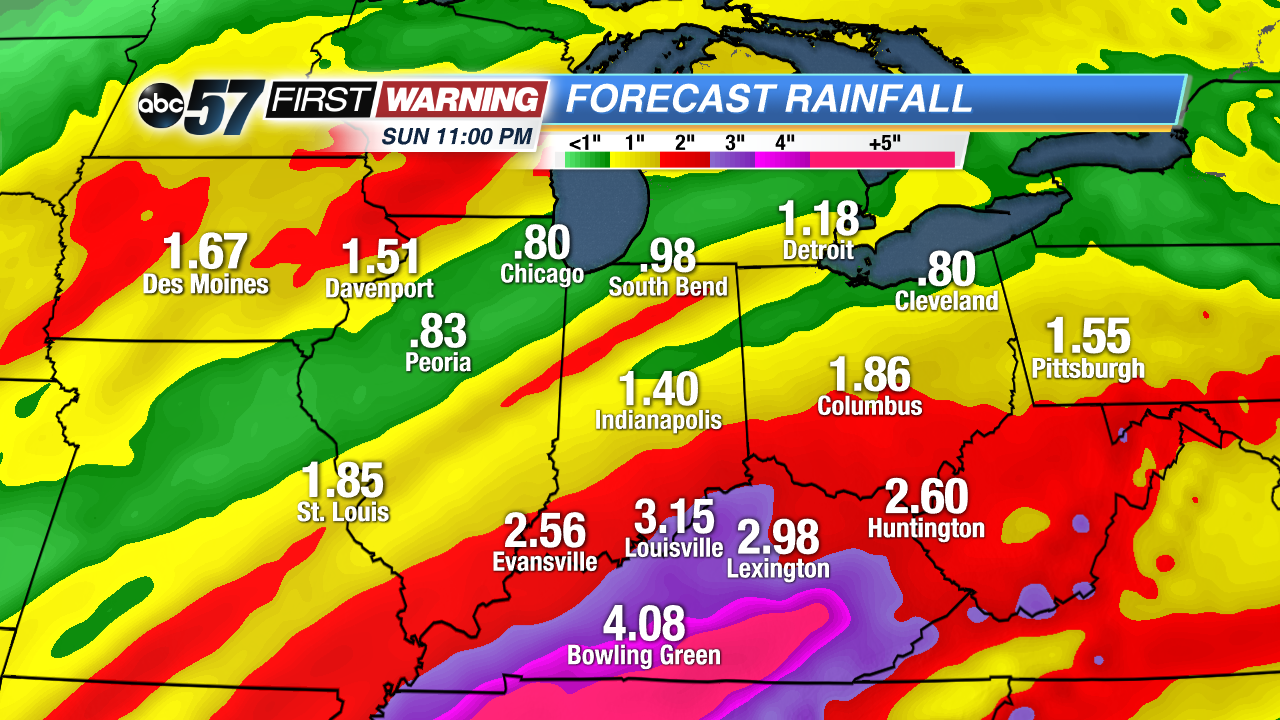
Let's switch back to the rain threat. With it being the anniversary of the record flooding of February 2018, any forecast containing rain may put some folks on edge. Fortunately, the heaviest rain and substantial flooding risk will remain to our south. Southern Indiana, Kentucky, Tennessee, and parts of Dixie Alley could see a few to several inches of rainfall by next Sunday. As a result, significant flooding is possibility for those locations with some rivers likely heading into major flood stage.
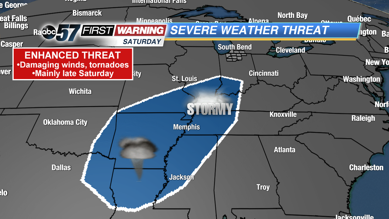
For us, rainfall totals will likely stay below one inch. That could lead to minor flooding concerns, but the overall flood risk is not high. But it doesn't stop there! This system will be spring-like, which means there will be a formidable thunderstorm and severe weather threat as well. Plenty of Gulf of Mexico moisture will surge northward to the Indiana-Michigan state line late in the day Saturday. There will also be quite a bit of wind energy in the upper levels of the atmosphere. These will combine to support an enhanced risk of severe weather from southern Illinois and Indiana to parts of Texas and Louisiana. Damaging winds and tornadoes will be possible in the blue outlined area above, per the Storm Prediction Center. The severe weather threat may shift some over the coming days, but will likely not push north of U.S. 24. Some thunder and lightning, though, are certainly plausible for Michiana late Saturday.

