
-
2:25

Lake effect snow through this morning
-
0:25

City commission approves new downtown paid parking plan
-
3:41

Community shares concerns at board meeting over offensive language...
-
2:03

Staying safe around downed power lines
-
3:10

Former players share stories of Lou Holtz before his burial
-
3:02

Trust, Love, and Commitment: Lou’s Life Lessons
-
1:32

Notre Dame ready for funeral traffic
-
3:23

Notre Dame community says their final farewell to Coach Lou Holtz
-
5:58

Remembering Lou Holtz: Broadcasters reflect on Holtz’ role...
-
16:25

ESPN’s Rece Davis remembers the life and legacy of Lou Holtz
-
1:17

Cold, snowy and breezy overnight
-
2:15

’Political vengeance,’ Drake, GOP leaders respond to swatting...

Wednesday, January 22nd, 2020
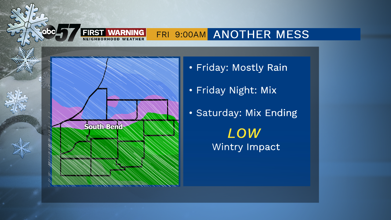
A mix of sun and clouds with daytime highs in the mid-30s. You’ll see more clouds build in for the evening. Temperatures then remain above normal for the rest of the week and gradually warm near 40 degrees. Another system moves it's way in starting Thursday evening and will last through Saturday. A wintry mix of rain and snow is expected.
Today: Partly cloudy. High 37.
Tonight: Mostly cloudy. Low of 28.
Thursday: Mostly cloudy, evening wintry mix then snow. High 37.
Friday: Cloudy, and rain/snow likely. High 40.
Sign up for the ABC 57 Newsletter