
-
2:04

Cold out the door, Fair by afternoon
-
0:20

School City of Mishawaka approves Growing Together Preschool,...
-
2:15

“Hoosier Hospitality, Hoosier Lanes” local business in Wheatfield...
-
2:34

Local student earns spot at the Scripps Howard National Spelling...
-
2:38

NWS confirms EF-2 tornado hits Starke County Tuesday night
-
0:59

Edwardsburg tornado cleanup continues after second round storm
-
2:28

Once in “tornado emergency,“ Knox residents reflect on twister’s...
-
3:11

SJC police officer talks flooding danger on roads
-
2:18

People in Starke County prepare to fix damage after Tuesday night’s...
-
1:07

A reminder it’s March, snow returns by next Monday
-
2:15

Starke County face-to-face with severe weather
-
2:03

Severe risk diminishing, cold rain staying today

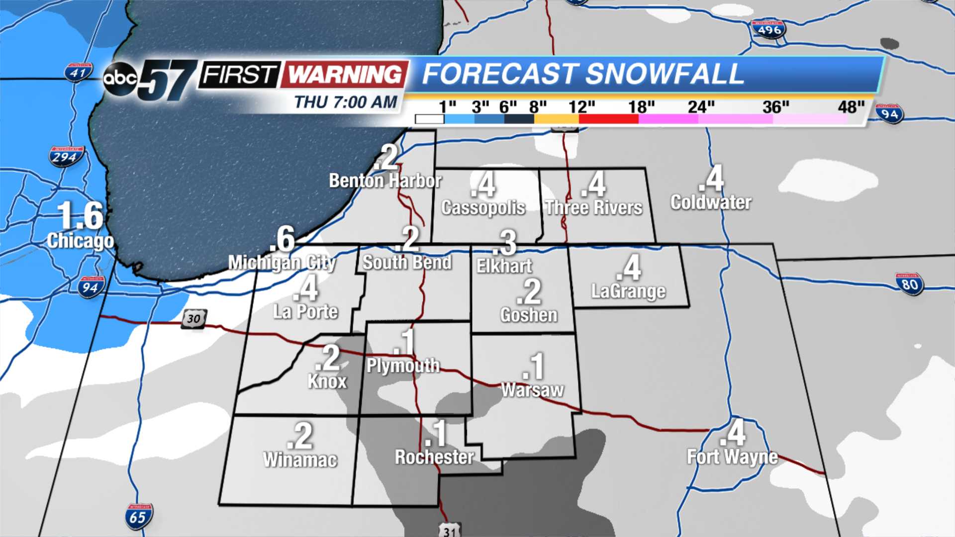
A cold rain changing to a wet snow overnight, slushy accumulation of less than one inch possible by Thursday morning.
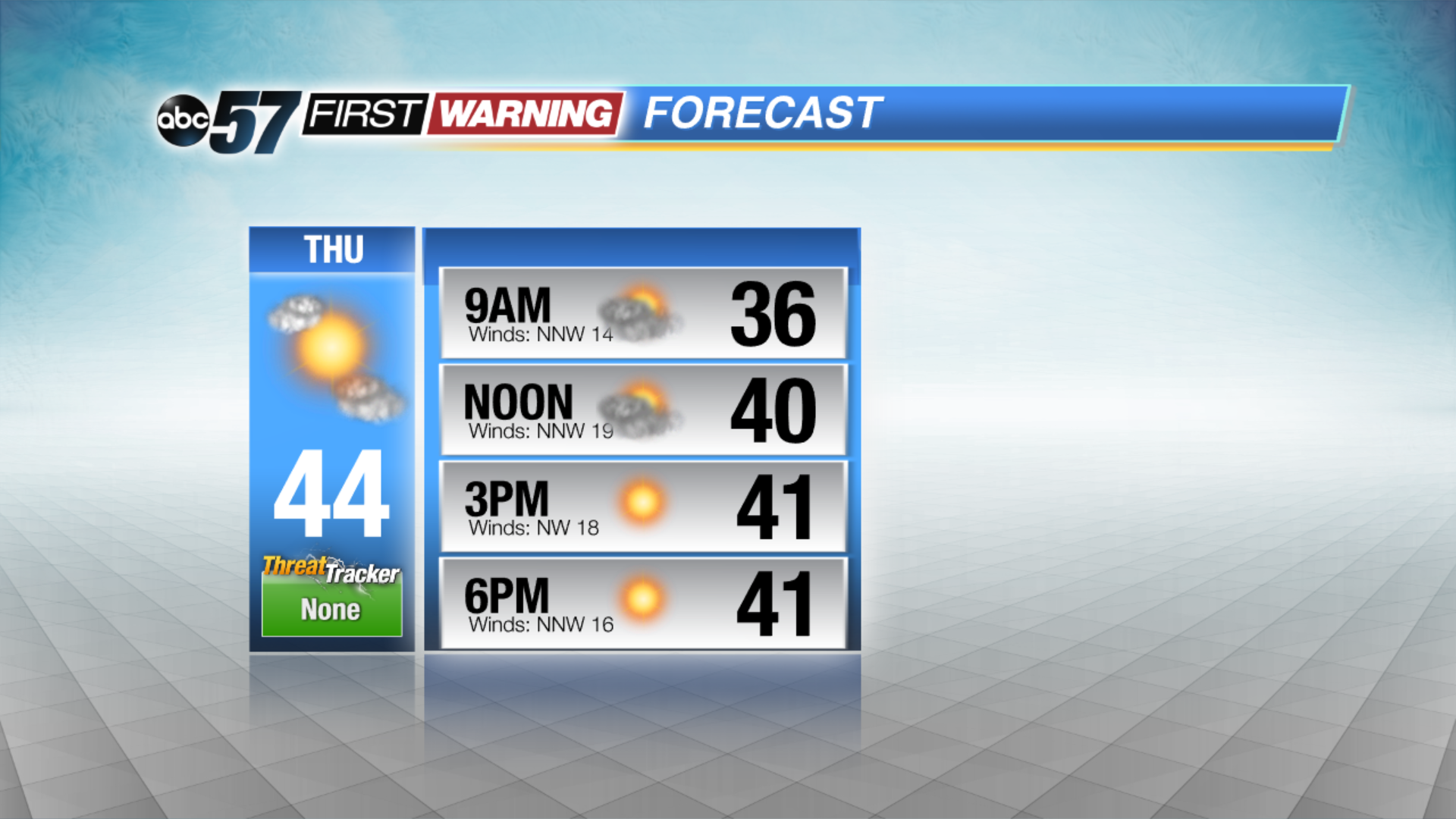
Skies clear Thursday but temperatures are slow to warm, highs struggle to make the mid-40s with a northwest breeze. The forecast improves greatly through the weekend with sunshine and a steady warm-up through the 50s. There’s little chance of rain until the middle of next week.
Tonight: Rain turns to a wet snow, low of 33.
Thursday: Clearing, cool and breezy, high of 44.
Friday: Sunny, high of 50.
Saturday: Partly cloudy, high of 54.
Sign up for the ABC 57 Newsletter