
-
0:44

26th annual St. Patrick’s Day Parade takes over Downtown South...
-
2:42

Active weather arrives Sunday
-
3:22

Calm today, storms return Sunday
-
2:58

Thousands of people across Michiana experienced power outages...
-
1:13

Earl Wigfall holds Detective Trivia Night for Sheriff campaign
-
1:50

Preparations underway for South Bend’s annual St. Patrick’s...
-
0:24

CAVA set to open in Mishawaka
-
1:16

Groundbreaking project underway for housing development
-
0:52

Jefferson Boulevard renamed to kickoff St. Patrick’s Day festivities
-
0:35

Congressman Rudy Yakym on Iran conflict
-
3:22

A look at some of the big concerts coming to St. Joseph County...
-
1:50

Mild Sunday, snow Monday

The mild week before Christmas continues with highs near 40 through Friday. A weak system could bring some rain Thursday night but the pattern stays quiet until Christmas Eve. Sunday will start the drop in temperatures, teens and twenties for highs and lows in the single digits, next week. There is a chance for a White Christmas but there’s no major snow in the forecast at this time.
Tonight: Mostly cloudy, low of 26.
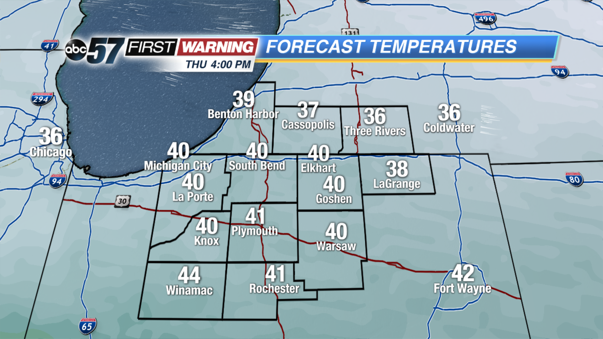 Thursday's Highs
Thursday: Partly cloudy, high of 40, chance of rain late.
Friday: Mostly cloudy, high of 42.
Saturday: Mostly cloudy, highs in the mid-30s.
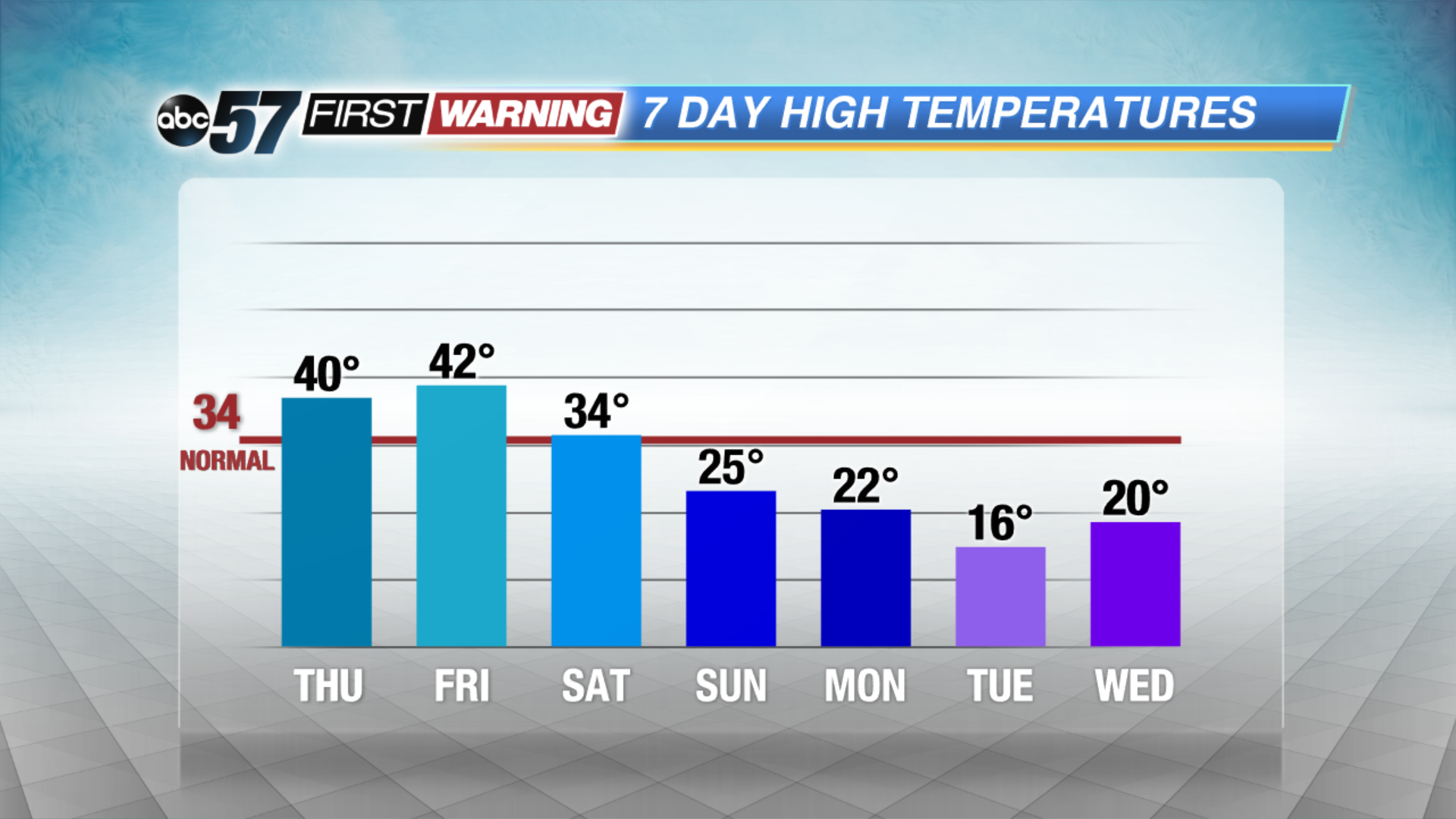 Turning MUCH colder by Christmas Eve.
Sign up for the ABC 57 Newsletter