


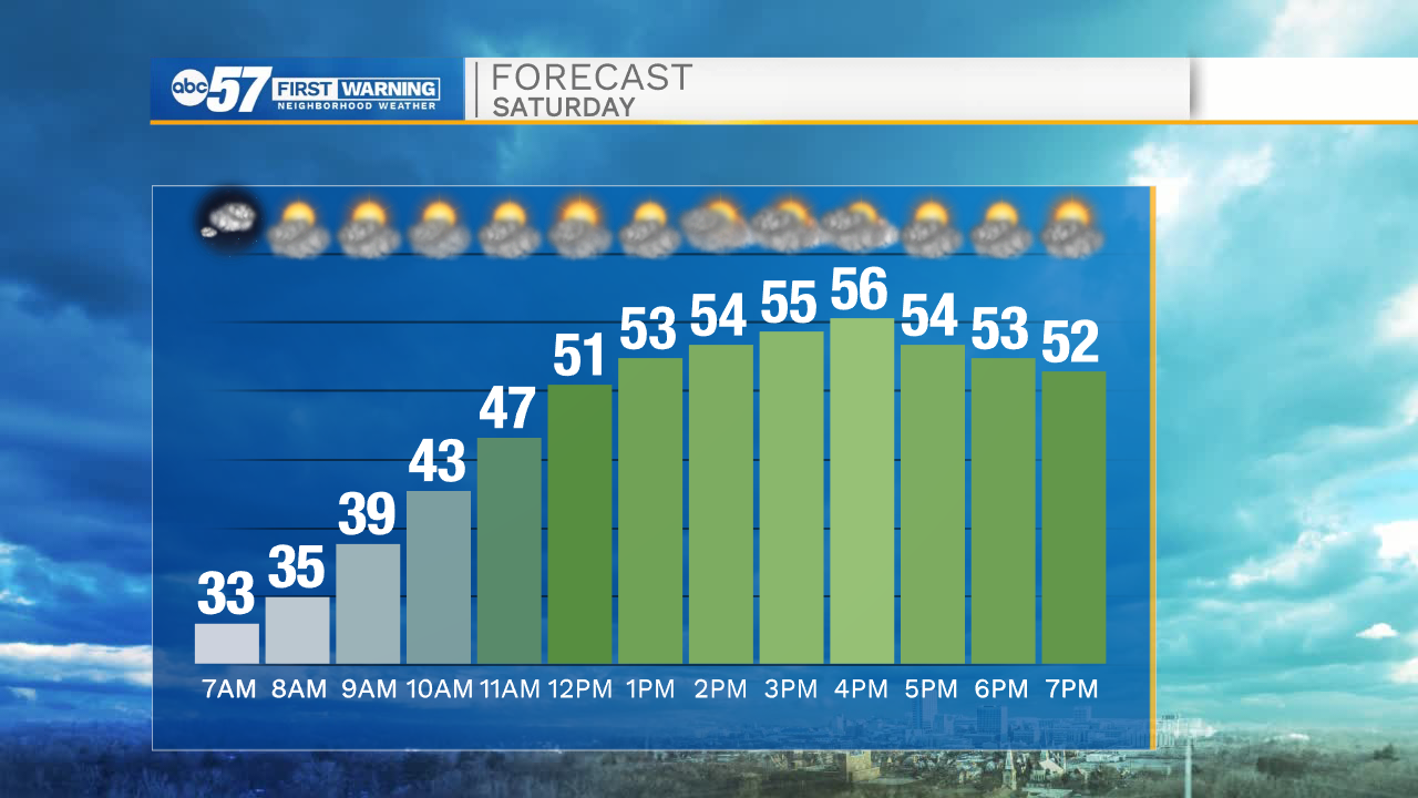
It’s a chilly start to the day with temperatures starting in the low 30s. You may find some frost on your windshield – you may even need to grab your scraper if you’ve put it away for the season.
We’ll climb through the 40s before reaching a high in the mid 50s, slightly warmer than yesterday. Today is quiet with partly cloudy skies.
Overnight temperatures dip into the mid 30s again, so patchy frost is possible again.
Sunday is warmer with a high around 60. We’ll continue to warm into Monday, then a big cool down for Tuesday along with precipitation.
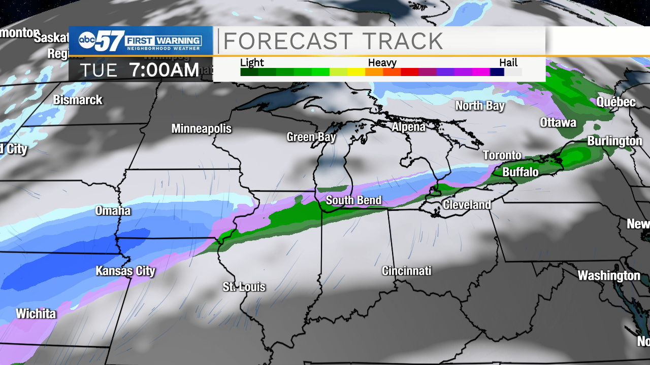
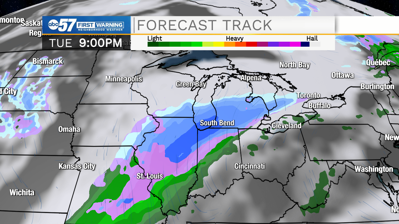
Monday night precipitation begins as rain, but as temperatures drop, could turn to a wintry mix or some snowflakes. Tuesday’s high stays in the low 40s as showers continue through most of the day. Wednesday morning there could be a few snow showers early, otherwise the day dries out and the rest of the week stays quiet.
Temperatures rebound into the 50s to end the week then 60s by next weekend.
Today: Partly cloudy. High 56.
Tonight: Partly cloudy, frost possible. Low 35.
Sunday: Partly cloudy. High 60.
Monday: Mostly sunny, breezy. High 64.