Milder end of the week, focus turns to Monday's potential snow.
By:
Tom Coomes
Posted: Dec 11, 2019 6:26 PM EDT

-
1:40

Elkhart holds annual Memorial Day parade
-
3:37

Law enforcement, veterans and more participate in Back the Blue...
-
3:47

Families honor lost loved ones as lifeguards return to South...
-
1:16

No shortage of sunshine today
-
1:37

Memorial Day parade forecast
-
4:51

Local band ’The Erly’ stops by ABC57 ahead of June 3 performance
-
1:17

VERY foggy first few hours of the morning
-
1:57

A local taste brings New Carlisle community together on race...
-
0:45

Pancakes help raise funds to support the Alzheimer’s Association
-
1:03

Lighter rain expected into the afternoon
-
1:04

Non-severe storms expected
-
1:16

Showers start this morning

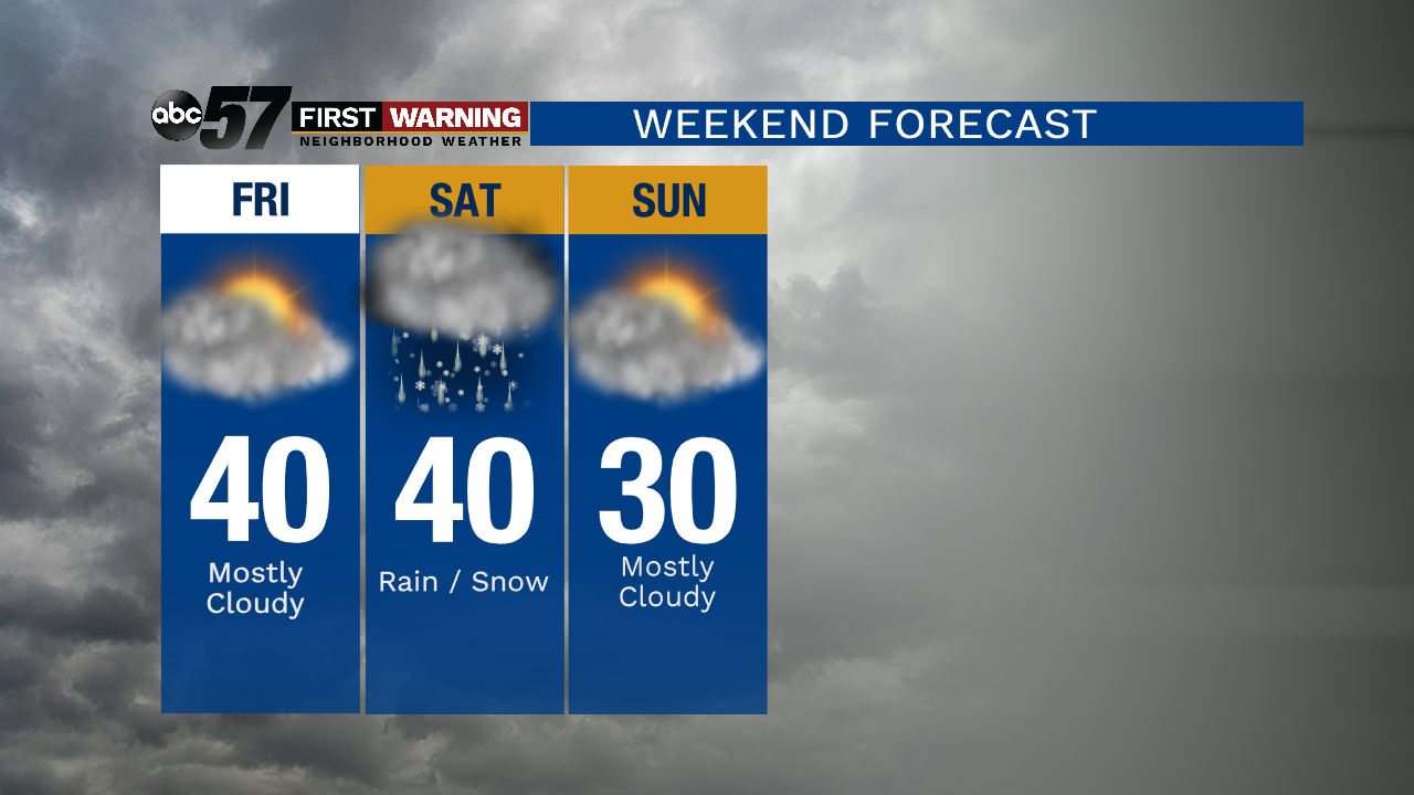
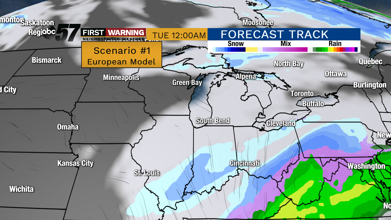
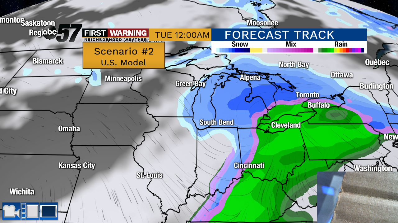
The weather moderates to end the week, mostly cloudy with highs near 40 and lows near the freezing mark. Michiana remains on the edge of any major weather with only a slight chance of rain/snow Saturday and temperatures cooling into Sunday. The main focus will be on Monday to see if we are grazed or take a more direct hit from a winter storm. There is still not a good model consensus.
Tonight: Partly cloudy. Low of 16.
Thursday: Increasing clouds. High of 40.
Friday: Mostly cloudy. High of 40.
Saturday: Cloudy, chance rain/snow. High of 40.
Sign up for the ABC 57 Newsletter