
-
1:48

Scattered showers this evening, Much cooler overnight
-
1:50

Showers and storms this afternoon
-
0:20

One person injured in shooting
-
0:36

Eddies Circuit Robotics holds competition Saturday
-
0:32

21st annual Nappanee Model Train Show
-
0:38

Local boys basketball team headed to IHSAA state finals
-
3:49

Midwest Meowfest brings kitten advocacy to attendees, new homes...
-
1:52

Mild tonight, showers tomorrow
-
1:43

Pleasant to start the weekend
-
3:06

Pulaski County weighs stricter solar rules amid resident concerns
-
0:40

Marian High School hosts World Down Syndrome Awareness Walk
-
2:33

South Bend leaders call for an end to gun violence

Winter weather returns, snow showers are likely through Wednesday. The cold northwesterly flow will set up lake effect snow showers during the early morning, when temperatures fall into the 20s. Snow showers wane each afternoon as temperature warm above freezing. Total accumulation of one to three inches is possible over the next three days, the brunt of which is likely Tuesday. Skies clear and temperatures warm to end the week, 50s possible by the weekend.
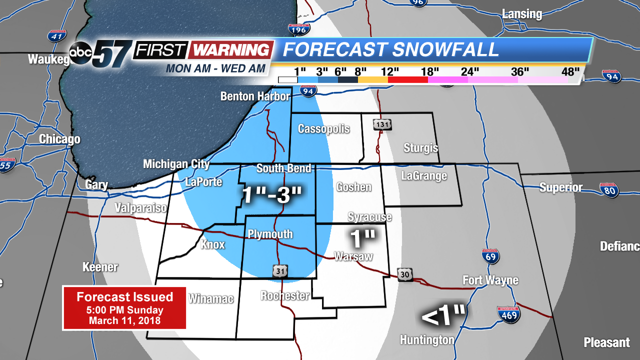
Tonight: Mostly clear, snow by morning, low of 24.
Monday: Mostly cloudy with a chance of scattered snow showers, breezy, high of 36.
Tuesday: Lake effect snow showers, high of 32.
Wednesday: Morning snow showers, highs in the mid-30s.
Sign up for the ABC 57 Newsletter