
-
2:14

More storms midweek
-
2:00

Elkhart nonprofit packs and delivers food for storm victims
-
0:38

Baroda community to decide on abolishment of village government
-
1:49

La Porte County tornado damage results
-
2:30

City of South Bend using AI in a resident-focused Program
-
2:59

Elkhart County Emergency Management starts recovery process after...
-
0:58

Wonderful start to week
-
0:58

Cooler out the door
-
1:27

Updated Tornado Survey- June 1, 2026
-
1:13

Severe Weather possible midweek
-
1:07

Quiet Monday, Stormy Midweek
-
2:52

GhostLight Theater presents Next to Normal Performance for Benton...

The wet pattern continues through Thursday. A few showers are possible during the day Wednesday but the heaviest rain this week will come Wednesday night into Thursday morning. Some areas could see more than one inch with embedded thunderstorms. The chance of thundershowers continues through Thursday. Overall any severe threat remains very low but minor flooding / standing water will continue to be an issue. The forecast still looks dry this weekend.
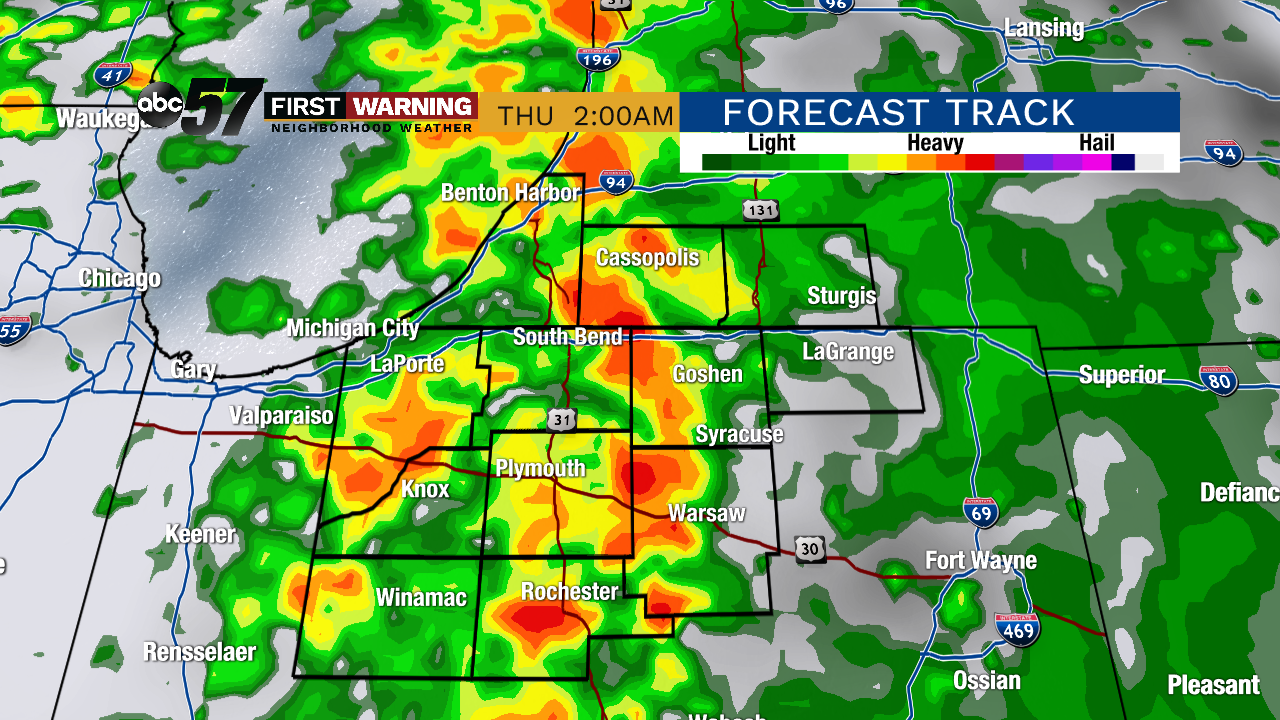
Tonight: Chance of showers, cloudy, low of 43.
Wednesday: Scattered showers, high of 62.
Thursday: Scattered showers and thunderstorms possible, high of 68.
Friday: Partly cloudy, high of 54.
Sign up for the ABC 57 Newsletter