
-
1:17

VERY foggy first few hours of the morning
-
1:57

A local taste brings New Carlisle community together on race...
-
0:45

Pancakes help raise funds to support the Alzheimer’s Association
-
1:03

Lighter rain expected into the afternoon
-
1:04

Non-severe storms expected
-
1:16

Showers start this morning
-
1:59

Mac & Cheese festival turns Four Winds Field into a kitchen
-
0:45

Michiana Spring Clay tour encourages people to try and take a...
-
2:56

Fresh Cuts, Fresh Starts: Re-Entry Program Gives Back in Elkhart
-
0:53

Jr. Irish Memorial Day invitational celebrates veterans and active-duty...
-
1:15

Another rain chance this holiday weekend
-
0:46

Holiday weekend starts rainy

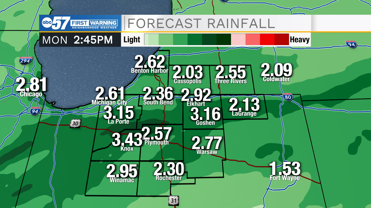
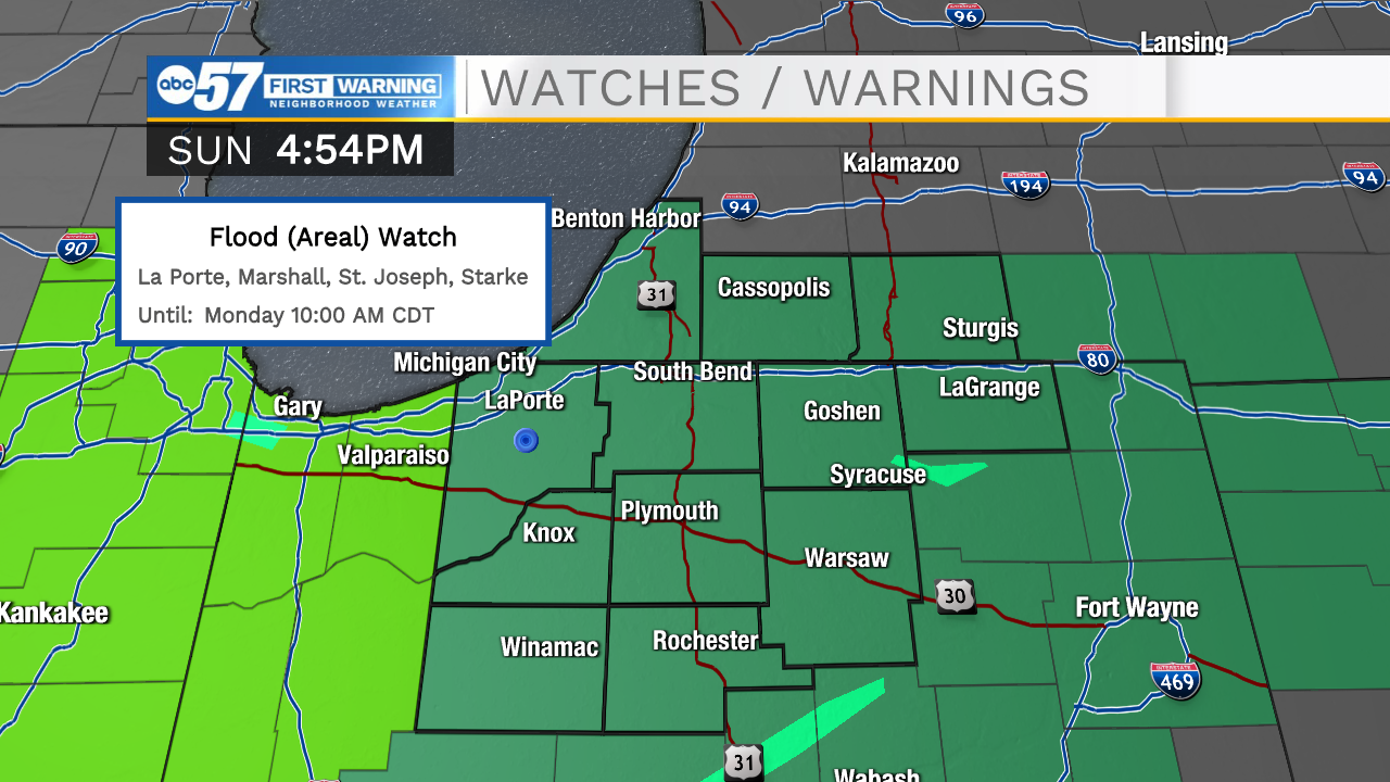
Scattered showers will continue through the rest of the evening and overnight. A few isolated thunderstorms look to develop later as well bringing a small chance we could see a few strong to severe thunderstorms. Overall severe threat is low, but we could get some gusty winds and smaller hail. Rain will persist into tomorrow afternoon as well, but all showers should clear by the evening. We will catch some dry weather Tuesday and most of Wednesday, but then another round of rain arrives Thursday and Friday. Temperatures this week will hold in the mid to upper 50s for highs.
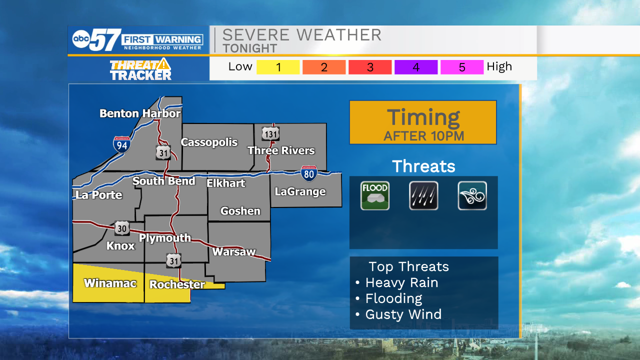
Tonight: Showers/storms. Low 38.
Tomorrow: Scattered showers. High 54.
Tuesday: Mostly sunny. High 56.
Wednesday: Mostly sunny/partly cloudy. High 58.
Sign up for the ABC 57 Newsletter