
-
2:11

This week’s ABC57 Cub Reporter is Lucas Castillo
-
2:48

Mishawaka Mayor Dave Wood gives the State of the City address
-
3:34

Indiana leads the U.S. in gas price increases
-
1:31

The Great Futures Breakfast held by the Elkhart Boys & Girls...
-
1:10

Boys & Girls Club of Benton Harbor wins a violence prevention...
-
2:28

Local landscaper turns heads with his manicured lawns and young...
-
2:38

Skylar Diggins returns to the Midwest as Chicago Sky look for...
-
4:52

U.S. senators representing Michiana work to ban government officials...
-
5:04

Family, friends, and South Bend community members mourn beloved...
-
5:25

Exclusive look inside Angels in the Attic operations and their...
-
0:49

INDOT makes public presentation to residents of Middlebury about...
-
2:53

Friendly poodle brings smiles, alleviate stress at the Ivy Tech...

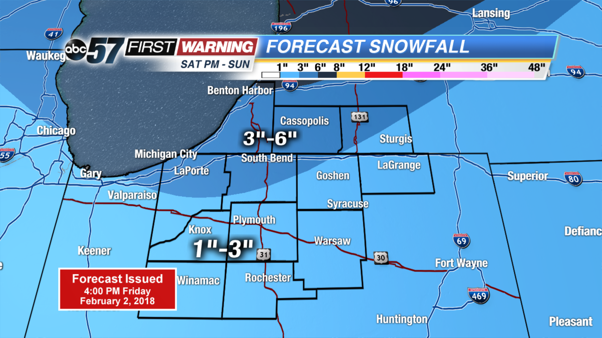
Temperatures warm through Saturday, highs may break the freezing mark ahead of our next round of snow. A storm system will bring a burst of snow Saturday night and light snow will continue through the first half of Sunday, with some lake enhanced snow showers. Many will see up to three inches of snow with amounts as high as six possible. Bitter cold continues next week, with more snow in forecast.
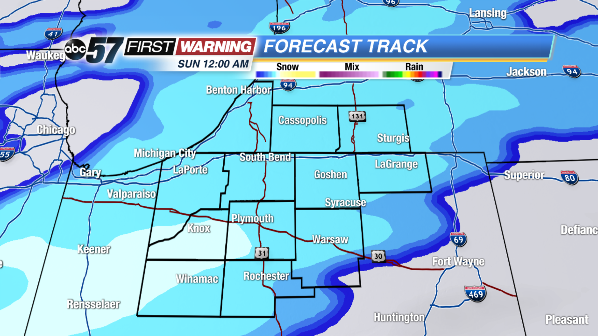
Tonight: Partly Cloudy, low of 14.
Saturday: Snow by the afternoon, high of 32.
Sunday: Snow showers through midday, temperatures fall from 30.
Monday: Mostly sunny, highs near 20.
Sign up for the ABC 57 Newsletter