
-
1:03

Cold showers continue this morning
-
1:07

Easter Bunny stops at Tako Loco and Tokyo for Easter fun
-
0:49

Annual Easter Egg Hunt brings families together in Elkhart
-
1:06

Marshall County Humane Society reschedules Dog Egg Hunt
-
2:01

Martin Luther King Dream Center hosts MLK March in South Bend
-
1:54

South Bend Cubs opener postponed by weather, but fans still find...
-
2:01

Sights and sounds from South Bend Cubs Opening Day
-
1:32

NIPSCO ’flatly rejected’ further negotiations, USW workers...
-
3:36

The art of groundskeeping at Four Winds Field
-
3:32

The history behind America’s only ballpark synagogue turned...
-
1:59

South Bend opens season against Quad Cities in familiar Midwest...
-
4:21

South Bend Cubs owner discusses $48M stadium expansion, changes...

Showers and storms continue overnight, the main threat being flooding with more heavy rain expected after midnight.
Thursday is the last muggy and stormy day. Shower and storms are still likely through the first half of the day, gradually clearing by evening. The humidity drops into Friday, a more pleasant and dry day. The weekend also looks pretty fair and milder with lower humidity. There is a chance of an isolated shower Sunday.
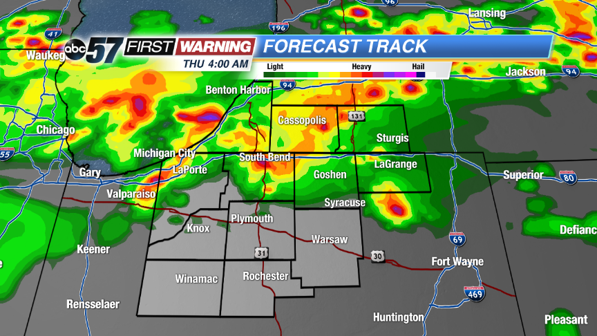 High resolution run of Forecast Track plots another round of heavy rain early Thursday.
Tonight: Scattered storms, low 72.
Thursday: AM showers and storms, mostly cloudy, high 84.
Friday: Partly cloudy, highs 76.
Saturday: Mostly sunny, highs in the low 80s.
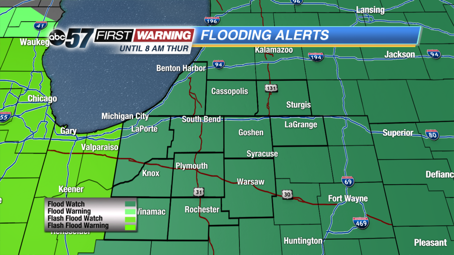 FLOOD WATCH: Expanded time until 8 AM EDT, expanded area all of Michiana.
Sign up for the ABC 57 Newsletter