


Today is still a little breezy, but it should be mostly dry.
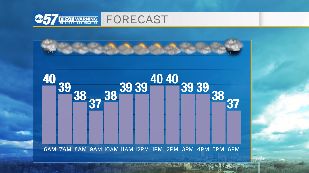
This evening, a few showers are possible. Showers could be a rain/snow mix, then all snow.
This is the last day through the 10-day forecast where temperatures climb into the 40s. It's noticeably cooler Friday, with a high in the lower 30s.
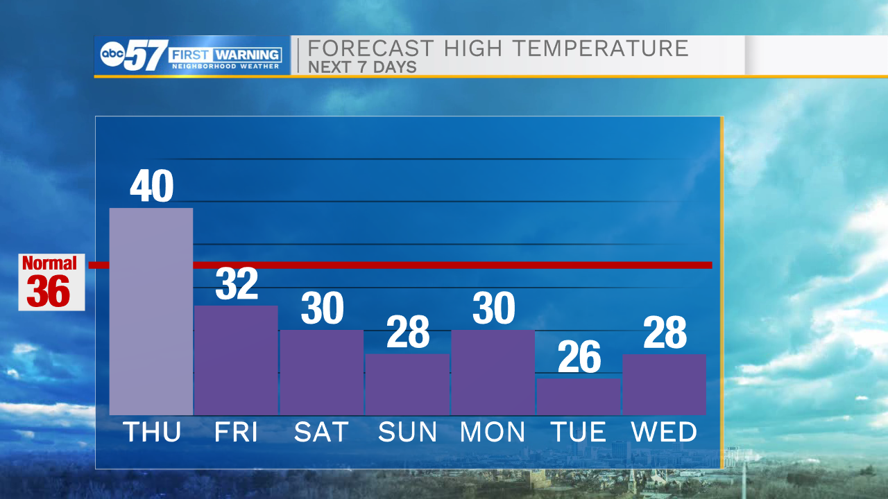
With the cool temperatures, we'll also see lake effect snow showers. Snow continues into Saturday and early Saturday night.
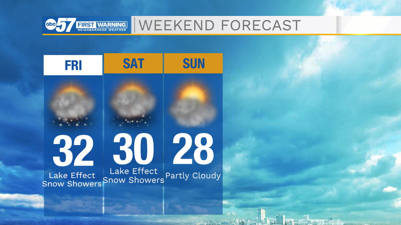
The northern half of Michiana will be impacted the most, especially our Michigan counties closer to the lakeshore.
Highs are near 30 this weekend, but temperatures continue to drop through next week.
Another round of snow looks likely mid to late next week; at this point Thursday looks like it may have the highest impact.
Single digit low temperatures are possible by Christmas Eve.
Today: Mostly cloudy. PM shower. High 40.
Tonight: Snow showers. Low 30.
Friday: Colder. Lake effect snow showers. High 32.
Saturday: Lake effect snow showers. High 30.
Sunday: Mostly to partly cloudy. High 28.