
-
1:05

Truly wonderful conditions
-
2:15

Fort Wayne Tin Caps put an end to the SB Cubs winning streak
-
1:21

This weekend is the annual Hall of Heroes Comic Con
-
0:46

Elkhart Police Department respond to shots fired call at the...
-
3:55

ABC57 speaks with Cass County Commissioners, Judge and Interim...
-
2:48

Common Council to consider appeal options following South Bend...
-
0:52

South Bend seniors explore local parks, event centers, and available...
-
1:51

Mentone Egg Fest celebrates 80th year
-
4:58

New reactions after Notre Dame releases findings of priest sex...
-
3:05

South Bend Police Tapes ordered to be destroyed after 14-year...
-
0:12

Road reopened after excavator fire at demolition site in Elkhart
-
3:25

Beloved board game comes to life at the Morris Performing Arts...

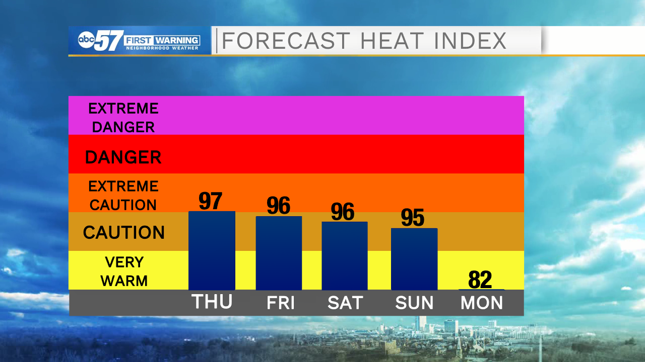
More of the same, extreme heat and humidity with a chance of storms by the afternoon / evening. There is no relief from the heat until Monday, the heat index will range 95 to 100 through Sunday. The one thing that could limit the heat is rain, which is very wait-and-see, the best set-up for storms is Thursday night into Friday morning. Extra clouds could limit Friday's warm-up.
Tonight: Mostly cloudy, chance of storms. Low 74.
Thursday: Hot and humid. Isolated thunderstorms. High 92.
Friday: Hot and humid. Scattered thunderstorms. High 90.
Saturday: Hot and humid. Isolated thunderstorms. High 92.
Sign up for the ABC 57 Newsletter