Northeast braces for a major snowstorm, but questions remain


It's a sad state of affairs when light snow showers in December is a Michiana forecast highlight.
However, that is where we are in 2020.
At this point ANY snow in December is significant.
— Tom Coomes (@TomCoomes) December 15, 2020
Snow showers Wednesday, something might stick ❄️https://t.co/x7ra8mwA78 | #inwx#miwxpic.twitter.com/ZbXsW6R5dm
While Michiana is hoping for a few tenths of an inch of snow Wednesday, parts of the northeastern United States could be in for a few FEET of snow by Thursday afternoon.
Tuesday evening update...snowfall forecast for the upcoming winter storm. pic.twitter.com/3CfDCuc8a5
— NWS Eastern Region (@NWSEastern) December 15, 2020
The same system that will bring light snow to Michiana will travel toward the East Coast and phase with a coastal low, combining into a powerful Nor'easter.
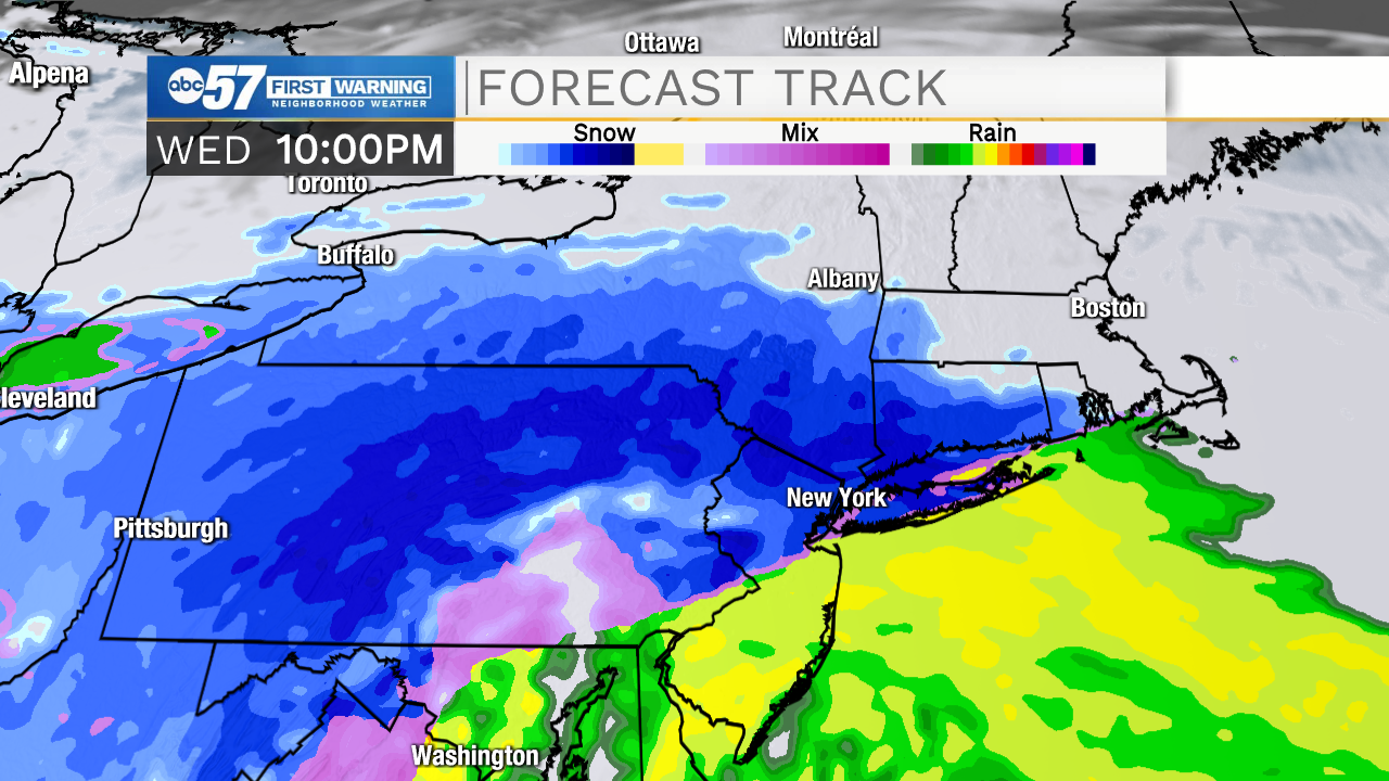
Major travel impacts in parts of Pennsylvania, New Jersey, New York, and New England are expected.
Meteorologists are anticipating a sharp cutoff in snow accumulations near the I-95 corridor. Warm air and a dry slot could make this only a nuisance system for spots like Washington, D.C., and Philadelphia as sleet and rain mix in. There is also still some uncertainty as to how far north the heavy snow will extend.
Precipitation is expected to end by Thursday afternoon.