Not as cold because more snow is on the way


Temperatures won’t be as frigid the rest of the week, the tradeoff is more snow. Another multi-day lake effect snow event is in the forecast. A clipper system will bring widespread light snowfall during the day Wednesday followed by a northwest flow that will setup lake effect bands. The more westerly, northwest wind will be more favorable to bring heavy snowfall to South Bend and Elkhart.
Snowfall through Thursday will bring more than six inches to extreme northern Indiana and southwest Michigan. After a brief lull there’s more snow through Friday, this could bring the three day total to more than a foot to some areas.
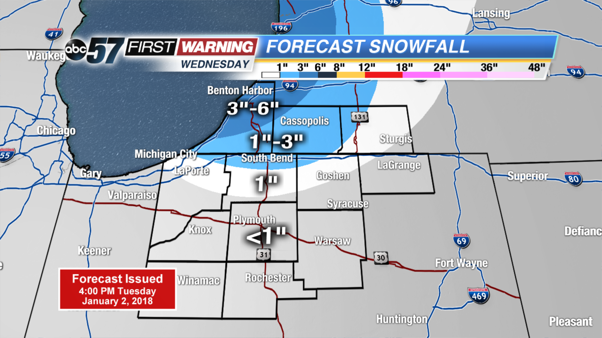 Wednesday's snowfall only
Tonight: Increasing clouds, low near 0, warming to single digits by morning.
Wednesday: Snow showers, high of 15.
Thursday: Lake effect snow showers, high of 12.
Friday: Lake effect snow showers, highs in the lower teens.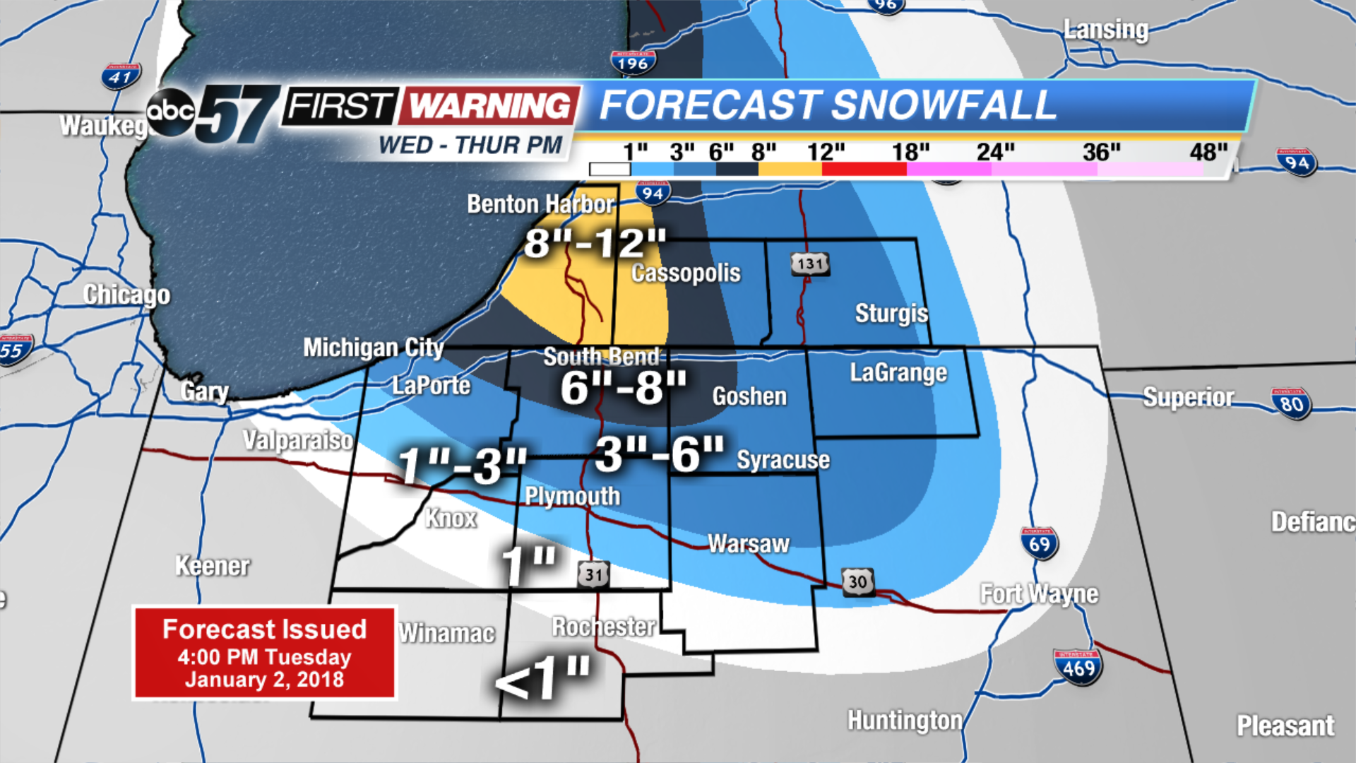 Two day snowfall Wednesday through Thursday.