
-
1:06

Mishawaka Fieldhouse features Adidas 3Striped basketball tournament
-
2:48

Former South Bend Cub Nico Hoerner reflects on path to Chicago...
-
1:00

Medieval times return to Plym Park with the Renaissance Faire
-
2:15

South Bend celebrates Kids to Parks Day with bike-riding workshop
-
2:43

Cubs clobber White Sox in first game of ’Crosstown Classic’
-
2:00

South Bend Police Department honors the fallen
-
0:52

St. Joe/Benton Harbor Rotary holds ribbon-cutting ceremony for...
-
2:25

Irish lacrosse head to NCAA quarterfinals with Johns Hopkins...
-
3:09

Cubs, White Sox open first Crosstown Classic series of summer...
-
3:45

South Bend Cubs dedicate plaque to Indiana born composer of ’Take...
-
1:52

Concord fourth graders launch weather balloon following months...
-
4:55

Gus Macker 3-on-3 basketball tournament returns to Benton Harbor

One more day of near-record ‘summer’ heat for the area. Sunny and a bit muggy Tuesday, change will happen with the passing of a cold front Wednesday morning. Temperatures will be lucky to break 70 Wednesday afternoon and stay in the 60s through the end of the week. The pattern, while cooler, remains near or above normal temperature wise.
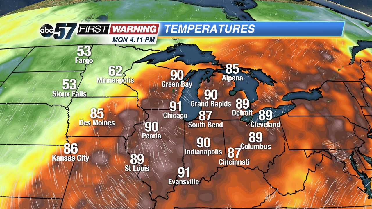 Monday's 4 PM Observed Temperatures
Tonight: Clear skies, low 64.
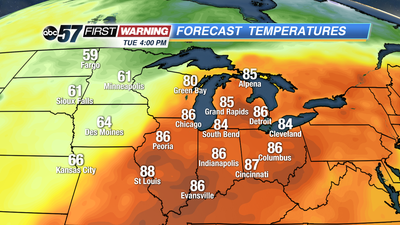 Tuesday's Forecast 4 PM Temperatures
Tuesday: Mostly sunny becoming partly cloudy, highs in the upper 80s.
Wednesday: AM showers, partly cloudy to mostly sunny, afternoon high 68.
Thursday: Mostly sunny, highs in the upper 60s.
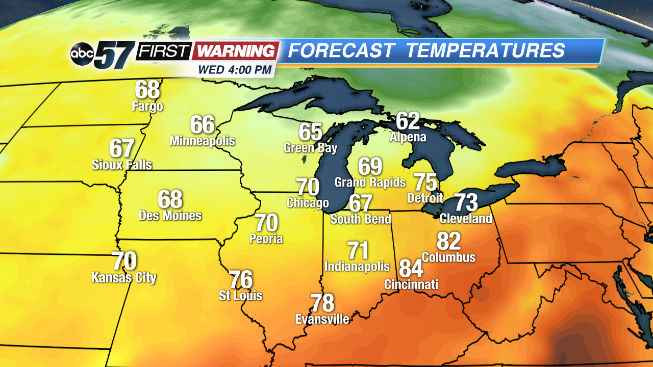 Wednesday's forecast 4 PM Temperatures
Sign up for the ABC 57 Newsletter