


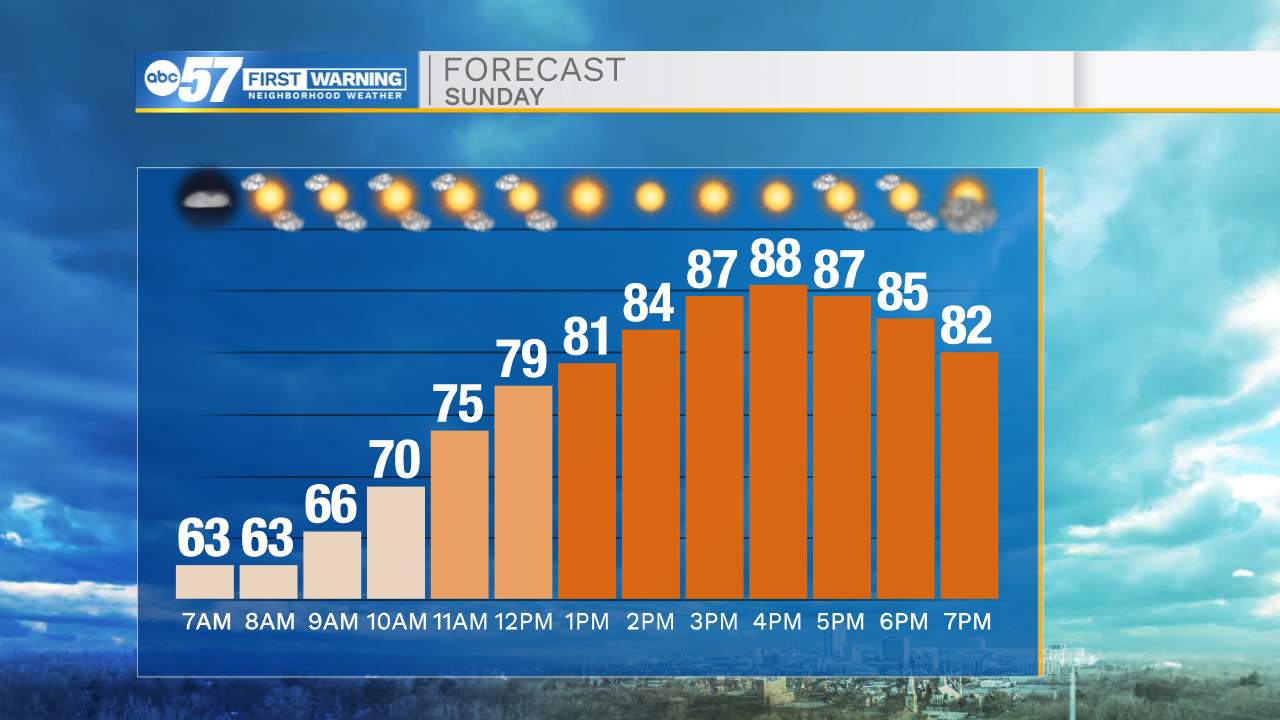
One more hot day today as temperatures climb from the low 60s this morning to the upper 80s by afternoon. It’s mostly sunny with dry weather, so you’ve got a green light for any outdoor plans to end the weekend.
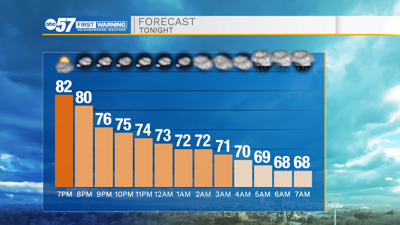
Tonight cloud cover increases, then we’ll see rain start before Monday’s sunrise. You’ll want the umbrella out the door to start the week. It stays rainy through most of Monday.
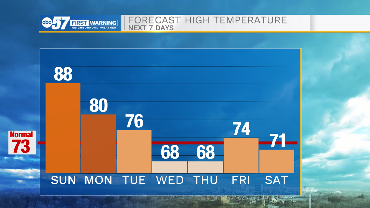
There is a lapse in the rain later Monday night, but another round of rain moves in Tuesday morning ahead of a cold front. This front could also produce some storms, although none look like they will be severe. There is a threat for heavy rain Tuesday – some areas could pick up 1 or 2 inches of rain.
We should be mostly dry heading into Wednesday and we’ll get a true taste of fall. For the first time since May, expect a high temperature in the 60s on Wednesday! Temperatures stay autumn-like through the end of the 10-day forecast.
Today: Mostly sunny and warm. High 88.
Tonight: Increasing clouds. Rain showers late. Low 65.
Monday: Overcast with rain showers. Afternoon thunder possible. High 80.
Tuesday: Rain and thunderstorms. High 76.