
-
1:03

Residents seek answers in fatal officer-involved shooting
-
0:48

Cool conditions continue this weekend
-
0:37

Two injured in single-vehicle crash, passenger ejected from vehicle
-
0:51

Cooling and drying through morning
-
0:47

Severe threat over
-
2:22

Notre Dame and Villanova to open 2026-27 basketball season in...
-
2:41

It’s about to get more expensive to use the Toll Road
-
1:01

South Bend Mayor Mueller builds on last year’s clean-up efforts
-
1:29

A principal puckers-up for a good cause
-
0:55

Karl King Tower not designated ’Chronic Problem Property’...
-
1:22

AHEPA Senior Living brings high-demand units for low-income seniors
-
1:55

Dangerous storms to our west not weakening much

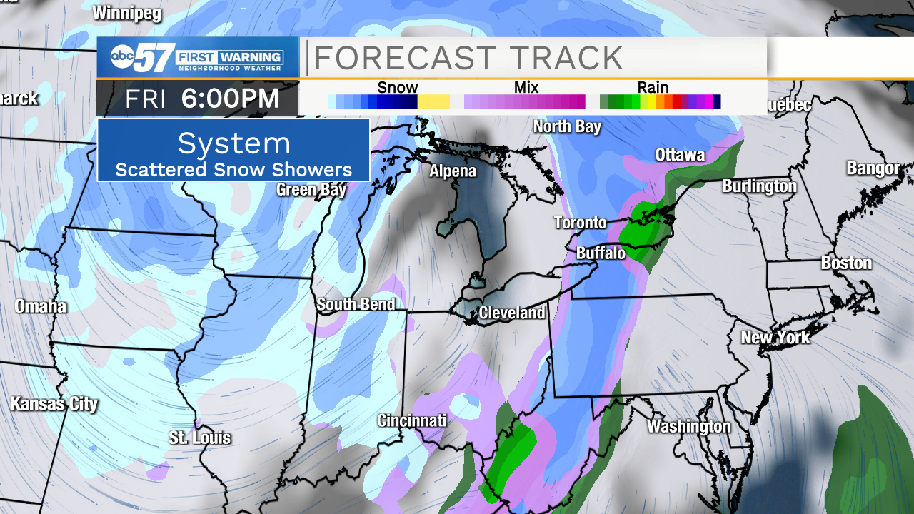
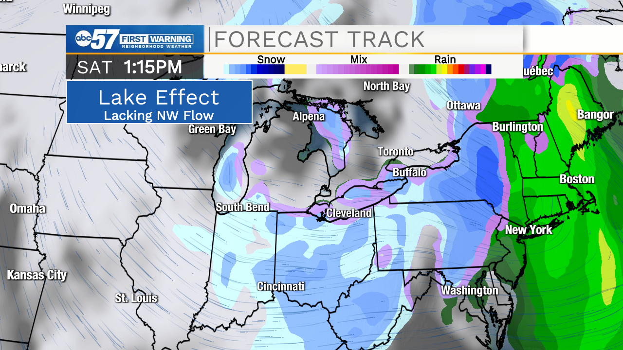
Clouds struggle to break again Tuesday, as the temperature also strain to warm above freezing. Temperatures warm midweek into the 40s ahead of our next storm system that will bring rain/snow showers Thursday evening. There is a chance of snow this weekend, Friday through Sunday morning. At this time a broad scattering of snow showers is likely. That does not mean there will be a lot of snow. The setup also lacks a strong northwest flow on the back side to crank up lake effect snow. The third strike is the lack of bitter cold, highs remain close to 30 this weekend. This forecast could change but as of Monday we are still waiting for any sign of significant winter weather.
Tonight: Cloudy, freezing fog/drizzle possible. Low 24
Tuesday: Mostly cloudy. Low 36
Wednesday: Partly cloudy. High 40.
Thursday: Mostly cloudy. High 40.