Rain accumulations could total several inches through the weekend
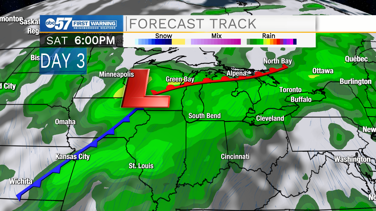
Starting today and through the weekend, we will see a few systems make their way into Michiana. Each system will bring us more chances for rain showers that look to linger throughout the days ahead. A few isolated thunderstorms are possible Friday and Saturday as well. Any place that does get storm activity, will hold a better chance to see isolated higher rainfall totals. As each system passes another one will be quick to follow, all leaving behind stationary boundaries that interact with plenty of Gulf moisture to keep our conditions cloudy and rainy.
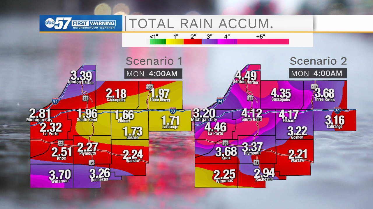
Long range models this morning, the GFS and EURO, both seem to be in agreement that 4 inches of rain is possible for portions of Michiana into next Monday morning. Isolated higher totals aren't out of the questions especially if thunderstorm activity increases. Given the heavy rain we had a couple days ago, it won't take much to saturate our soils, leaving us with better chances for flooding. If you are traveling this weekend make sure to be on the lookout for standing water on the roadways. Always remember, turn around and don't drowned, when encountering flooded roadways. Water levels in rivers and creeks will also be rising across Michiana through the weekend, so be cautious of the flooding potential near those areas.


