


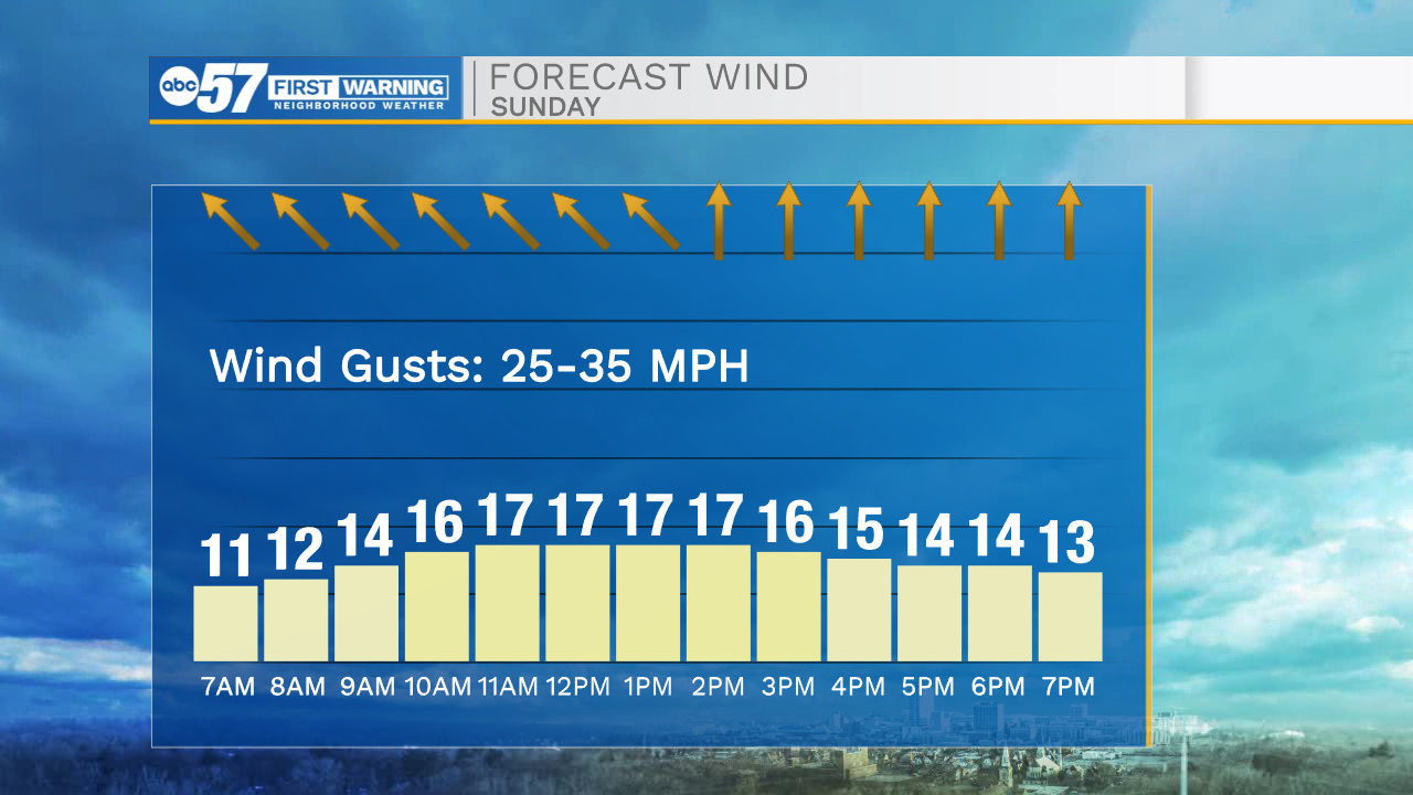
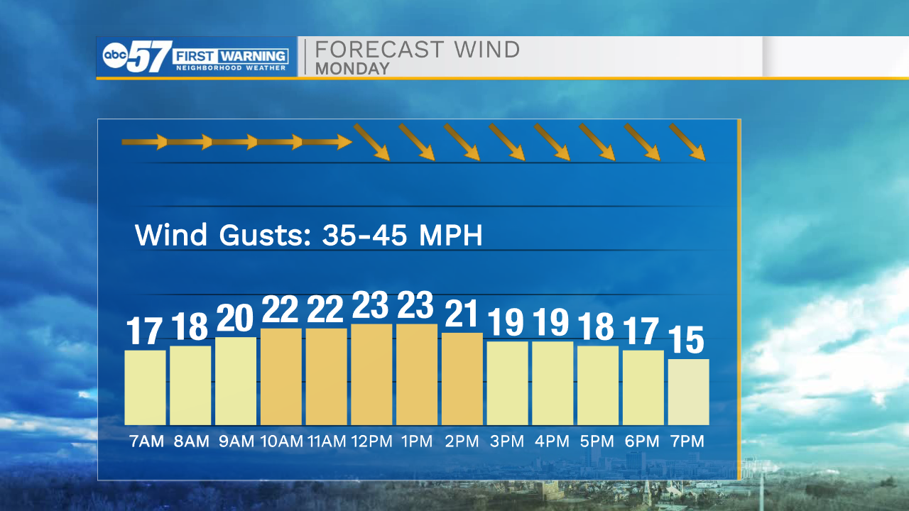
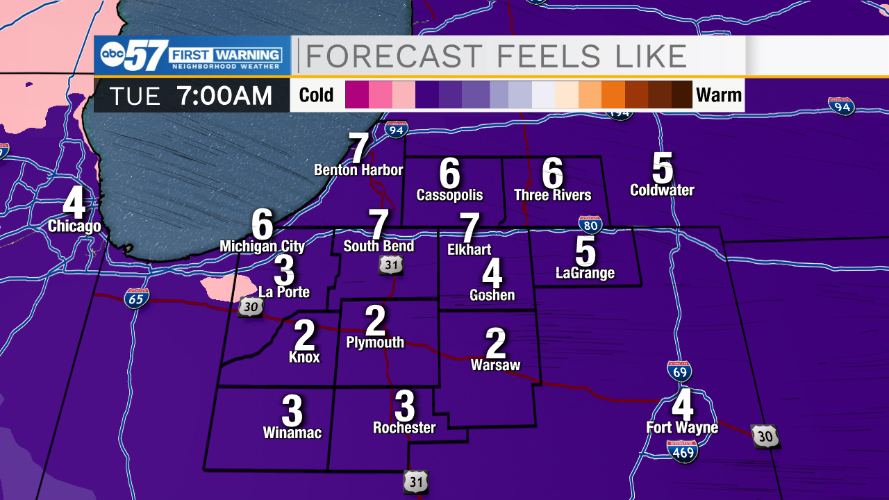
This morning our weather is cool and quiet. Temperatures will drop into the low to mid 30s, and then warm into the upper 40s to lower 50s by this afternoon. Rain chances return to the forecast after lunchtime today. This afternoon and evening every place throughout Michiana will see rain. The rain will stick around through midnight tonight, and then turn to isolated flurries Monday morning. Also today, winds will increase into the upper teens with wind gusts ranging from 25-35mph. Tomorrow morning after the front passes, winds will increase even more with gusts reaching into the 40-45mph range. Power outages are possible with the strong winds. Low snow chances remain in the forecast for Monday, Tuesday, and Wednesday. Accumulating snow chances look low for us here in Michiana. Temperatures Tuesday and Wednesday morning will drop near the teens with wind chills in the single digits. Temperatures will finally rebound back into the 40s later in the week.
Today: Scattered showers. High 50.
Tonight: Isolated showers/flurries. Low 30.
Tomorrow: Mostly cloudy/flurries. High 35.
Tuesday: Mostly cloudy/flurries. High 30.