Rainy midweek, first thunderstorms of 2020 possible Thursday

-
1:26

Amidst several rounds of storms, some could be severe today
-
0:34

South Bend Community Review Board hosts open discussion on youth...
-
2:19

INDOT walks through a proposed diverging diamond intersection...
-
1:08

Notre Dame’s Leonard Moore highlights student success and raises...
-
1:05

Mayflower Bridge set to close beginning April 6
-
0:21

Colfax Avenue eastbound lane closed for water and sewer work
-
0:46

Madison Street closed for lifestyle district project
-
4:11

Non-profit organization provides deep dive into Blackstone, a...
-
1:52

Storms possible overnight, strong storms by Tuesday evening
-
3:48

New partnership aims to help fight food insecurity across Elkhart...
-
2:00

A sunny Monday ahead, rainy almost every other day this week
-
2:59

Dusty May leads Michigan back to Final Four with dominant win...

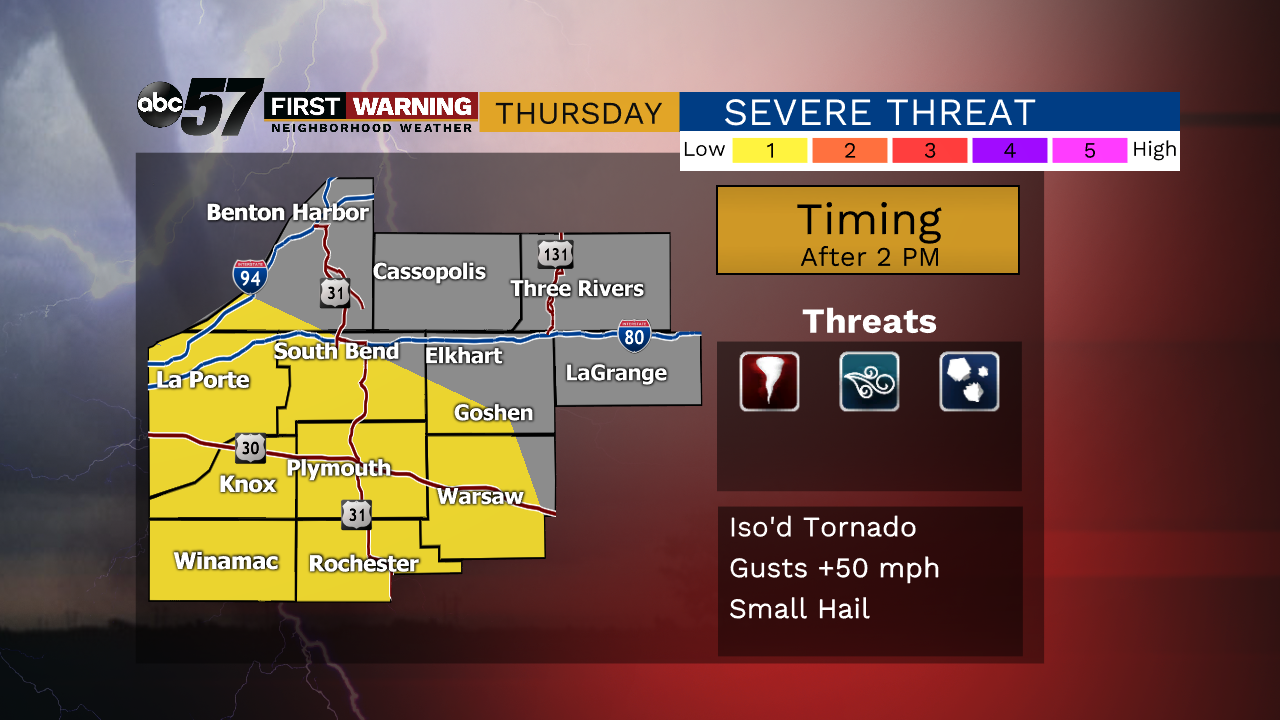
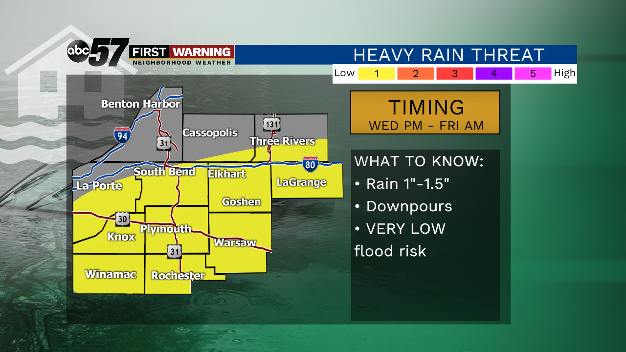
Rain is likely midweek and temperatures swing up and down sharply Thursday-Friday. The first round of rain arrives Wednesday afternoon with a soaking rain up to a half inch. The second round comes with a stronger storm system Thursday afternoon rain and possible thunderstorms as temperatures rise into the mid-60s. Temperatures fall sharply as the rain clears into Friday morning. Temperatures drop from the mid-50s early to the mid-30s by Friday afternoon. The weekend is chilly but fair.
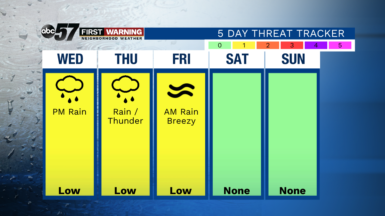
Tonight: Partly to mostly cloudy. Low 32.
Wednesday: Rain likely by the afternoon. High 48.
Thursday: Rain showers. Thunder possible. High 64.
Friday: Breezy, colder, temps fall from 56.
Flood threat is extremely low.
Severe weather is possible but not extremely likely.