


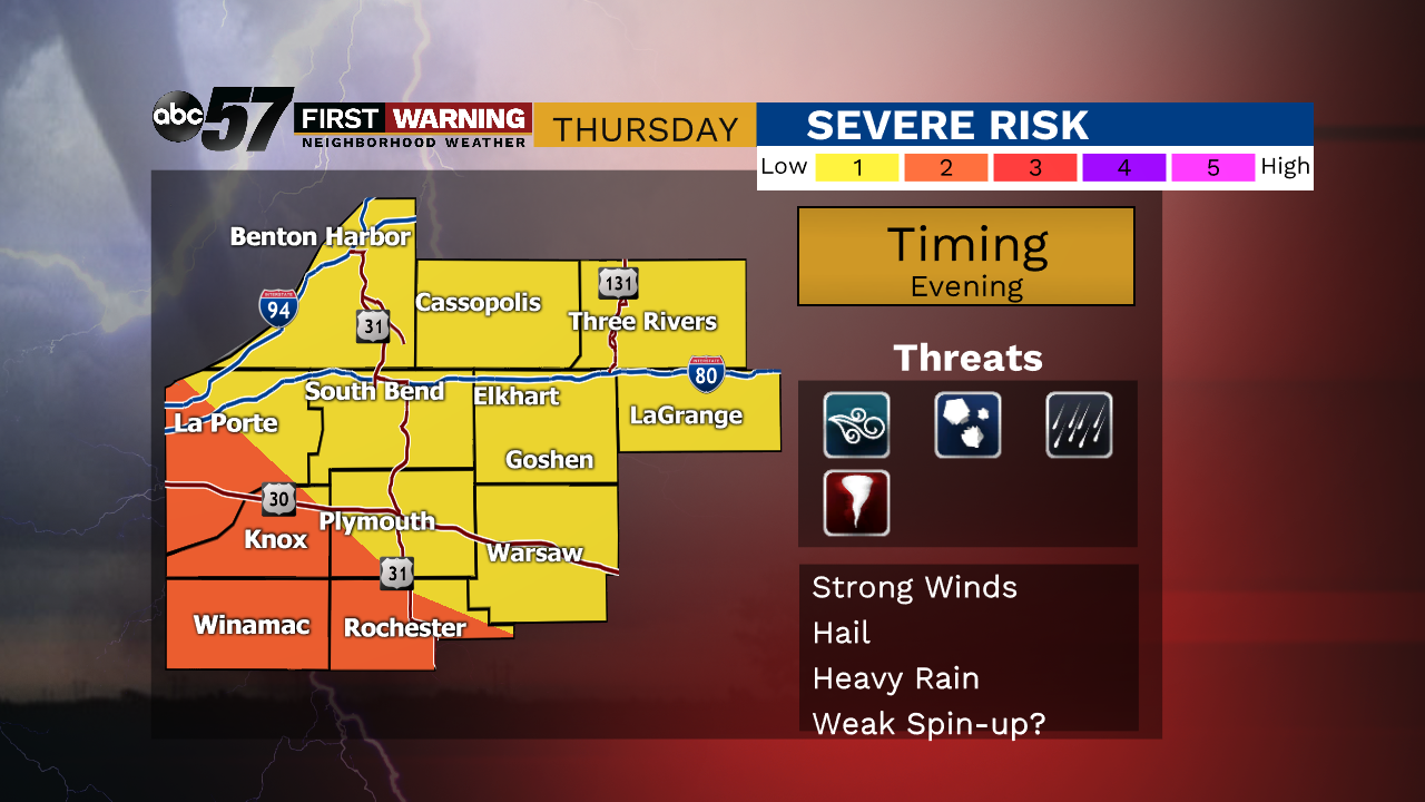
Rain continues this evening, especially before midnight. Temperatures overnight will be around 40. Thursday morning is cloudy but dry. Thursday afternoon is another round of rain. There is a chance for thunder during this afternoon rain. Some stronger thunderstorms are possible Thursday evening. The impact right now looks to be low to moderate, but we are continuing to track these storms.
Temperatures warm to the 60s on Thursday, but will drop quickly on Friday. The high temperature Friday is technically 55, but temperatures will be dropping from this throughout the day. Friday will be breezy with mostly to partly cloudy skies. Friday night is a chilly 23 degrees. The weekend will be dry with some sunshine Saturday and Sunday.
Tonight: Rainy before midnight. Cloudy skies overnight. Low 40.
Thursday: Rain showers, especially in afternoon and evening. Thunder possible. High 63.
Friday: A few AM showers. Breezy with temperatures dropping from 55.
Saturday: Mostly sunny. High 38.