
-
2:00

Annual Studebaker car show takes over Ironwood Plaza
-
0:55

Beautiful weekend expected
-
1:05

Truly wonderful conditions
-
0:41

One person left with serious injuries after high-speed pursuit...
-
2:15

Fort Wayne Tin Caps put an end to the SB Cubs winning streak
-
1:21

This weekend is the annual Hall of Heroes Comic Con
-
0:46

Elkhart Police Department respond to shots fired call at the...
-
3:55

ABC57 speaks with Cass County Commissioners, Judge and Interim...
-
2:48

Common Council to consider appeal options following South Bend...
-
0:52

South Bend seniors explore local parks, event centers, and available...
-
1:51

Mentone Egg Fest celebrates 80th year
-
4:58

New reactions after Notre Dame releases findings of priest sex...

Record cold is possible early Wednesday morning as lows could fall into the single digits, more breaks in the clouds will mean colder temps.
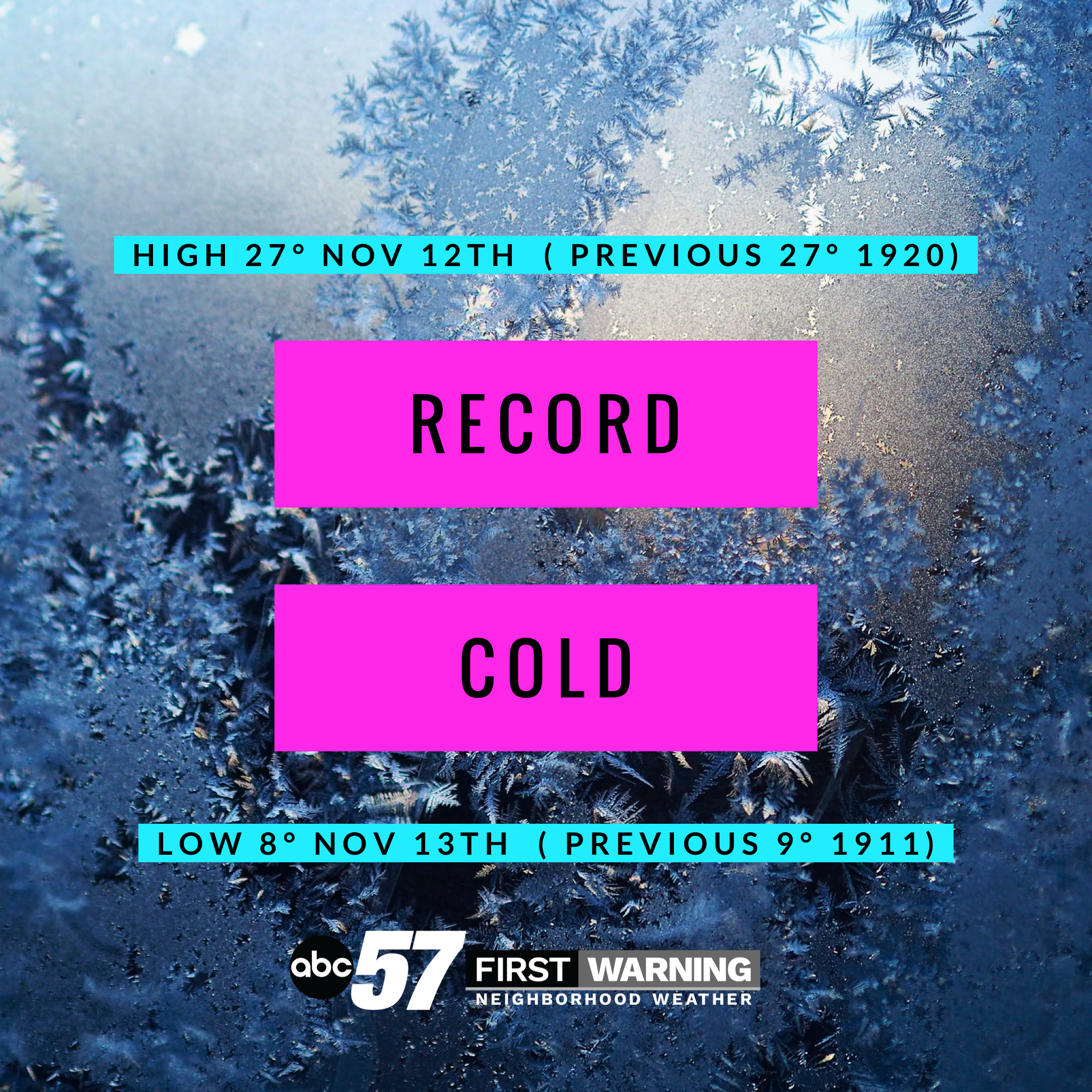
Temperatures gradually warm and clouds break by the weekend. Highs struggle to reach 30 Wednesday and 40 will be tough to break until the end of the weekend. There could be a few flurries Wednesday night otherwise the forecast is fair through the weekend.
Tonight: Mostly/ partly cloudy. Low of 8.
Wednesday: Mostly to partly cloudy. High of 28.
Thursday: Mostly cloudy. High of 34.
Friday: Mostly sunny. High of 34.
Sign up for the ABC 57 Newsletter