
-
2:53

Street camping now illegal across Hoosier state
-
2:37

Preview the possibilities at the St. Joseph County 4H Fair
-
1:17

Local reactions to the Supreme Court’s ruling on transgender...
-
2:32

Local experts and politicians weigh-in on the Supreme Court’s...
-
7:19

Savoring Michiana
-
3:16

Dowagiac residents seek class action over noise from hyperscale...
-
2:03

Families in St. Joseph County finding fun ways to cool off
-
1:00

Fibrosan breaks ground in the Cassopolis area, promising new...
-
6:10

Fulton County man speaks out after being sued by Indiana Attorney...
-
2:51

Local county fair officials discuss new law allowing alcohol...
-
2:44

Benton Harbor Area Schools begin search for new superintendent
-
1:21

How firefighters keep cool in the summer heat

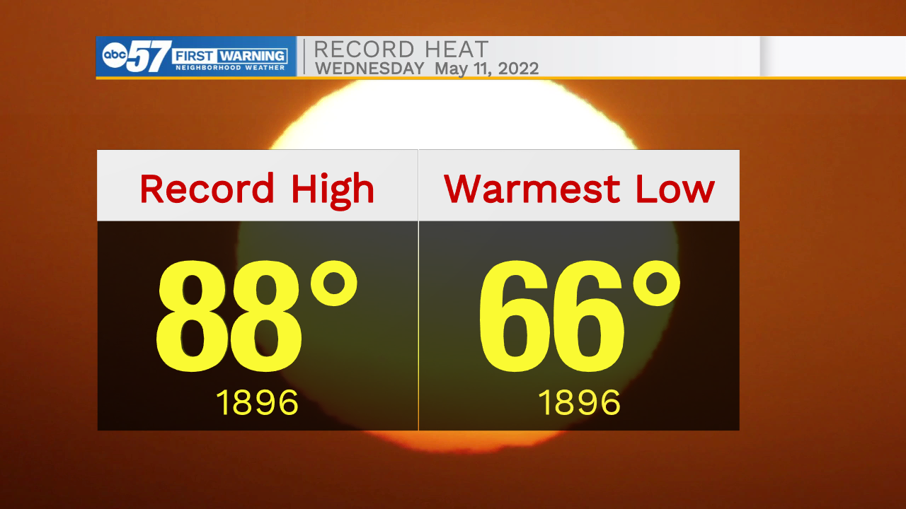
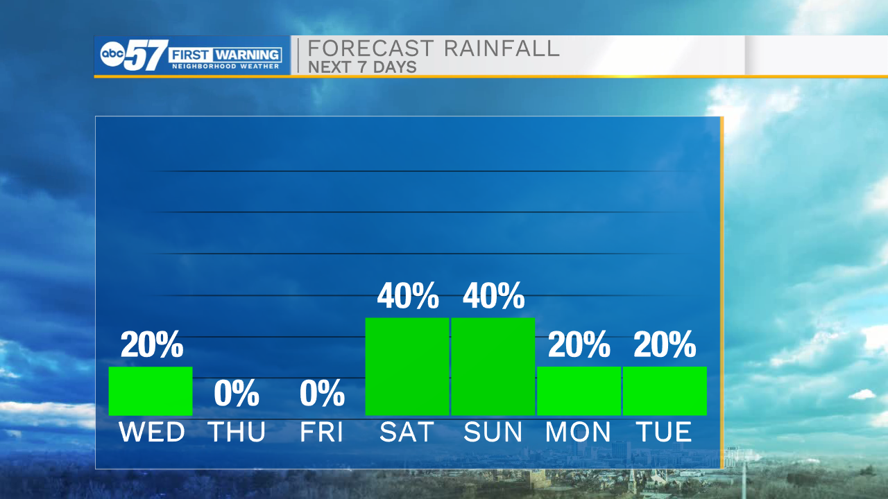
The muggy May weather lasts through Wednesday. The area will flirt with record heat for May 11, the warmest low in South Bend is 66, the record high 88, both set in 1896 could be tied of broken. The humidity will break Thursday, with highs in the mid-80s through the end of the week. Saturday is the transition back to cooler weather, starting Sunday. That transition will come with showers and thunderstorms. Models differ in how the storm system organizes, so for now a storm threat is possible, with more consistency needed in the forecast to say more.
Tonight: Partly cloudy. Low 68.
Wednesday: Partly cloudy. High 88.
Thursday: Mostly sunny. High 84.
Friday: Mostly sunny. High 84.
Sign up for the ABC 57 Newsletter