
-
2:52

Police say widely shared video of man held captive, beaten was...
-
4:14

Where do our local politicians stand on the war in Iran?
-
3:48

ABC57 sits down with candidates running for Elkhart County Sheriff...
-
3:12

County officials hopes to call further attention to littering...
-
6:06

Candidates for Indiana state senate speak following President...
-
0:57

Sunny and windy today
-
5:10

Pop-Up Kitty Cafe coming to Michigan City
-
2:51

Nappanee will soon be home to the World’s Largest Cabinet
-
0:38

Drying out and warming up
-
1:15

Cold and bleak weather to start off the day
-
3:49

Asking for Accountability: Michiana Elected Officials on on-going...
-
3:37

South Bend Cubs explain weekend washout

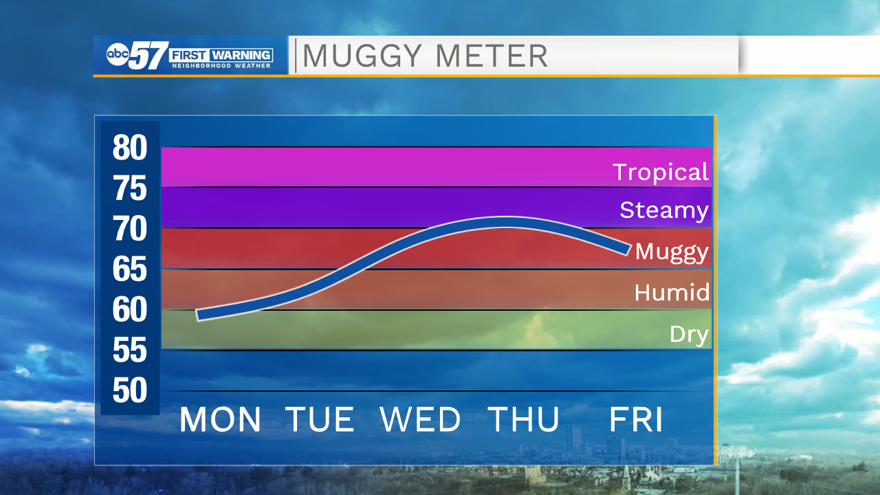
The humidity starts to rise Tuesday and temperatures rise into the upper 80s. The first peak in the mugginess Wednesday evening brings a chance of scattered storms into Thursday morning and a short-lived break in the heat. The storm severe threat is very low. The real hot weather starts Friday and lasts through the weekend, highs in the 90s and a heat index in the mid to upper 90s.
Tonight: Clear. Low 60.
Tuesday: Mostly sunny. High 87.
Wednesday: Partly cloudy, afternoon/evening thunderstorms. High 88.
Thursday: Morning showers evening, partly cloudy. High of 86.
Sign up for the ABC 57 Newsletter