
-
1:50

Top Ten Snow Year 2025-26
-
1:17

South Bend Cubs unveil fan-focused upgrades ahead of Opening...
-
2:21

Notre Dame Fighting Irish ready for spring football
-
2:06

Fighting Irish using time off to refocus ahead of spring practice
-
2:35

What are the privacy implications of SBPD’s ’Drone as First...
-
1:22

Expert discusses Wednesday’s Fed decision
-
3:19

New legislation could make Michigan the 30th constitutional carry...
-
2:15

SBPD using drones to help improve response time
-
1:20

The March roller coaster ride continues
-
1:52

Snow today, rain tomorrow, and warm this weekend
-
0:49

Celebrating St. Patrick’s Day at Corby’s Irish Pub
-
1:58

The Free Market promotes sustainable shopping

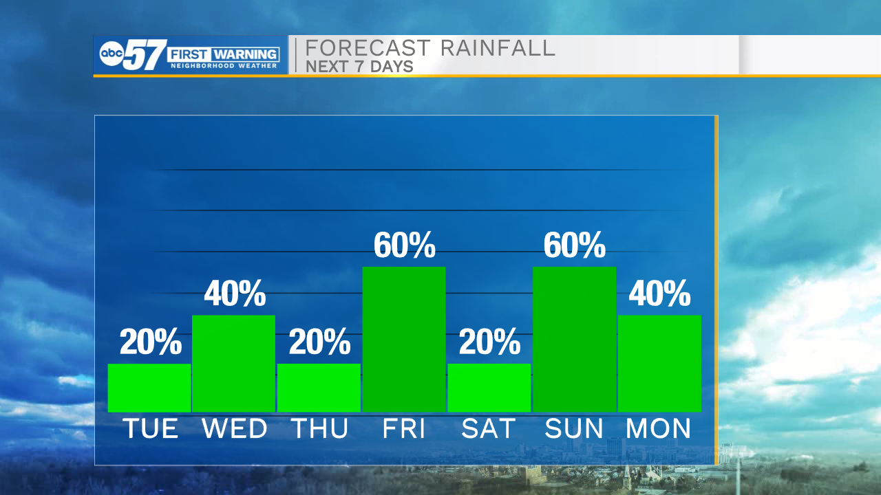
The weather stays chilly through Tuesday, but clouds start to break. Wednesday starts a return to milder weather, but there's still rain in the forecast. Showers, Wednesday afternoon-evening, another round Friday, and the possibility of thunderstorms Sunday afternoon. The capstone of the week is Saturday, with highs nearing 80, and dry. A strong cold front will drop temperatures back to the 50s next week, so enjoy the warm weather while it lasts.
Tonight: Drizzle/flurries Low 34.
Tuesday: AM flurries, PM clearing High 44.
Wednesday: PM showers. High 57.
Thursday: Partly cloudy. High 66
Sign up for the ABC 57 Newsletter