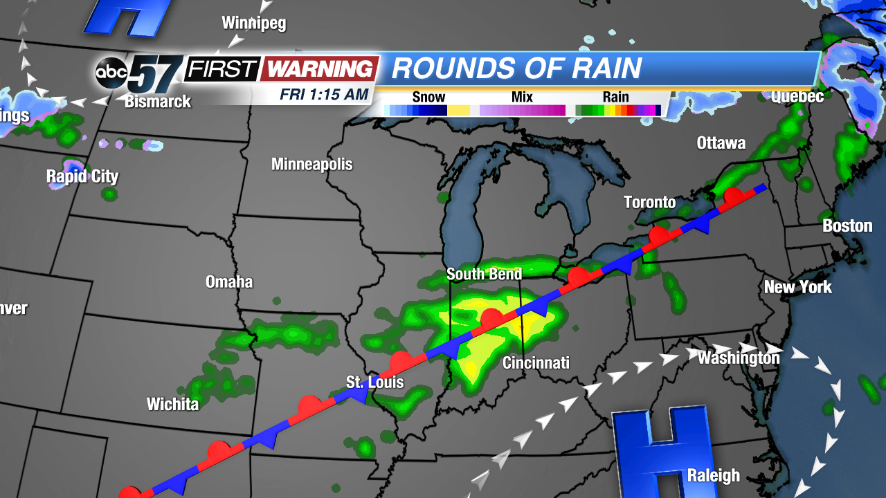
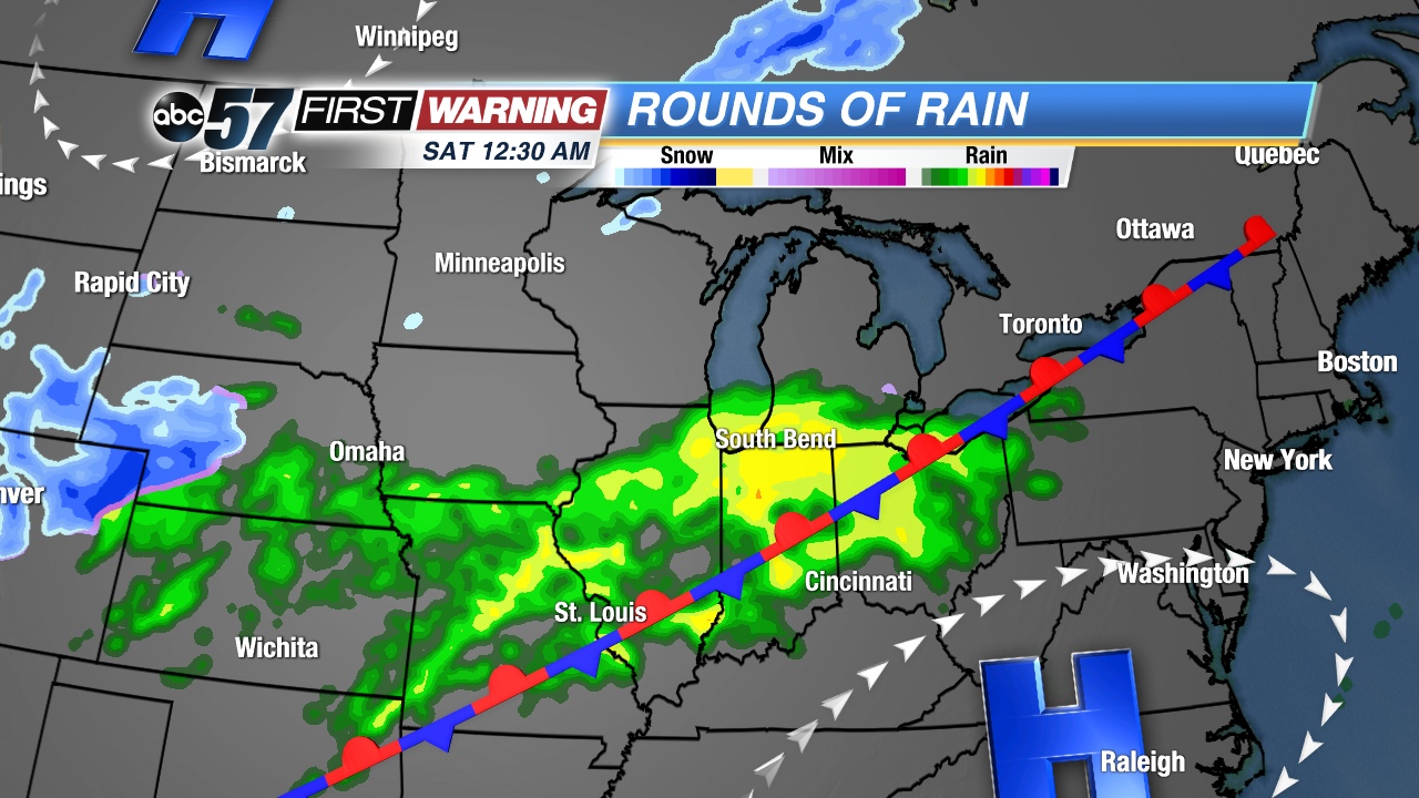
Rounds of rain move into Michiana from Thursday night to Saturday. The weather pattern is staying active due to a stationary front that is slicing through Michiana and the Midwest. The frontal system is staying stationary, because it is sandwiched between two high pressure masses, one over the north and one over the southeast.
Several rounds of rain will move through Michiana over the coming days, but the heaviest rounds of rain will be Thursday night and Friday night. This is actually good news, since the rain will be coming down while many of us are indoors, sleeping. Plus, the daytime hours will stay mainly dry.
However, due to the rounds of rain, there is a Marginal risk of excessive rain. This means that there is a 5-10% chance of flash flooding within 25 miles of a point within the green shading.
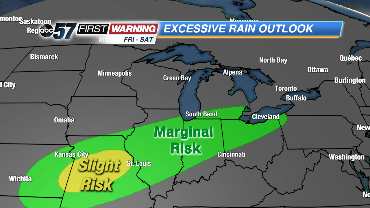
This is not a high chance for flooding by any means, but it could cause a rise in the rivers and impact low lying, flood prone areas due to the cold, dense ground. The only river that may be impacted is the Tippecanoe River at Winamac and Ora, rising into the Action flood stage by Monday. Flooding in low lying areas would occur mainly Saturday morning and midday.
