
-
3:11

Former players and coaches return to Notre Dame to honor Lou...
-
3:17

Notre Dame prepares for funeral of legendary coach Lou Holtz
-
0:56

Shipshewana on the Road takes over Elkhart
-
3:44

Large crowds expected at Notre Dame for Lou Holtz visitation
-
2:48

Storms arrive this evening, Snow Monday morning
-
4:33

Blustery and stormy today
-
0:39

Michiana Home Show continues to bring vendors to South Bend
-
0:58

Cookies and Canvas for the Heart raises awareness for children’s...
-
2:07

Most residents have power restored following high winds
-
0:44

26th annual St. Patrick’s Day Parade takes over Downtown South...
-
2:42

Active weather arrives Sunday
-
3:22

Calm today, storms return Sunday

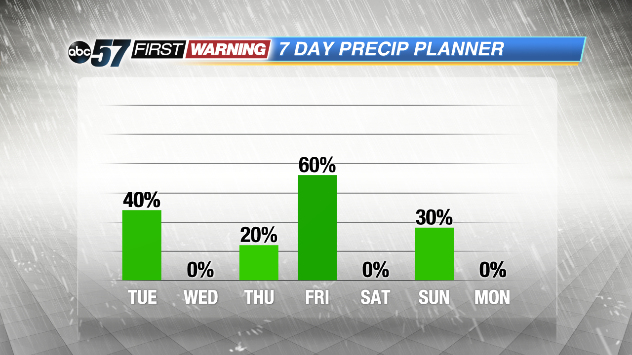 Friday will be the best chance of widespread showers and storms this week.
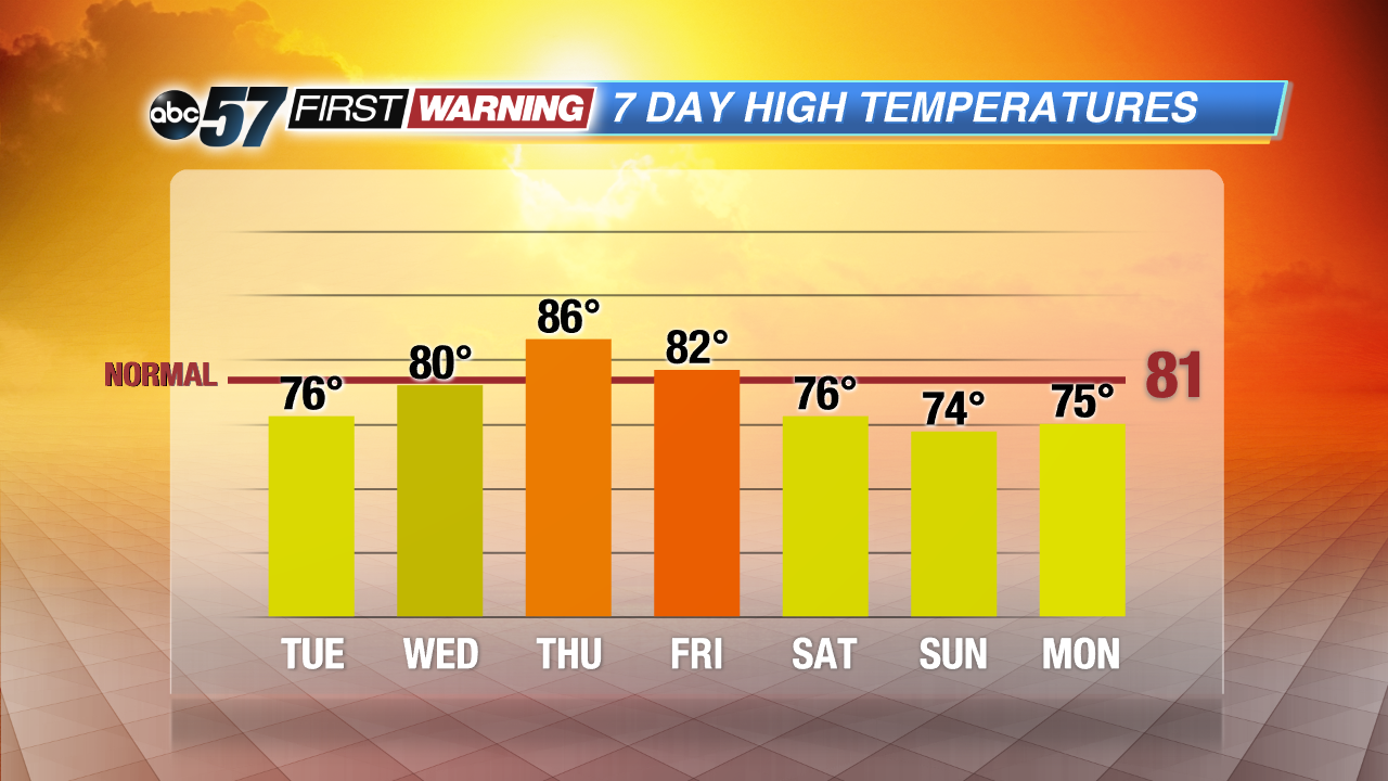 Temperatures rise to end the week, but most of the next 7 days are mild for June.
Milder weather lasts through midweek with lows in the 50s and highs mostly in the 70s. A chance of showers and storms still lingers through Tuesday evening. Wednesday and most of Thursday looks dry as the heat and humidity builds again to end the week. Friday looks to be the best shot and widespread storms and significant rainfall. The pattern turns mild again through next week and the end of June.
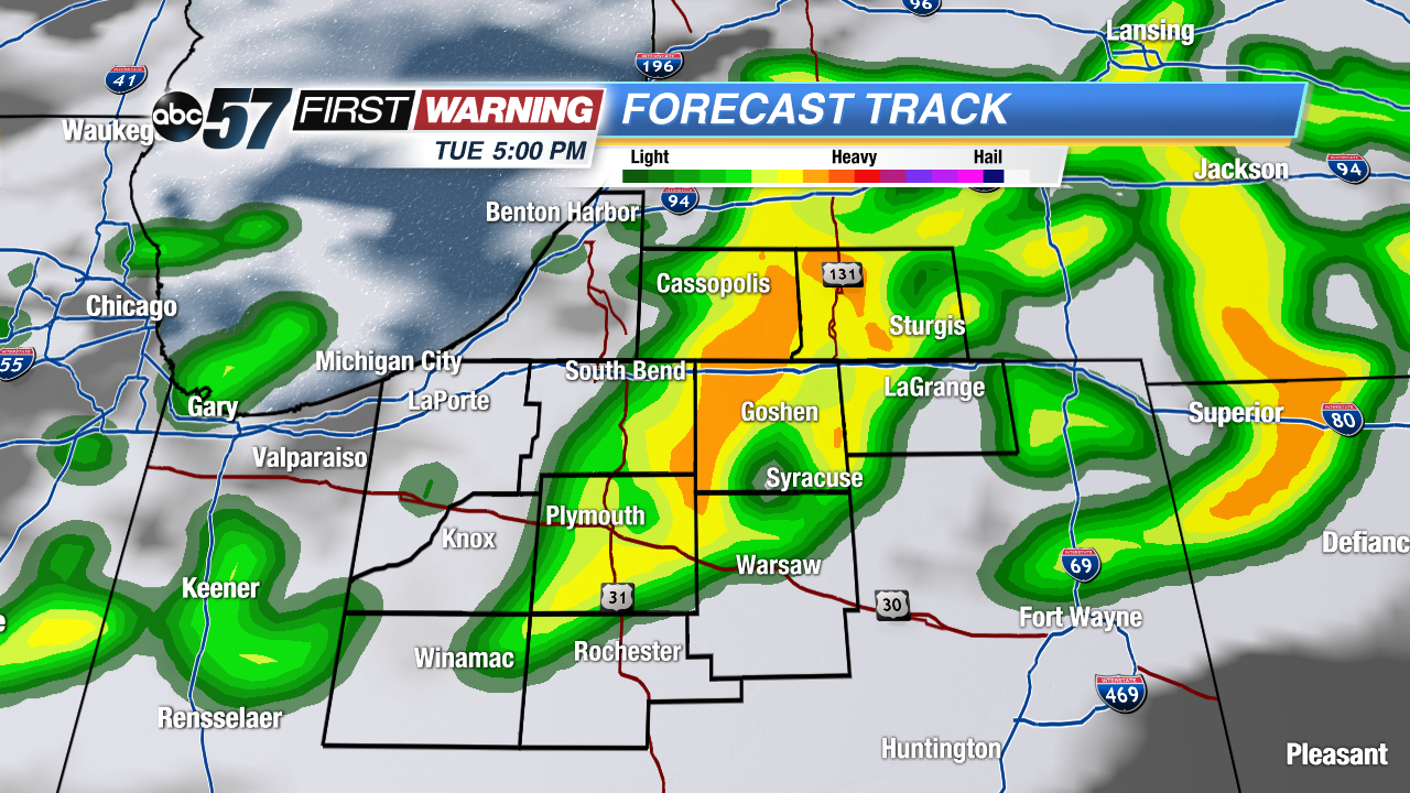
Tonight: Showers and storms ending, low 56.
Tuesday: Mostly to partly cloudy, afternoon scattered storms, high 76
Wednesday: Mostly sunny, highs near 80.
Thursday: Partly cloudy, highs in the mid-80s.
Sign up for the ABC 57 Newsletter