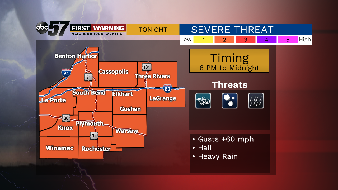
MIDNIGHT -- Storm threat has ended, weather is quiet through Wednesday afternoon.
STORMS LIKELY BETWEEN 10 PM - MIDNIGHT: Winds gusts, Hail
The warm and relatively muggy April afternoon will fuel the potential for thunderstorms this evening. Timing is key with thunderstorms and the peak energy may not align with when storms develop, between 8 PM and midnight. A scattered / broken line of storms means some could be missed and not everyone is likely to see severe weather. The greatest threats are damaging wind gusts topping 60 mph and hail. This is not a widespread life threatening situation but scattered damage and power outages are possible.
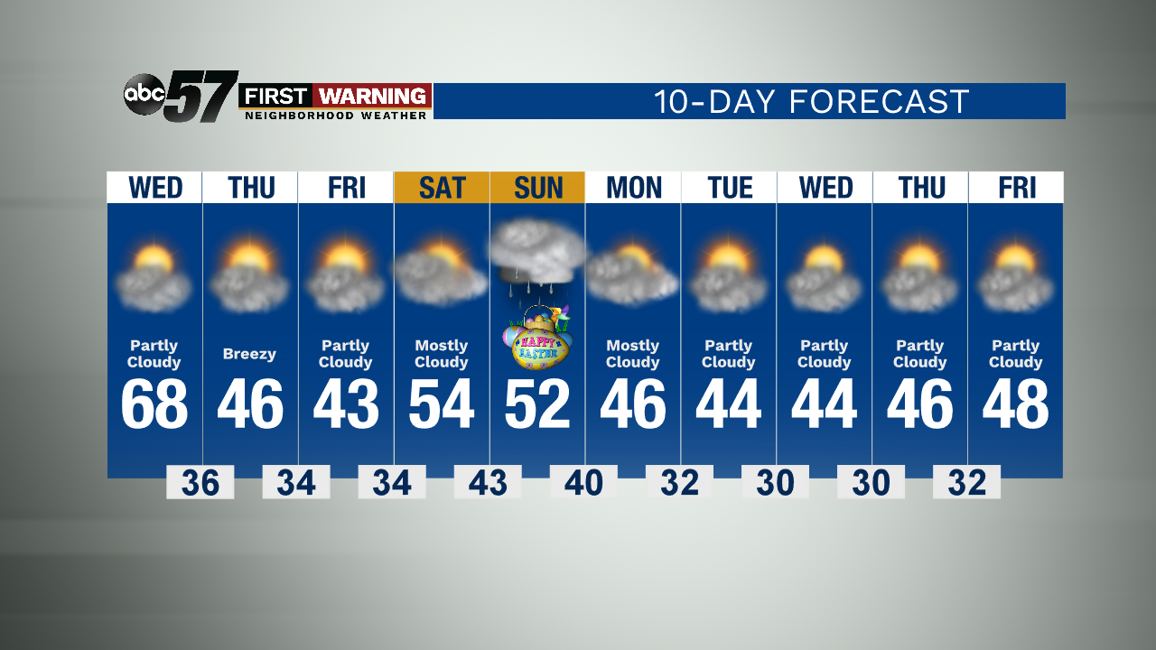
Wednesday is the last mid day for awhile, fair as temperatures near 70 again. Rain moves in Wednesday evening and temperatures drop sharply into Thursday. Cool and breezy Thursday as gusts could top 40 mph and the chilly weather lasts through Friday. A slight warm-up with weekend comes with the chance of rain and temperatures remain chilly, in the 40s through next week.
Tonight: Scattered Storms Low 50.
Wednesday: Partly cloudy. High 68.
Thursday: Partly cloudy. Breezy. High of 46.
Friday: Chilly, sunny. High of 43.