


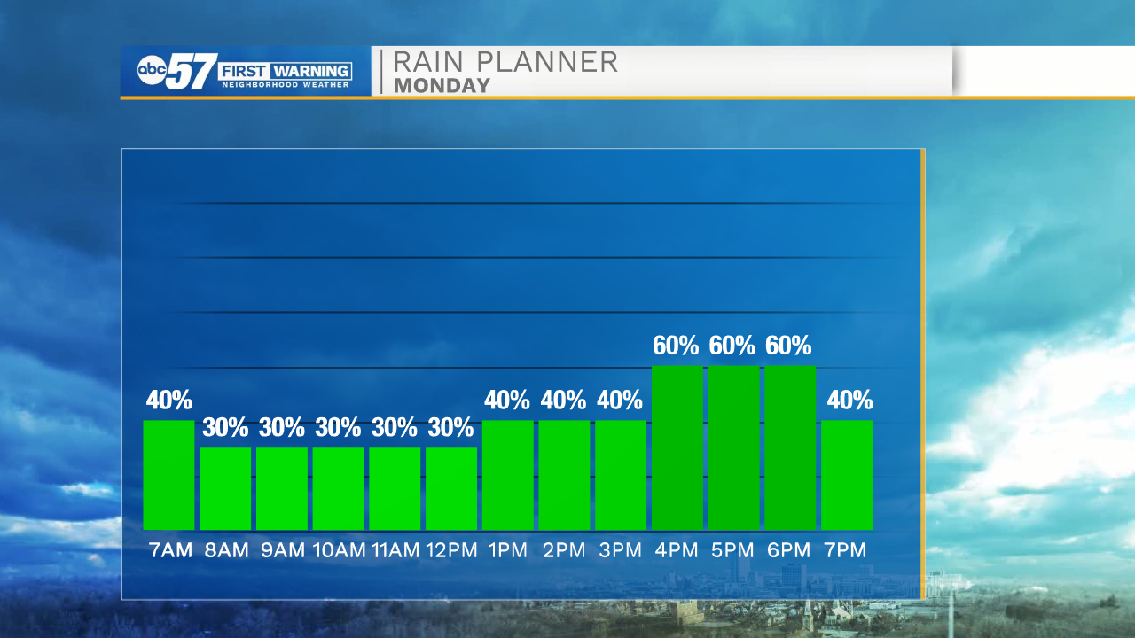
Tonight a cold front will move in out of the northwest bringing a low isolated rain chance before midnight. Better rain chances arrive during the early morning hours tomorrow. The front will slow up tomorrow morning, bringing prolonged rain chances for most of the area tomorrow afternoon. A few isolated thunderstorms can’t be ruled out as well, but little to no severe threat is expected. High temperatures tomorrow afternoon will be in the lower 80s. Showers will clear out tomorrow evening.
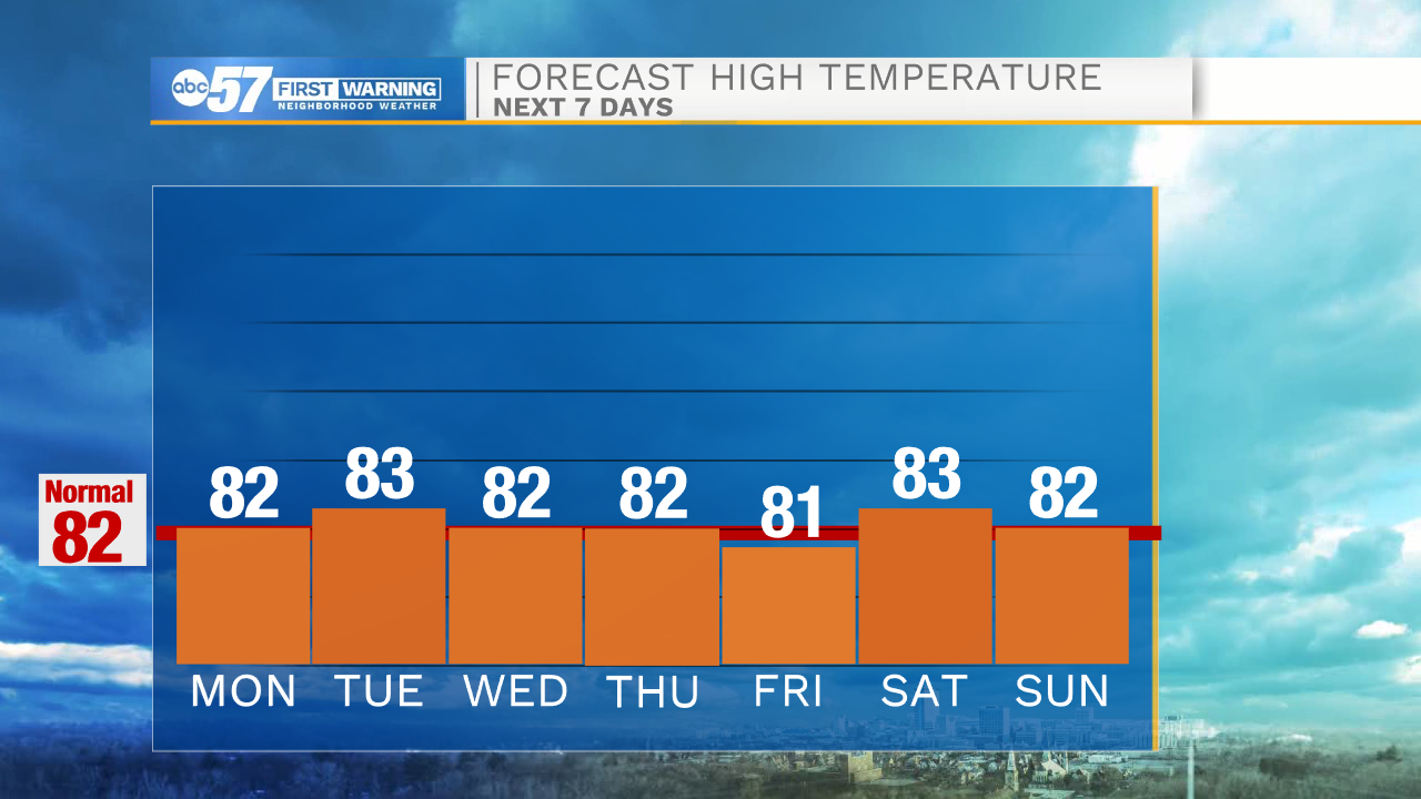
Dry weather is expected for the rest of the week along with seasonable high temperatures. Highs should only top out in the low to mid 80s heading into next weekend. This week humidity will be on the lower side making for more comfortable conditions throughout Michiana.
Tonight: Showers and thunderstorms late. Low 74.
Monday: Scattered showers and a few thunderstorms. High 82.
Tuesday: Mostly sunny. High 83.
Wednesday: Mostly sunny. High 82.